<< Our Photo Pages >> Dolmen Lou Pou - Burial Chamber or Dolmen in France in Languedoc:Pyrénées-Orientales 66
Submitted by dt44 on Saturday, 24 October 2009 Page Views: 3464
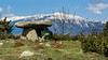
Neolithic and Bronze AgeSite Name: Dolmen Lou Pou Alternative Name: Dolmen dit Lou PouCountry: France
NOTE: This site is 0.768 km away from the location you searched for.
Département: Languedoc:Pyrénées-Orientales 66 Type: Burial Chamber or Dolmen
Nearest Town: Font-me Nearest Village: Eyne
Latitude: 42.481130N Longitude: 2.079560E
Condition:
| 5 | Perfect |
| 4 | Almost Perfect |
| 3 | Reasonable but with some damage |
| 2 | Ruined but still recognisable as an ancient site |
| 1 | Pretty much destroyed, possibly visible as crop marks |
| 0 | No data. |
| -1 | Completely destroyed |
| 5 | Superb |
| 4 | Good |
| 3 | Ordinary |
| 2 | Not Good |
| 1 | Awful |
| 0 | No data. |
| 5 | Can be driven to, probably with disabled access |
| 4 | Short walk on a footpath |
| 3 | Requiring a bit more of a walk |
| 2 | A long walk |
| 1 | In the middle of nowhere, a nightmare to find |
| 0 | No data. |
| 5 | co-ordinates taken by GPS or official recorded co-ordinates |
| 4 | co-ordinates scaled from a detailed map |
| 3 | co-ordinates scaled from a bad map |
| 2 | co-ordinates of the nearest village |
| 1 | co-ordinates of the nearest town |
| 0 | no data |
Internal Links:
External Links:
I have visited· I would like to visit
regina dt44 have visited here
")
A five kilometres path is arranged through the countryside here. There are several megalithic sites and an ancient Roman road to be seen.
You may be viewing yesterday's version of this page. To see the most up to date information please register for a free account.
")
")
")
")
Do not use the above information on other web sites or publications without permission of the contributor.
Nearby Images from Flickr
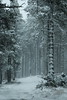
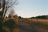
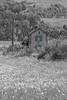
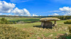

The above images may not be of the site on this page, but were taken nearby. They are loaded from Flickr so please click on them for image credits.
Click here to see more info for this site
Nearby sites
Click here to view sites on an interactive map of the areaKey: Red: member's photo, Blue: 3rd party photo, Yellow: other image, Green: no photo - please go there and take one, Grey: site destroyed
Download sites to:
KML (Google Earth)
GPX (GPS waypoints)
CSV (Garmin/Navman)
CSV (Excel)
To unlock full downloads you need to sign up as a Contributory Member. Otherwise downloads are limited to 50 sites.
Turn off the page maps and other distractions
Nearby sites listing. In the following links * = Image available
645m NW 317° Dolmen de Pascarets* Burial Chamber or Dolmen
779m ENE 66° Menhir de la Font del Sastre* Standing Stone (Menhir)
817m WNW 289° Cista del Molí* Burial Chamber or Dolmen
835m WSW 239° Menhir Pla del Bac* Standing Stone (Menhir)
837m ENE 56° Menhir du Col de la Perche* Standing Stone (Menhir)
890m W 277° Pont Megalithique (Eyne)* Ancient Trackway
1.1km SSW 212° Roche à cupules (Eyne) Sculptured Stone
1.2km WNW 291° Ciste n°1 Roca flavia* Cist
1.4km SSW 212° Abri Lo Pla del Bach (Eyne)* Cave or Rock Shelter
1.9km W 271° Ciste del Bac d'Amount* Chambered Tomb
3.3km SSW 208° Llo menhir (Font-Romeu)* Standing Stone (Menhir)
3.9km NW 314° Menhir d'Odeillo* Standing Stone (Menhir)
5.5km WNW 292° Dolmen d'Egat Burial Chamber or Dolmen
5.5km WNW 294° Menhir d'Egat Standing Stone (Menhir)
7.0km WNW 300° Dolmen de l'Arrel Burial Chamber or Dolmen
7.5km WNW 283° Menhir n°2 de Targassonne* Standing Stone (Menhir)
7.6km WNW 283° Menhir Pedra dreta n°1 de Targassonne* Standing Stone (Menhir)
8.3km WSW 256° Llivia dolmen Burial Chamber or Dolmen
8.9km W 276° Tombe mégalithique des Fontetes* Chambered Tomb
9.3km WSW 255° Menhir Pedra Dreta de Llivia* Standing Stone (Menhir)
11.5km W 273° Dolmen de Dorres Burial Chamber or Dolmen
13.1km W 271° Menhir du Col de Juell* Standing Stone (Menhir)
14.0km SSE 155° Dolmen de Fontalba Burial Chamber or Dolmen
14.3km W 270° Cova del Camp de la Marrunya* Burial Chamber or Dolmen
18.1km SSW 213° Dolmen de la Paborda en la Molina* Burial Chamber or Dolmen
View more nearby sites and additional images


 We would like to know more about this location. Please feel free to add a brief description and any relevant information in your own language.
 Wir möchten mehr über diese Stätte erfahren. Bitte zögern Sie nicht, eine kurze Beschreibung und relevante Informationen in Deutsch hinzuzufügen.
 Nous aimerions en savoir encore un peu sur les lieux. S'il vous plaît n'hesitez pas à ajouter une courte description et tous les renseignements pertinents dans votre propre langue.
 Quisieramos informarnos un poco más de las lugares. No dude en añadir una breve descripción y otros datos relevantes en su propio idioma.