<< Text Pages >> Grodzisko Chełmo - Hillfort in Poland in Lodzkie
Submitted by SolarMegalith on Friday, 26 October 2018 Page Views: 864
Iron Age and Later PrehistorySite Name: Grodzisko ChełmoCountry: Poland
NOTE: This site is 16.7 km away from the location you searched for.
Voivodeship: Lodzkie Type: Hillfort
Nearest Village: Masłowice
Latitude: 51.059955N Longitude: 19.745522E
Condition:
| 5 | Perfect |
| 4 | Almost Perfect |
| 3 | Reasonable but with some damage |
| 2 | Ruined but still recognisable as an ancient site |
| 1 | Pretty much destroyed, possibly visible as crop marks |
| 0 | No data. |
| -1 | Completely destroyed |
| 5 | Superb |
| 4 | Good |
| 3 | Ordinary |
| 2 | Not Good |
| 1 | Awful |
| 0 | No data. |
| 5 | Can be driven to, probably with disabled access |
| 4 | Short walk on a footpath |
| 3 | Requiring a bit more of a walk |
| 2 | A long walk |
| 1 | In the middle of nowhere, a nightmare to find |
| 0 | No data. |
| 5 | co-ordinates taken by GPS or official recorded co-ordinates |
| 4 | co-ordinates scaled from a detailed map |
| 3 | co-ordinates scaled from a bad map |
| 2 | co-ordinates of the nearest village |
| 1 | co-ordinates of the nearest town |
| 0 | no data |
Internal Links:
External Links:
Hillfort in Lodzkie
This large early medieval multivallate hillfort is located on the top of Góra Chełmo (Chełmo Mountain) of 323m altitude. Originally it was believed to have two rings of earthworks, but further surveys revealed another two lines of ramparts.
Read more at atlasgrodzisk.pl
You may be viewing yesterday's version of this page. To see the most up to date information please register for a free account.
Do not use the above information on other web sites or publications without permission of the contributor.
Nearby Images from Flickr
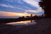
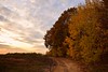
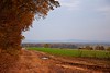
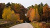
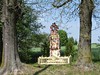

The above images may not be of the site on this page, but were taken nearby. They are loaded from Flickr so please click on them for image credits.
Click here to see more info for this site
Nearby sites
Click here to view sites on an interactive map of the areaKey: Red: member's photo, Blue: 3rd party photo, Yellow: other image, Green: no photo - please go there and take one, Grey: site destroyed
Download sites to:
KML (Google Earth)
GPX (GPS waypoints)
CSV (Garmin/Navman)
CSV (Excel)
To unlock full downloads you need to sign up as a Contributory Member. Otherwise downloads are limited to 50 sites.
Turn off the page maps and other distractions
Nearby sites listing. In the following links * = Image available
42.7km E 101° Dobrzeszowska Góra* Misc. Earthwork
44.1km SW 234° Grodzisko Gąszczyk* Hillfort
46.4km WSW 239° Wyczerpy Górne Bronze Age Settlement Ancient Village or Settlement
46.6km SW 226° Jaskinia Towarna Cave or Rock Shelter
46.9km SSW 209° Grodzisko Wały - Potok Złoty* Hillfort
48.0km SW 221° Jaskinia Komarowa Cave or Rock Shelter
53.6km SSW 193° Grodzisko Góra Słupsko* Hillfort
58.6km E 99° Tumlin Earthwork* Misc. Earthwork
59.1km SSW 195° Jaskinia w Dziadowej Skale Cave or Rock Shelter
68.5km S 179° Grodzisko Udórz Hillfort
69.3km S 184° Smoleń - Zamek Pilcza* Ancient Village or Settlement
70.7km S 185° Jaskinia Na Biśniku Cave or Rock Shelter
70.8km WNW 293° Kurhany Krzętle* Barrow Cemetery
71.0km W 277° Kurhany Przywóz* Barrow Cemetery
71.3km W 277° Przywóz Bronze Age Settlement Ancient Village or Settlement
78.2km NW 306° Grodzisko Witów Hillfort
81.1km NE 49° Grodzisko Klwów Hillfort
82.2km NNW 346° Muzeum Archeologiczne i Etnograficzne w Łodzi* Museum
87.4km S 190° Grodzisko Stary Olkusz* Hillfort
89.2km SSE 152° Kurhan Szczotkowice Round Barrow(s)
89.7km WSW 247° Kopiec Dzielna Round Barrow(s)
93.5km SSE 154° Kurhan Pałecznica Round Barrow(s)
94.6km ESE 103° Łysa Góra Sacred Mountain* Misc. Earthwork
96.0km ESE 103° Pielgrzym Sculpture* Sculptured Stone
98.6km S 177° Jaskinia Wierzchowska Górna* Cave or Rock Shelter
View more nearby sites and additional images


 We would like to know more about this location. Please feel free to add a brief description and any relevant information in your own language.
 Wir möchten mehr über diese Stätte erfahren. Bitte zögern Sie nicht, eine kurze Beschreibung und relevante Informationen in Deutsch hinzuzufügen.
 Nous aimerions en savoir encore un peu sur les lieux. S'il vous plaît n'hesitez pas à ajouter une courte description et tous les renseignements pertinents dans votre propre langue.
 Quisieramos informarnos un poco más de las lugares. No dude en añadir una breve descripción y otros datos relevantes en su propio idioma.