<< Text Pages >> Jaskinia w Dziadowej Skale - Cave or Rock Shelter in Poland in Slaskie
Submitted by SolarMegalith on Saturday, 10 August 2013 Page Views: 1728
Natural PlacesSite Name: Jaskinia w Dziadowej SkaleCountry: Poland Voivodeship: Slaskie Type: Cave or Rock Shelter
Nearest Town: Zawiercie Nearest Village: Podlesice
Latitude: 50.546040N Longitude: 19.531149E
Condition:
| 5 | Perfect |
| 4 | Almost Perfect |
| 3 | Reasonable but with some damage |
| 2 | Ruined but still recognisable as an ancient site |
| 1 | Pretty much destroyed, possibly visible as crop marks |
| 0 | No data. |
| -1 | Completely destroyed |
| 5 | Superb |
| 4 | Good |
| 3 | Ordinary |
| 2 | Not Good |
| 1 | Awful |
| 0 | No data. |
| 5 | Can be driven to, probably with disabled access |
| 4 | Short walk on a footpath |
| 3 | Requiring a bit more of a walk |
| 2 | A long walk |
| 1 | In the middle of nowhere, a nightmare to find |
| 0 | No data. |
| 5 | co-ordinates taken by GPS or official recorded co-ordinates |
| 4 | co-ordinates scaled from a detailed map |
| 3 | co-ordinates scaled from a bad map |
| 2 | co-ordinates of the nearest village |
| 1 | co-ordinates of the nearest town |
| 0 | no data |
Internal Links:
External Links:
Cave in Slaskie
This cave produced the animal remains dated to the Palaeolithic. Skull of the horse was interpreted as possible evidence for the rituals.
Reference:
Kostrzewski, J., Chmielewski, W. and Jażdżewski, K. 1965. "Pradzieje Polski". Warsaw: Ossolineum, p. 29.
You may be viewing yesterday's version of this page. To see the most up to date information please register for a free account.
Do not use the above information on other web sites or publications without permission of the contributor.
Nearby Images from Flickr
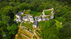
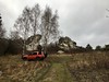


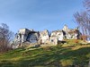
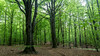
The above images may not be of the site on this page, but were taken nearby. They are loaded from Flickr so please click on them for image credits.
Click here to see more info for this site
Nearby sites
Click here to view sites on an interactive map of the areaKey: Red: member's photo, Blue: 3rd party photo, Yellow: other image, Green: no photo - please go there and take one, Grey: site destroyed
Download sites to:
KML (Google Earth)
GPX (GPS waypoints)
CSV (Garmin/Navman)
CSV (Excel)
To unlock full downloads you need to sign up as a Contributory Member. Otherwise downloads are limited to 50 sites.
Turn off the page maps and other distractions
Nearby sites listing. In the following links * = Image available
5.7km NNE 30° Grodzisko Góra Słupsko* Hillfort
15.7km SE 140° Smoleń - Zamek Pilcza* Ancient Village or Settlement
16.4km SE 144° Jaskinia Na Biśniku Cave or Rock Shelter
18.1km NNW 334° Grodzisko Wały - Potok Złoty* Hillfort
20.2km SE 124° Grodzisko Udórz Hillfort
26.5km NW 322° Jaskinia Komarowa Cave or Rock Shelter
28.9km S 181° Grodzisko Stary Olkusz* Hillfort
30.7km NW 323° Jaskinia Towarna Cave or Rock Shelter
37.3km NNW 327° Grodzisko Gąszczyk* Hillfort
41.0km NW 323° Wyczerpy Górne Bronze Age Settlement Ancient Village or Settlement
44.2km SSE 160° Grodzisko Będkowice* Hillfort
44.9km S 171° Grodzisko Bartlowa Góra - Czatkowice Hillfort
45.7km SSE 155° Jaskinia Wierzchowska Górna* Cave or Rock Shelter
46.0km SSE 155° Jaskinia Mamutowa* Cave or Rock Shelter
56.1km SSE 166° Grodzisko Mników Hillfort
59.1km NNE 15° Grodzisko Chełmo Hillfort
60.9km ESE 111° Kurhan Szczotkowice Round Barrow(s)
61.4km SSE 152° Archaeological Museum of Kraków* Museum
61.8km SSE 152° Kraków - Wawel* Ancient Village or Settlement
62.0km ESE 116° Kurhan Pałecznica Round Barrow(s)
63.1km SSE 168° Wołowice Flint Mine Ancient Mine, Quarry or other Industry
64.1km SSE 152° Kopiec Krakusa* Artificial Mound
65.2km SE 144° Kopiec Wandy* Artificial Mound
70.9km WNW 288° Kopiec Dzielna Round Barrow(s)
75.4km NE 49° Dobrzeszowska Góra* Misc. Earthwork
View more nearby sites and additional images


 We would like to know more about this location. Please feel free to add a brief description and any relevant information in your own language.
 Wir möchten mehr über diese Stätte erfahren. Bitte zögern Sie nicht, eine kurze Beschreibung und relevante Informationen in Deutsch hinzuzufügen.
 Nous aimerions en savoir encore un peu sur les lieux. S'il vous plaît n'hesitez pas à ajouter une courte description et tous les renseignements pertinents dans votre propre langue.
 Quisieramos informarnos un poco más de las lugares. No dude en añadir una breve descripción y otros datos relevantes en su propio idioma.