<< Our Photo Pages >> Grodzisko Tum - Hillfort in Poland in Lodzkie
Submitted by SolarMegalith on Tuesday, 21 August 2012 Page Views: 2796
Iron Age and Later PrehistorySite Name: Grodzisko Tum Alternative Name: Szwedzka GóraCountry: Poland
NOTE: This site is 10.59 km away from the location you searched for.
Voivodeship: Lodzkie Type: Hillfort
Nearest Town: Łęczyca
Latitude: 52.053652N Longitude: 19.227140E
Condition:
| 5 | Perfect |
| 4 | Almost Perfect |
| 3 | Reasonable but with some damage |
| 2 | Ruined but still recognisable as an ancient site |
| 1 | Pretty much destroyed, possibly visible as crop marks |
| 0 | No data. |
| -1 | Completely destroyed |
| 5 | Superb |
| 4 | Good |
| 3 | Ordinary |
| 2 | Not Good |
| 1 | Awful |
| 0 | No data. |
| 5 | Can be driven to, probably with disabled access |
| 4 | Short walk on a footpath |
| 3 | Requiring a bit more of a walk |
| 2 | A long walk |
| 1 | In the middle of nowhere, a nightmare to find |
| 0 | No data. |
| 5 | co-ordinates taken by GPS or official recorded co-ordinates |
| 4 | co-ordinates scaled from a detailed map |
| 3 | co-ordinates scaled from a bad map |
| 2 | co-ordinates of the nearest village |
| 1 | co-ordinates of the nearest town |
| 0 | no data |
Internal Links:
External Links:
")
The early medieval fort called "Szwedzka Góra" ("Swedish Mountain") is located SW of the village of Tum. The first foertified settlement was built here in 6th century AD (early tribal period). In 8th-10th century (late tribal period) a circular bank was constructed and the ditch was cut, while the final phase is dated for 12th century AD.
The earthworks are in perfect condition and surrounded with meadows.
You may be viewing yesterday's version of this page. To see the most up to date information please register for a free account.
")
")
")
Do not use the above information on other web sites or publications without permission of the contributor.
Nearby Images from Flickr
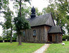
The above images may not be of the site on this page, but were taken nearby. They are loaded from Flickr so please click on them for image credits.
Click here to see more info for this site
Nearby sites
Click here to view sites on an interactive map of the areaKey: Red: member's photo, Blue: 3rd party photo, Yellow: other image, Green: no photo - please go there and take one, Grey: site destroyed
Download sites to:
KML (Google Earth)
GPX (GPS waypoints)
CSV (Garmin/Navman)
CSV (Excel)
To unlock full downloads you need to sign up as a Contributory Member. Otherwise downloads are limited to 50 sites.
Turn off the page maps and other distractions
Nearby sites listing. In the following links * = Image available
11.1km NE 44° Kurhan Ględzianówek Round Barrow(s)
28.8km NNE 33° Mnich Stone Circle* Stone Circle
34.6km SSE 153° Muzeum Archeologiczne i Etnograficzne w Łodzi* Museum
46.3km NNW 329° Wietrzychowice Long Barrows* Long Barrow
47.2km NW 320° Wólka Komorowska Long Barrows Long Barrow
48.5km NNW 327° Obałki Long Barrows Long Barrow
49.0km NW 318° Gaj Long Barrow* Long Barrow
58.0km NNW 327° Sarnowo Long Barrows* Long Barrow
67.9km NE 45° Grodzisko Miszewo Murowane Hillfort
70.2km SSW 203° Grodzisko Witów Hillfort
74.2km NNE 26° Grodzisko Nowe Proboszczewice* Hillfort
77.7km NE 54° Grodzisko Wilkanowo Hillfort
77.8km NE 54° Grodzisko Orszymowo Hillfort
79.0km ENE 73° Kurhan Strzyżew Round Barrow(s)
82.9km NNE 31° Grodzisko Mokrzk* Hillfort
88.2km SSW 199° Kurhany Krzętle* Barrow Cemetery
90.4km N 5° Grodzisko Skępe Hillfort
108.1km SSW 199° Przywóz Bronze Age Settlement Ancient Village or Settlement
108.1km SSW 199° Kurhany Przywóz* Barrow Cemetery
109.1km NW 319° Grodzisko Kościelec Kujawski Hillfort
112.7km ESE 120° Grodzisko Klwów Hillfort
112.9km WNW 288° Grodzisko Grzybowo* Hillfort
113.4km SW 222° Grodzisko Podzamcze* Hillfort
116.2km SSE 162° Grodzisko Chełmo Hillfort
120.1km N 350° Grodzisko Chełmonie Hillfort
View more nearby sites and additional images


 We would like to know more about this location. Please feel free to add a brief description and any relevant information in your own language.
 Wir möchten mehr über diese Stätte erfahren. Bitte zögern Sie nicht, eine kurze Beschreibung und relevante Informationen in Deutsch hinzuzufügen.
 Nous aimerions en savoir encore un peu sur les lieux. S'il vous plaît n'hesitez pas à ajouter une courte description et tous les renseignements pertinents dans votre propre langue.
 Quisieramos informarnos un poco más de las lugares. No dude en añadir una breve descripción y otros datos relevantes en su propio idioma.