<< Text Pages >> Grodzisko Gruta - Hillfort in Poland in Kujawsko-pomorskie
Submitted by SolarMegalith on Saturday, 11 July 2009 Page Views: 2597
Iron Age and Later PrehistorySite Name: Grodzisko Gruta Alternative Name: Stary SzaniecCountry: Poland
NOTE: This site is 4.525 km away from the location you searched for.
Voivodeship: Kujawsko-pomorskie Type: Hillfort
Nearest Town: Grudziądz Nearest Village: Gruta
Latitude: 53.464730N Longitude: 18.971650E
Condition:
| 5 | Perfect |
| 4 | Almost Perfect |
| 3 | Reasonable but with some damage |
| 2 | Ruined but still recognisable as an ancient site |
| 1 | Pretty much destroyed, possibly visible as crop marks |
| 0 | No data. |
| -1 | Completely destroyed |
| 5 | Superb |
| 4 | Good |
| 3 | Ordinary |
| 2 | Not Good |
| 1 | Awful |
| 0 | No data. |
| 5 | Can be driven to, probably with disabled access |
| 4 | Short walk on a footpath |
| 3 | Requiring a bit more of a walk |
| 2 | A long walk |
| 1 | In the middle of nowhere, a nightmare to find |
| 0 | No data. |
| 5 | co-ordinates taken by GPS or official recorded co-ordinates |
| 4 | co-ordinates scaled from a detailed map |
| 3 | co-ordinates scaled from a bad map |
| 2 | co-ordinates of the nearest village |
| 1 | co-ordinates of the nearest town |
| 0 | no data |
Internal Links:
External Links:
Hillfort in Kujawsko-pomorskie
The site is located between the lakes Duże and Księże. The earthwork is well preserved and in it's highest point it reaches 5 meters. Remains of the moat are clerealy visible as well.
You may be viewing yesterday's version of this page. To see the most up to date information please register for a free account.
Do not use the above information on other web sites or publications without permission of the contributor.
Nearby Images from Flickr
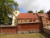
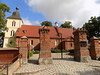
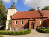
The above images may not be of the site on this page, but were taken nearby. They are loaded from Flickr so please click on them for image credits.
Click here to see more info for this site
Nearby sites
Click here to view sites on an interactive map of the areaKey: Red: member's photo, Blue: 3rd party photo, Yellow: other image, Green: no photo - please go there and take one, Grey: site destroyed
Download sites to:
KML (Google Earth)
GPX (GPS waypoints)
CSV (Garmin/Navman)
CSV (Excel)
To unlock full downloads you need to sign up as a Contributory Member. Otherwise downloads are limited to 50 sites.
Turn off the page maps and other distractions
Nearby sites listing. In the following links * = Image available
12.7km SSW 207° Grodzisko Gawłowice Hillfort
14.3km N 11° Grodzisko Szembruk Promontory Fort / Cliff Castle
14.5km SE 127° Grodzisko Jabłonowo Pomorskie* Hillfort
15.6km SE 130° Grodzisko Jaguszewice* Hillfort
20.9km SE 130° Grodzisko Lembarg* Hillfort
25.8km NNE 21° Grodzisko Klasztorek Promontory Fort / Cliff Castle
30.1km SW 225° Grodzisko Lipienek Hillfort
31.8km ENE 64° Grodzisko Laseczno Hillfort
32.5km ENE 67° Grodzisko Stróżkowa Góra - Gulb Hillfort
32.9km N 356° Grodzisko Baldram Hillfort
36.7km SW 236° Grodzisko Storlus Hillfort
36.8km ESE 118° Grodzisko Bachotek Hillfort
36.9km NE 41° Grodzisko Susz* Hillfort
37.5km SW 233° Grodzisko Żygląd* Hillfort
39.0km S 186° Grodzisko Chełmonie Hillfort
40.0km SSW 196° Grodzisko Gronowo Hillfort
40.6km ESE 104° Grodzisko Nielbark Hillfort
40.8km E 101° Grodzisko Kurzętnik* Hillfort
44.0km WSW 242° Grodzisko Płutowo Hillfort
46.1km NNW 342° Brody Pomorskie Neolithic Settlement Ancient Village or Settlement
47.5km E 84° Grodzisko Sampława* Hillfort
52.3km NNE 32° Grodzisko Stary Dzierzgoń* Hillfort
53.9km NNE 30° Grodzisko Stare Miasto* Hillfort
55.2km N 3° Kurhany Koniecwałd Barrow Cemetery
55.4km NNE 11° Grodzisko Kalwa* Hillfort
View more nearby sites and additional images


 We would like to know more about this location. Please feel free to add a brief description and any relevant information in your own language.
 Wir möchten mehr über diese Stätte erfahren. Bitte zögern Sie nicht, eine kurze Beschreibung und relevante Informationen in Deutsch hinzuzufügen.
 Nous aimerions en savoir encore un peu sur les lieux. S'il vous plaît n'hesitez pas à ajouter une courte description et tous les renseignements pertinents dans votre propre langue.
 Quisieramos informarnos un poco más de las lugares. No dude en añadir una breve descripción y otros datos relevantes en su propio idioma.