<< Our Photo Pages >> Örsta hällristning - Rock Art in Sweden in Uppland
Submitted by Meginring on Monday, 19 February 2007 Page Views: 6675
Rock ArtSite Name: Örsta hällristning Alternative Name: Angarnsjöns hällristningCountry: Sweden
NOTE: This site is 4.598 km away from the location you searched for.
Landskap: Uppland Type: Rock Art
Nearest Town: Vallentuna Nearest Village: Angarn
Latitude: 59.544700N Longitude: 18.170900E
Condition:
| 5 | Perfect |
| 4 | Almost Perfect |
| 3 | Reasonable but with some damage |
| 2 | Ruined but still recognisable as an ancient site |
| 1 | Pretty much destroyed, possibly visible as crop marks |
| 0 | No data. |
| -1 | Completely destroyed |
| 5 | Superb |
| 4 | Good |
| 3 | Ordinary |
| 2 | Not Good |
| 1 | Awful |
| 0 | No data. |
| 5 | Can be driven to, probably with disabled access |
| 4 | Short walk on a footpath |
| 3 | Requiring a bit more of a walk |
| 2 | A long walk |
| 1 | In the middle of nowhere, a nightmare to find |
| 0 | No data. |
| 5 | co-ordinates taken by GPS or official recorded co-ordinates |
| 4 | co-ordinates scaled from a detailed map |
| 3 | co-ordinates scaled from a bad map |
| 2 | co-ordinates of the nearest village |
| 1 | co-ordinates of the nearest town |
| 0 | no data |
Internal Links:
External Links:
")
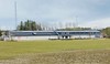
The hällristning (rock carving) within lake Angarnsjön bird sanctuary and recreation area, which during the Bronze Age was a bay of the Baltic Sea.
The biggest ship is 2,6 meters long.
You may be viewing yesterday's version of this page. To see the most up to date information please register for a free account.
")
")
Do not use the above information on other web sites or publications without permission of the contributor.
Nearby Images from Flickr
The above images may not be of the site on this page, but were taken nearby. They are loaded from Flickr so please click on them for image credits.
Click here to see more info for this site
Nearby sites
Click here to view sites on an interactive map of the areaKey: Red: member's photo, Blue: 3rd party photo, Yellow: other image, Green: no photo - please go there and take one, Grey: site destroyed
Download sites to:
KML (Google Earth)
GPX (GPS waypoints)
CSV (Garmin/Navman)
CSV (Excel)
To unlock full downloads you need to sign up as a Contributory Member. Otherwise downloads are limited to 50 sites.
Turn off the page maps and other distractions
Nearby sites listing. In the following links * = Image available
7.9km SW 230° Runriket* Standing Stones
11.5km SW 228° Täby* Carving
15.4km WSW 257° Hammarby 154:1* Sculptured Stone
15.7km WNW 289° Nordians hög* Barrow Cemetery
15.9km W 259° Zamores kulle* Barrow Cemetery
16.5km WSW 259° Smedby* Sculptured Stone
17.0km SSE 154° U 170 (Vaxholm)* Carving
17.7km NW 309° Arlanda Mäby Rune Stone* Carving
19.2km W 276° Runsa (Upplands-Väsby)* Stone Circle
24.2km S 191° Historiska Museet* Museum
24.6km SSW 194° Medelhavsmuseet Museum Museum
24.7km SSW 192° Museum of Far Eastern Antiquities* Museum
25.1km SSW 193° Gamla stans runsten* Carving
26.6km WNW 288° Sigtuna U Fv1958 250* Sculptured Stone
26.6km WNW 288° Sigtuna U 390* Sculptured Stone
26.6km WNW 287° Sigtuna U 389* Sculptured Stone
26.7km SW 216° Björklunds hage* Barrow Cemetery
31.5km W 263° Upplands-Bro* Carving
34.3km SSW 207° Skärholmen Domarringen* Stone Circle
34.7km W 264° Rösaring* Carving
35.9km SW 235° Sånga 70:1 Cairn
36.0km WSW 252° Vallbyåsen* Standing Stones
37.4km SSW 209° Slagsta Hällristning* Rock Art
39.2km SW 225° Nyckelby* Standing Stone (Menhir)
41.6km WSW 241° Skopintull* Round Barrow(s)
View more nearby sites and additional images


 We would like to know more about this location. Please feel free to add a brief description and any relevant information in your own language.
 Wir möchten mehr über diese Stätte erfahren. Bitte zögern Sie nicht, eine kurze Beschreibung und relevante Informationen in Deutsch hinzuzufügen.
 Nous aimerions en savoir encore un peu sur les lieux. S'il vous plaît n'hesitez pas à ajouter une courte description et tous les renseignements pertinents dans votre propre langue.
 Quisieramos informarnos un poco más de las lugares. No dude en añadir una breve descripción y otros datos relevantes en su propio idioma.