


<< Text Pages >> Diabelski Kamień - Natural Stone / Erratic / Other Natural Feature in Poland in Pomorskie
Submitted by KaiHofmann on Monday, 06 September 2021 Page Views: 275
Natural PlacesSite Name: Diabelski KamieńCountry: Poland Voivodeship: Pomorskie Type: Natural Stone / Erratic / Other Natural Feature
Nearest Town: Gdańsk Nearest Village: Świecino
Latitude: 54.727366N Longitude: 18.210725E
Condition:
| 5 | Perfect |
| 4 | Almost Perfect |
| 3 | Reasonable but with some damage |
| 2 | Ruined but still recognisable as an ancient site |
| 1 | Pretty much destroyed, possibly visible as crop marks |
| 0 | No data. |
| -1 | Completely destroyed |
| 5 | Superb |
| 4 | Good |
| 3 | Ordinary |
| 2 | Not Good |
| 1 | Awful |
| 0 | No data. |
| 5 | Can be driven to, probably with disabled access |
| 4 | Short walk on a footpath |
| 3 | Requiring a bit more of a walk |
| 2 | A long walk |
| 1 | In the middle of nowhere, a nightmare to find |
| 0 | No data. |
| 5 | co-ordinates taken by GPS or official recorded co-ordinates |
| 4 | co-ordinates scaled from a detailed map |
| 3 | co-ordinates scaled from a bad map |
| 2 | co-ordinates of the nearest village |
| 1 | co-ordinates of the nearest town |
| 0 | no data |
Internal Links:
External Links:
Natural Stone / Erratic / Other Natural Feature in Pomorskie
natural boulder Diabelski Kamień (Devil´s stone)
You may be viewing yesterday's version of this page. To see the most up to date information please register for a free account.
Do not use the above information on other web sites or publications without permission of the contributor.
Nearby Images from Flickr
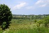
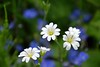
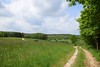
The above images may not be of the site on this page, but were taken nearby. They are loaded from Flickr so please click on them for image credits.
Click here to see more info for this site
Nearby sites
Click here to view sites on an interactive map of the areaKey: Red: member's photo, Blue: 3rd party photo, Yellow: other image, Green: no photo - please go there and take one, Grey: site destroyed
Download sites to:
KML (Google Earth)
GPX (GPS waypoints)
CSV (Garmin/Navman)
CSV (Excel)
To unlock full downloads you need to sign up as a Contributory Member. Otherwise downloads are limited to 50 sites.
Turn off the page maps and other distractions
Nearby sites listing. In the following links * = Image available
366m NW 322° Boża Stopka Rock Art
7.2km WNW 291° Grodzisko Sobieńczyce Hillfort
11.4km NE 38° Kurhan Mieroszyno Round Barrow(s)
37.9km SSW 209° Potęgowo Megalithic Tomb Chambered Tomb
38.5km S 173° Przodkowo Stone Circles Stone Circle
45.4km SW 224° Kurhany Cewice Barrow Cemetery
47.3km SW 219° Kurhany Siemirowice Barrow Cemetery
47.8km SW 230° Kurhany Unieszynko Barrow Cemetery
48.2km SW 220° Siemirowice 7 Chambered Tomb
48.2km SW 220° Siemirowice 6* Chambered Tomb
48.2km SW 220° Siemirowice 5* Chambered Tomb
48.3km SW 220° Siemirowice 3* Chambered Tomb
48.4km SW 220° Siemirowice 2* Chambered Tomb
48.4km SW 220° Siemirowice 4* Chambered Tomb
48.4km SW 220° Siemirowice 1* Chambered Tomb
48.6km SSW 196° Grodzisko Borzestowo Hillfort
49.1km S 175° Kurhany Trątkownica* Barrow Cemetery
50.0km SSE 147° Gdansk* Sculptured Stone
52.8km SSE 159° Lublewo Gdańskie Stone Circles Stone Circle
53.7km WSW 254° Szczypkowice Chambered Tomb Chambered Tomb
55.5km SSW 195° Zgorzałe Stone Circles Stone Circle
56.4km SSW 205° Kurhany Mściszewice* Barrow Cemetery
57.3km WSW 245° Kurhan Grapice Round Barrow(s)
57.7km SSW 194° Kurchany Uniradze Barrow Cemetery
57.9km SW 235° Dąbrówno Chambered Tomb II* Chambered Tomb
View more nearby sites and additional images


 We would like to know more about this location. Please feel free to add a brief description and any relevant information in your own language.
 Wir möchten mehr über diese Stätte erfahren. Bitte zögern Sie nicht, eine kurze Beschreibung und relevante Informationen in Deutsch hinzuzufügen.
 Nous aimerions en savoir encore un peu sur les lieux. S'il vous plaît n'hesitez pas à ajouter une courte description et tous les renseignements pertinents dans votre propre langue.
 Quisieramos informarnos un poco más de las lugares. No dude en añadir una breve descripción y otros datos relevantes en su propio idioma.