<< Our Photo Pages >> Roman inscription in Trenčín - Carving in Slovakia
Submitted by ladrin on Tuesday, 09 April 2024 Page Views: 73
Roman, Greek and ClassicalSite Name: Roman inscription in TrenčínCountry: Slovakia
NOTE: This site is 0.603 km away from the location you searched for.
Type: Carving
Nearest Town: Trenčín
Latitude: 48.895805N Longitude: 18.044489E
Condition:
| 5 | Perfect |
| 4 | Almost Perfect |
| 3 | Reasonable but with some damage |
| 2 | Ruined but still recognisable as an ancient site |
| 1 | Pretty much destroyed, possibly visible as crop marks |
| 0 | No data. |
| -1 | Completely destroyed |
| 5 | Superb |
| 4 | Good |
| 3 | Ordinary |
| 2 | Not Good |
| 1 | Awful |
| 0 | No data. |
| 5 | Can be driven to, probably with disabled access |
| 4 | Short walk on a footpath |
| 3 | Requiring a bit more of a walk |
| 2 | A long walk |
| 1 | In the middle of nowhere, a nightmare to find |
| 0 | No data. |
| 5 | co-ordinates taken by GPS or official recorded co-ordinates |
| 4 | co-ordinates scaled from a detailed map |
| 3 | co-ordinates scaled from a bad map |
| 2 | co-ordinates of the nearest village |
| 1 | co-ordinates of the nearest town |
| 0 | no data |
Internal Links:
External Links:
")
Exceptional and well preserved Roman inscription carved into the rock below Trencin castle. Dated to 179 it represents one of the few Roman written references north of the Danube and also proves long term presence of Romans in Central Europe.
When translated it says:
“To the victory of the emperors and the army of 855 soldiers of the Second Legion that was based at Laugaricio. Made to order of Marcus Valerius Maximianus, a legate of the Second Auxiliary Legion.”
This amazing monument can be reached through the main entrance of the Hotel Elizabeth on the second floor. Tourists welcomed..
You may be viewing yesterday's version of this page. To see the most up to date information please register for a free account.
")
")
")
")
Do not use the above information on other web sites or publications without permission of the contributor.
Nearby Images from Flickr
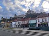
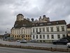


The above images may not be of the site on this page, but were taken nearby. They are loaded from Flickr so please click on them for image credits.
Click here to see more info for this site
Nearby sites
Click here to view sites on an interactive map of the areaKey: Red: member's photo, Blue: 3rd party photo, Yellow: other image, Green: no photo - please go there and take one, Grey: site destroyed
Download sites to:
KML (Google Earth)
GPX (GPS waypoints)
CSV (Garmin/Navman)
CSV (Excel)
To unlock full downloads you need to sign up as a Contributory Member. Otherwise downloads are limited to 50 sites.
Turn off the page maps and other distractions
Nearby sites listing. In the following links * = Image available
37.6km W 264° Javorníky Menhir Standing Stone (Menhir)
52.0km WNW 297° Archeological Outdoor Museum Modrá* Museum
55.0km WNW 300° The King's Table* Sculptured Stone
60.7km N 3° Vidče Stone Spheres* Natural Stone / Erratic / Other Natural Feature
65.3km W 262° Menhiry Holic* Standing Stones
69.4km W 261° Church of Saint Margaret of Antioch, Kopčany* Misc. Earthwork
70.8km W 262° Slavic fortified settlement in Mikulčice* Ancient Village or Settlement
77.4km NW 325° Predmosti* Ancient Village or Settlement
78.0km SE 128° Štiavnické Menhiry* Standing Stone (Menhir)
86.7km ESE 115° Pusty Hrad* Ancient Village or Settlement
87.5km WSW 255° Rabensburg Tumulus (2) Round Barrow(s)
89.0km WSW 253° Rabensburg Tumuli (1) Round Barrow(s)
92.8km S 172° Nitriansky Hrádok Ancient Village or Settlement
98.9km SW 226° Stupavsky hrad* Hillfort
100.1km W 269° Archeopark Pavlov* Museum
100.7km NNE 27° Puńców Settlement* Ancient Village or Settlement
100.9km NNE 30° Góra Ostry Settlement* Ancient Village or Settlement
101.6km W 267° Klentnice Stone Circle* Modern Stone Circle etc
102.4km W 270° Dolní Věstonice* Ancient Village or Settlement
102.6km NNE 29° Góra Tuł Settlement* Ancient Village or Settlement
103.3km WSW 239° Stillfried Zentrum der Urzeit* Museum
103.7km N 3° Selebice Menhir Standing Stone (Menhir)
104.0km NNE 30° Góra Grodzisko Settlement* Ancient Village or Settlement
104.1km NNE 24° Grodzisko Góra Zamkowa - Cieszyn* Hillfort
105.2km NNE 29° Machulowa Settlement* Ancient Village or Settlement
View more nearby sites and additional images

")
 We would like to know more about this location. Please feel free to add a brief description and any relevant information in your own language.
 Wir möchten mehr über diese Stätte erfahren. Bitte zögern Sie nicht, eine kurze Beschreibung und relevante Informationen in Deutsch hinzuzufügen.
 Nous aimerions en savoir encore un peu sur les lieux. S'il vous plaît n'hesitez pas à ajouter une courte description et tous les renseignements pertinents dans votre propre langue.
 Quisieramos informarnos un poco más de las lugares. No dude en añadir una breve descripción y otros datos relevantes en su propio idioma.