


<< Our Photo Pages >> Whakawhitiwhiti Pā - Hillfort in New Zealand
Submitted by DrewParsons on Tuesday, 19 April 2022 Page Views: 1175
Other ArchaeologySite Name: Whakawhitiwhiti PāCountry: New Zealand Type: Hillfort
Nearest Town: New Plymouth
Latitude: 39.07902S Longitude: 174.045000E
Condition:
| 5 | Perfect |
| 4 | Almost Perfect |
| 3 | Reasonable but with some damage |
| 2 | Ruined but still recognisable as an ancient site |
| 1 | Pretty much destroyed, possibly visible as crop marks |
| 0 | No data. |
| -1 | Completely destroyed |
| 5 | Superb |
| 4 | Good |
| 3 | Ordinary |
| 2 | Not Good |
| 1 | Awful |
| 0 | No data. |
| 5 | Can be driven to, probably with disabled access |
| 4 | Short walk on a footpath |
| 3 | Requiring a bit more of a walk |
| 2 | A long walk |
| 1 | In the middle of nowhere, a nightmare to find |
| 0 | No data. |
| 5 | co-ordinates taken by GPS or official recorded co-ordinates |
| 4 | co-ordinates scaled from a detailed map |
| 3 | co-ordinates scaled from a bad map |
| 2 | co-ordinates of the nearest village |
| 1 | co-ordinates of the nearest town |
| 0 | no data |
Internal Links:
External Links:
I have visited· I would like to visit
DrewParsons has visited here
")
Relatively little is known about the pa, although it's thought to date from a turbulant period in the 1700s when the boundary of the Taranaki and Te Ati Awa tribes alternated between Paritutu and the Waiwhakaiho River. Whakawhitiwhiti is the most significant of a series of defensive pa constructed by Taranaki iwi after they had occupied Te Atiawa territory. By about 1770 it appears that Taranaki were prepared to abandon their hold on the area and return peaceably to their original territory.
In December 1859 under the Native Reserves Act, 56 acres, more or less, of Fern Land, on the Omata road, adjoining the estates of Mr W. Bayly and Mr P. Elliot, called Whakawhitiwhiti were sold by public auction.
As New Plymouth grew rapidly in the post-war years many of the pa sites under private ownership were destroyed or badly damaged. In the mid-1960s, as development of the nearby subdivision progressed, concern was raised that the destruction of Whakawhitiwhiti pa was inevitable.
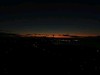
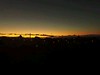
Fortunately a local campaigner championed to save the historic site. As a result, the pa and its surrounds were acquired by the New Plymouth District Council between 1977 and 1988. The site is now known as the Whakawhitiwhiti Pa Historic Reserve, with several access points, and it offers excellent views of the city and the mountain.
Location: Close to 88 Wallath Road, Taranaki
Note: Tours and talks (some online and accessible worldwide) for New Zealand Archaeology week, 23rd April to 1st May, including to this site on the North Island, more details in the comment on our page
You may be viewing yesterday's version of this page. To see the most up to date information please register for a free account.
")
")
Do not use the above information on other web sites or publications without permission of the contributor.
Nearby Images from Flickr


The above images may not be of the site on this page, but were taken nearby. They are loaded from Flickr so please click on them for image credits.
Click here to see more info for this site
Nearby sites
Click here to view sites on an interactive map of the areaKey: Red: member's photo, Blue: 3rd party photo, Yellow: other image, Green: no photo - please go there and take one, Grey: site destroyed
Download sites to:
KML (Google Earth)
GPX (GPS waypoints)
CSV (Garmin/Navman)
CSV (Excel)
To unlock full downloads you need to sign up as a Contributory Member. Otherwise downloads are limited to 50 sites.
Turn off the page maps and other distractions
Nearby sites listing. In the following links * = Image available
3.4km NE 43° Te Punga a Matori* Sculptured Stone
58.2km SSE 159° Turuturu Mokai Pa* Hillfort
58.3km SSE 159° Te Uma a Tongahake Pa* Hillfort
59.0km SSE 157° Tawhiti Museum* Museum
145.1km NNE 26° Ruapuke Pa* Standing Stone (Menhir)
185.7km E 86° Kaimanawa Wall* Natural Stone / Erratic / Other Natural Feature
186.2km ENE 67° Pohaturoa* Hillfort
224.7km SSW 209° Te Waikoropupu Springs* Holy Well or Sacred Spring
242.3km SE 146° Wairarapa Stone Circle Modern Stone Circle etc
245.4km NNE 16° Mangere Mountain Pa* Hillfort
248.4km NNE 14° Puketapapa Pa* Hillfort
248.7km NNE 17° Otahuhu Pa* Hillfort
250.8km NNE 15° Maungakiekie Pa* Hillfort
251.2km NNE 15° Cornwall Park Rongo Stone* Standing Stone (Menhir)
252.0km NNE 15° Epsom Modern Megalith* Modern Stone Circle etc
252.5km NNE 15° Te Kopuke Pa* Hillfort
252.7km NNE 15° Maungawhau* Hillfort
253.0km NNE 16° Maungarei Stonefields* Ancient Village or Settlement
253.1km NNE 16° Maungarei Pa* Hillfort
253.3km NNE 15° Remuera Pa* Hillfort
254.9km NNE 15° Auckland Museum* Museum
256.1km NNE 17° Tahuna Torea* Ancient Village or Settlement
256.5km NNE 25° Tapapakanga Park* Ancient Village or Settlement
256.6km NNE 17° Taurere Pa* Hillfort
259.8km SSE 150° Stonehenge Aotearoa* Modern Stone Circle etc
View more nearby sites and additional images


 We would like to know more about this location. Please feel free to add a brief description and any relevant information in your own language.
 Wir möchten mehr über diese Stätte erfahren. Bitte zögern Sie nicht, eine kurze Beschreibung und relevante Informationen in Deutsch hinzuzufügen.
 Nous aimerions en savoir encore un peu sur les lieux. S'il vous plaît n'hesitez pas à ajouter une courte description et tous les renseignements pertinents dans votre propre langue.
 Quisieramos informarnos un poco más de las lugares. No dude en añadir una breve descripción y otros datos relevantes en su propio idioma.