<< Text Pages >> Grodzisko Sobieńczyce - Hillfort in Poland in Pomorskie
Submitted by SolarMegalith on Friday, 13 May 2011 Page Views: 2803
Iron Age and Later PrehistorySite Name: Grodzisko SobieńczyceCountry: Poland
NOTE: This site is 13.149 km away from the location you searched for.
Voivodeship: Pomorskie Type: Hillfort
Nearest Village: Sobieńczyce
Latitude: 54.750318N Longitude: 18.105268E
Condition:
| 5 | Perfect |
| 4 | Almost Perfect |
| 3 | Reasonable but with some damage |
| 2 | Ruined but still recognisable as an ancient site |
| 1 | Pretty much destroyed, possibly visible as crop marks |
| 0 | No data. |
| -1 | Completely destroyed |
| 5 | Superb |
| 4 | Good |
| 3 | Ordinary |
| 2 | Not Good |
| 1 | Awful |
| 0 | No data. |
| 5 | Can be driven to, probably with disabled access |
| 4 | Short walk on a footpath |
| 3 | Requiring a bit more of a walk |
| 2 | A long walk |
| 1 | In the middle of nowhere, a nightmare to find |
| 0 | No data. |
| 5 | co-ordinates taken by GPS or official recorded co-ordinates |
| 4 | co-ordinates scaled from a detailed map |
| 3 | co-ordinates scaled from a bad map |
| 2 | co-ordinates of the nearest village |
| 1 | co-ordinates of the nearest town |
| 0 | no data |
Internal Links:
External Links:
Hillfort in Pomorskie
An early medieval hillfort located on top of a hill called Zamkowa Góra (“Castle Mountain”). It’s earthen rampart is strengthen with layer of stones.
You may be viewing yesterday's version of this page. To see the most up to date information please register for a free account.
Do not use the above information on other web sites or publications without permission of the contributor.
Nearby Images from Flickr

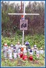
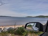


The above images may not be of the site on this page, but were taken nearby. They are loaded from Flickr so please click on them for image credits.
Click here to see more info for this site
Nearby sites
Click here to view sites on an interactive map of the areaKey: Red: member's photo, Blue: 3rd party photo, Yellow: other image, Green: no photo - please go there and take one, Grey: site destroyed
Download sites to:
KML (Google Earth)
GPX (GPS waypoints)
CSV (Garmin/Navman)
CSV (Excel)
To unlock full downloads you need to sign up as a Contributory Member. Otherwise downloads are limited to 50 sites.
Turn off the page maps and other distractions
Nearby sites listing. In the following links * = Image available
6.9km ESE 109° Boża Stopka Rock Art
7.2km ESE 111° Diabelski Kamień Natural Stone / Erratic / Other Natural Feature
15.2km ENE 65° Kurhan Mieroszyno Round Barrow(s)
37.6km SSW 198° Potęgowo Megalithic Tomb Chambered Tomb
42.4km SSE 164° Przodkowo Stone Circles Stone Circle
43.0km SW 215° Kurhany Cewice Barrow Cemetery
44.7km SW 222° Kurhany Unieszynko Barrow Cemetery
45.5km SSW 210° Kurhany Siemirowice Barrow Cemetery
46.3km SSW 211° Siemirowice 7 Chambered Tomb
46.4km SSW 211° Siemirowice 6* Chambered Tomb
46.4km SSW 211° Siemirowice 5* Chambered Tomb
46.5km SSW 211° Siemirowice 3* Chambered Tomb
46.5km SSW 211° Siemirowice 2* Chambered Tomb
46.5km SSW 211° Siemirowice 4* Chambered Tomb
46.5km SSW 211° Siemirowice 1* Chambered Tomb
48.1km WSW 249° Szczypkowice Chambered Tomb Chambered Tomb
49.7km S 188° Grodzisko Borzestowo Hillfort
52.5km WSW 239° Kurhan Grapice Round Barrow(s)
52.6km SSE 168° Kurhany Trątkownica* Barrow Cemetery
54.2km SW 229° Dąbrówno Chambered Tomb II* Chambered Tomb
54.2km SW 229° Dąbrówno Chambered Tomb I.* Chambered Tomb
56.0km SE 142° Gdansk* Sculptured Stone
56.3km SW 228° Łupawa 2* Chambered Tomb
56.3km SSW 198° Kurhany Mściszewice* Barrow Cemetery
56.3km SW 232° Łupawa 1* Chambered Tomb
View more nearby sites and additional images


 We would like to know more about this location. Please feel free to add a brief description and any relevant information in your own language.
 Wir möchten mehr über diese Stätte erfahren. Bitte zögern Sie nicht, eine kurze Beschreibung und relevante Informationen in Deutsch hinzuzufügen.
 Nous aimerions en savoir encore un peu sur les lieux. S'il vous plaît n'hesitez pas à ajouter une courte description et tous les renseignements pertinents dans votre propre langue.
 Quisieramos informarnos un poco más de las lugares. No dude en añadir una breve descripción y otros datos relevantes en su propio idioma.