<< Text Pages >> Feles Cave rock art - Rock Art in Pacific Islands
Submitted by KaiHofmann on Saturday, 27 April 2013 Page Views: 2624
Rock ArtSite Name: Feles Cave rock artCountry: Pacific Islands
NOTE: This site is 6.939 km away from the location you searched for.
Type: Rock Art
Nearest Village: Natapao
Latitude: 17.611359S Longitude: 168.211278E
Condition:
| 5 | Perfect |
| 4 | Almost Perfect |
| 3 | Reasonable but with some damage |
| 2 | Ruined but still recognisable as an ancient site |
| 1 | Pretty much destroyed, possibly visible as crop marks |
| 0 | No data. |
| -1 | Completely destroyed |
| 5 | Superb |
| 4 | Good |
| 3 | Ordinary |
| 2 | Not Good |
| 1 | Awful |
| 0 | No data. |
| 5 | Can be driven to, probably with disabled access |
| 4 | Short walk on a footpath |
| 3 | Requiring a bit more of a walk |
| 2 | A long walk |
| 1 | In the middle of nowhere, a nightmare to find |
| 0 | No data. |
| 5 | co-ordinates taken by GPS or official recorded co-ordinates |
| 4 | co-ordinates scaled from a detailed map |
| 3 | co-ordinates scaled from a bad map |
| 2 | co-ordinates of the nearest village |
| 1 | co-ordinates of the nearest town |
| 0 | no data |
Be the first person to rate this site - see the 'Contribute!' box in the right hand menu.
Internal Links:
External Links:
Cave with black rock paintings on the island of Lelepa. The drawings show fishes, birds and humans. They are dated back to 900 CE.
You may be viewing yesterday's version of this page. To see the most up to date information please register for a free account.
Do not use the above information on other web sites or publications without permission of the contributor.
Nearby Images from Flickr
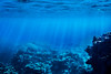
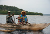
The above images may not be of the site on this page, but were taken nearby. They are loaded from Flickr so please click on them for image credits.
Click here to see more info for this site
Nearby sites
Click here to view sites on an interactive map of the areaKey: Red: member's photo, Blue: 3rd party photo, Yellow: other image, Green: no photo - please go there and take one, Grey: site destroyed
Download sites to:
KML (Google Earth)
GPX (GPS waypoints)
CSV (Garmin/Navman)
CSV (Excel)
To unlock full downloads you need to sign up as a Contributory Member. Otherwise downloads are limited to 50 sites.
Turn off the page maps and other distractions
Nearby sites listing. In the following links * = Image available
32.0km SE 134° Teouma Ancient Cemetery Barrow Cemetery
150.2km SSE 146° Velemendi cave Rock Art
189.4km SE 144° Potnangai cave Petroglyphs Rock Art
208.4km NNW 333° Tolamp Standing Stone (Menhir)
211.8km NNW 329° Yalo Cave & Apialo Cave Rock Art
213.6km NNW 333° Norohure & Togh-Vanu Sculptured Stone
328.7km SSE 149° Aname petroglyphs Rock Art
466.4km NNW 348° Tamate stone engravings Rock Art
538.0km SSW 201° Paita Valley Petroglyphs* Rock Art
1054.0km E 90° Nakauvadra Standing Stones and Narara Caves Standing Stones
1789.8km ESE 105° Nukuleka Ancient Village or Settlement
1792.0km ESE 105° Langi (Tonga) Cairn
1798.3km ESE 105° Maka Fa'akinanga Standing Stone (Menhir)
1798.3km ESE 105° Ha'amonga 'a Maui* Standing Stones
1856.5km E 100° Foa Island Petroglyphs Rock Art
1941.6km SW 231° Humming Stone Beaudesert (Summstein) Modern Stone Circle etc
2059.9km SW 230° 03-5-0010 Stone Row / Alignment
2062.5km SW 229° 12-2-0028 Stone Row / Alignment
2072.1km SSE 166° Waipoua Stone City* Ancient Village or Settlement
2081.3km SSE 166° Puketapu Hill* Cairn
2102.5km SW 228° 12-5-0047 Stone Row / Alignment
2106.2km SSE 165° Little Stone City* Cairn
2112.1km WNW 297° O'utuyam* Burial Chamber or Dolmen
2123.4km SW 227° 12-5-0056 Stone Row / Alignment
2146.9km SW 228° Australian Standing Stones* Modern Stone Circle etc
View more nearby sites and additional images


 We would like to know more about this location. Please feel free to add a brief description and any relevant information in your own language.
 Wir möchten mehr über diese Stätte erfahren. Bitte zögern Sie nicht, eine kurze Beschreibung und relevante Informationen in Deutsch hinzuzufügen.
 Nous aimerions en savoir encore un peu sur les lieux. S'il vous plaît n'hesitez pas à ajouter une courte description et tous les renseignements pertinents dans votre propre langue.
 Quisieramos informarnos un poco más de las lugares. No dude en añadir una breve descripción y otros datos relevantes en su propio idioma.