


<< Our Photo Pages >> Sørrollnes - Cairn in Norway in Troms
Submitted by kenntha88 on Monday, 12 October 2020 Page Views: 417
Neolithic and Bronze AgeSite Name: SørrollnesCountry: Norway
NOTE: This site is 5.559 km away from the location you searched for.
Fylke: Troms Type: Cairn
Nearest Town: Harstad Nearest Village: Ibestad
Latitude: 68.728483N Longitude: 16.829204E
Condition:
| 5 | Perfect |
| 4 | Almost Perfect |
| 3 | Reasonable but with some damage |
| 2 | Ruined but still recognisable as an ancient site |
| 1 | Pretty much destroyed, possibly visible as crop marks |
| 0 | No data. |
| -1 | Completely destroyed |
| 5 | Superb |
| 4 | Good |
| 3 | Ordinary |
| 2 | Not Good |
| 1 | Awful |
| 0 | No data. |
| 5 | Can be driven to, probably with disabled access |
| 4 | Short walk on a footpath |
| 3 | Requiring a bit more of a walk |
| 2 | A long walk |
| 1 | In the middle of nowhere, a nightmare to find |
| 0 | No data. |
| 5 | co-ordinates taken by GPS or official recorded co-ordinates |
| 4 | co-ordinates scaled from a detailed map |
| 3 | co-ordinates scaled from a bad map |
| 2 | co-ordinates of the nearest village |
| 1 | co-ordinates of the nearest town |
| 0 | no data |
Internal Links:
External Links:
")
The largest burial cairn is around 11 metres in diameter and about 1,5 metres in height. It has a deep crater in it. It is overgrown with grass and moss and appear more as a barrow than a cairn.
The other two cairns visible are around 8-9 metres in diameter and around 0,5 metres in height. They are also easily visible.
There was also several more burial cairns in the area but many have been plowed over and removed in later years.
You may be viewing yesterday's version of this page. To see the most up to date information please register for a free account.
")
")
")
")
Do not use the above information on other web sites or publications without permission of the contributor.
Nearby Images from Flickr
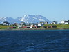


The above images may not be of the site on this page, but were taken nearby. They are loaded from Flickr so please click on them for image credits.
Click here to see more info for this site
Nearby sites
Click here to view sites on an interactive map of the areaKey: Red: member's photo, Blue: 3rd party photo, Yellow: other image, Green: no photo - please go there and take one, Grey: site destroyed
Download sites to:
KML (Google Earth)
GPX (GPS waypoints)
CSV (Garmin/Navman)
CSV (Excel)
To unlock full downloads you need to sign up as a Contributory Member. Otherwise downloads are limited to 50 sites.
Turn off the page maps and other distractions
Nearby sites listing. In the following links * = Image available
13.4km WNW 299° Harstad hill fort* Hillfort
13.6km S 187° Blåfjell sacrificial site* Natural Stone / Erratic / Other Natural Feature
14.1km ENE 58° Vik on Rolla* Carving
16.1km NW 316° Trondenes* Ancient Village or Settlement
19.5km NNW 327° Bessebostad, Grytøya* Barrow Cemetery
20.0km WSW 252° Storjorda sacrificial site* Natural Stone / Erratic / Other Natural Feature
20.2km NNW 338° Alvestad, Grytøya* Barrow Cemetery
26.7km SW 221° Hol-Tjeldsund Kirke* Round Barrow(s)
27.1km WNW 282° Borkenes Cemetary* Standing Stone (Menhir)
28.1km SW 228° Ballstadneset* Standing Stone (Menhir)
28.1km SW 228° Ballstad burial site* Barrow Cemetery
29.1km SW 229° Tjønneset* Barrow Cemetery
30.1km NW 312° Indre Elgneset* Barrow Cemetery
30.2km SW 228° Sandsbukta boat houses* Ancient Village or Settlement
30.3km WNW 286° Utstrand Bautasten* Standing Stone (Menhir)
30.9km NW 313° Ytre Elgneset* Cairn
31.3km W 280° Leitet* Barrow Cemetery
31.4km W 270° Hemmestad* Standing Stone (Menhir)
31.4km W 280° Piklisteinen* Standing Stone (Menhir)
31.6km NNW 337° Bjarkøya barrow cemetary* Barrow Cemetery
31.6km SW 230° Ripelen cairns* Barrow Cemetery
31.7km NNW 333° Øyra* Barrow Cemetery
32.0km NNW 338° Bjarkøya Centre, the chieftain's farm* Ancient Village or Settlement
34.2km NW 318° Grøtavær, Grytøya* Barrow Cemetery
34.4km NW 319° Grøtavær* Barrow Cemetery
View more nearby sites and additional images


 We would like to know more about this location. Please feel free to add a brief description and any relevant information in your own language.
 Wir möchten mehr über diese Stätte erfahren. Bitte zögern Sie nicht, eine kurze Beschreibung und relevante Informationen in Deutsch hinzuzufügen.
 Nous aimerions en savoir encore un peu sur les lieux. S'il vous plaît n'hesitez pas à ajouter une courte description et tous les renseignements pertinents dans votre propre langue.
 Quisieramos informarnos un poco más de las lugares. No dude en añadir una breve descripción y otros datos relevantes en su propio idioma.