


<< Our Photo Pages >> Hol-Tjeldsund Kirke - Round Barrow(s) in Norway in Troms
Submitted by kenntha88 on Saturday, 19 September 2020 Page Views: 347
Neolithic and Bronze AgeSite Name: Hol-Tjeldsund KirkeCountry: Norway
NOTE: This site is 5.426 km away from the location you searched for.
Fylke: Troms Type: Round Barrow(s)
Nearest Town: Harstad Nearest Village: Tjeldsud
Latitude: 68.547232N Longitude: 16.398201E
Condition:
| 5 | Perfect |
| 4 | Almost Perfect |
| 3 | Reasonable but with some damage |
| 2 | Ruined but still recognisable as an ancient site |
| 1 | Pretty much destroyed, possibly visible as crop marks |
| 0 | No data. |
| -1 | Completely destroyed |
| 5 | Superb |
| 4 | Good |
| 3 | Ordinary |
| 2 | Not Good |
| 1 | Awful |
| 0 | No data. |
| 5 | Can be driven to, probably with disabled access |
| 4 | Short walk on a footpath |
| 3 | Requiring a bit more of a walk |
| 2 | A long walk |
| 1 | In the middle of nowhere, a nightmare to find |
| 0 | No data. |
| 5 | co-ordinates taken by GPS or official recorded co-ordinates |
| 4 | co-ordinates scaled from a detailed map |
| 3 | co-ordinates scaled from a bad map |
| 2 | co-ordinates of the nearest village |
| 1 | co-ordinates of the nearest town |
| 0 | no data |
Internal Links:
External Links:
")
The barrow is 7 metres in diameter and around 1 metre in height. It is covered only with short grass that is regularly being mowed, making the barrow easy to see. It has a very pretty rounded top and doesn't seem to have any damage.
You may be viewing yesterday's version of this page. To see the most up to date information please register for a free account.
")
")
Do not use the above information on other web sites or publications without permission of the contributor.
Nearby Images from Flickr
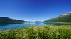
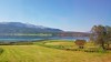
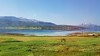
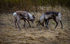
The above images may not be of the site on this page, but were taken nearby. They are loaded from Flickr so please click on them for image credits.
Click here to see more info for this site
Nearby sites
Click here to view sites on an interactive map of the areaKey: Red: member's photo, Blue: 3rd party photo, Yellow: other image, Green: no photo - please go there and take one, Grey: site destroyed
Download sites to:
KML (Google Earth)
GPX (GPS waypoints)
CSV (Garmin/Navman)
CSV (Excel)
To unlock full downloads you need to sign up as a Contributory Member. Otherwise downloads are limited to 50 sites.
Turn off the page maps and other distractions
Nearby sites listing. In the following links * = Image available
3.8km WNW 291° Ballstad burial site* Barrow Cemetery
3.8km WNW 292° Ballstadneset* Standing Stone (Menhir)
4.7km WNW 284° Tjønneset* Barrow Cemetery
4.8km W 268° Sandsbukta boat houses* Ancient Village or Settlement
6.7km W 267° Ripelen cairns* Barrow Cemetery
14.1km N 353° Storjorda sacrificial site* Natural Stone / Erratic / Other Natural Feature
17.2km ENE 67° Blåfjell sacrificial site* Natural Stone / Erratic / Other Natural Feature
20.0km SSW 194° Skarstad* Barrow Cemetery
20.8km SSW 194° Storvardhaugen* Cairn
24.5km WSW 237° Lødingen* Ancient Village or Settlement
24.6km NW 325° Hemmestad* Standing Stone (Menhir)
26.4km SW 230° Nes-Fort-Øst* Rock Art
26.6km SW 230° Neshaugen-Sør* Rock Art
26.6km SW 231° Nes-Fort-Vest* Rock Art
26.7km NE 41° Sørrollnes* Cairn
26.8km SSE 154° Trollsteinen* Natural Stone / Erratic / Other Natural Feature
26.9km S 188° Valle carvings* Carving
27.1km NNE 12° Harstad hill fort* Hillfort
27.2km NNW 340° Borkenes Cemetary* Standing Stone (Menhir)
28.7km NNW 332° Leitet* Barrow Cemetery
29.1km NNW 332° Piklisteinen* Standing Stone (Menhir)
30.8km NNW 338° Utstrand Bautasten* Standing Stone (Menhir)
32.2km N 11° Trondenes* Ancient Village or Settlement
35.3km WSW 236° Flåbergan* Rock Art
37.2km N 10° Bessebostad, Grytøya* Barrow Cemetery
View more nearby sites and additional images


 We would like to know more about this location. Please feel free to add a brief description and any relevant information in your own language.
 Wir möchten mehr über diese Stätte erfahren. Bitte zögern Sie nicht, eine kurze Beschreibung und relevante Informationen in Deutsch hinzuzufügen.
 Nous aimerions en savoir encore un peu sur les lieux. S'il vous plaît n'hesitez pas à ajouter une courte description et tous les renseignements pertinents dans votre propre langue.
 Quisieramos informarnos un poco más de las lugares. No dude en añadir una breve descripción y otros datos relevantes en su propio idioma.