<< Our Photo Pages >> Sagelv - Carving in Norway in Nordland
Submitted by kenntha88 on Sunday, 09 December 2007 Page Views: 3772
Multi-periodSite Name: SagelvCountry: Norway
NOTE: This site is 25.853 km away from the location you searched for.
Fylke: Nordland Type: Carving
Nearest Town: Narvik Nearest Village: Hamarøy
Latitude: 67.900789N Longitude: 15.859108E
Condition:
| 5 | Perfect |
| 4 | Almost Perfect |
| 3 | Reasonable but with some damage |
| 2 | Ruined but still recognisable as an ancient site |
| 1 | Pretty much destroyed, possibly visible as crop marks |
| 0 | No data. |
| -1 | Completely destroyed |
| 5 | Superb |
| 4 | Good |
| 3 | Ordinary |
| 2 | Not Good |
| 1 | Awful |
| 0 | No data. |
| 5 | Can be driven to, probably with disabled access |
| 4 | Short walk on a footpath |
| 3 | Requiring a bit more of a walk |
| 2 | A long walk |
| 1 | In the middle of nowhere, a nightmare to find |
| 0 | No data. |
| 5 | co-ordinates taken by GPS or official recorded co-ordinates |
| 4 | co-ordinates scaled from a detailed map |
| 3 | co-ordinates scaled from a bad map |
| 2 | co-ordinates of the nearest village |
| 1 | co-ordinates of the nearest town |
| 0 | no data |
Internal Links:
External Links:
I have visited· I would like to visit
Martin_L has visited here
")
The carving is of the same type as the ones at Valla and Leiknes. It is ground into the rock and not carved as most of the rock carvings in scandinavia and the world! It is believed to be from the early stone age, about 6000-8000 BC!
The carving itself is beautful, it is made of one single line, and picture the raindeer in a "running" position, it is the only carving picturing a moving animal of the rock carvings of this type!
The site is close to the European road nmb6, and is easy to find. Sign posts are placed along the road and a small footpath is leading to the site. It is on a rock side going straight into a small river, so the carving has to be seen and photographed from the other side of the small river.
Note: Nordland county
You may be viewing yesterday's version of this page. To see the most up to date information please register for a free account.
")
Do not use the above information on other web sites or publications without permission of the contributor.
Nearby Images from Flickr


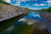
The above images may not be of the site on this page, but were taken nearby. They are loaded from Flickr so please click on them for image credits.
Click here to see more info for this site
Nearby sites
Click here to view sites on an interactive map of the areaKey: Red: member's photo, Blue: 3rd party photo, Yellow: other image, Green: no photo - please go there and take one, Grey: site destroyed
Download sites to:
KML (Google Earth)
GPX (GPS waypoints)
CSV (Garmin/Navman)
CSV (Excel)
To unlock full downloads you need to sign up as a Contributory Member. Otherwise downloads are limited to 50 sites.
Turn off the page maps and other distractions
Nearby sites listing. In the following links * = Image available
21.5km WNW 300° Nesset* Barrow Cemetery
21.9km NNW 331° Oppeid sacrificial site* Stone Circle
22.0km S 181° Mørsvikbotn sacrificial site* Natural Stone / Erratic / Other Natural Feature
23.1km NNW 330° Oppeid cairn* Cairn
25.5km N 3° Ulvsvåg sacrificial stone* Carving
26.4km NW 307° Dragseidet burial site* Barrow Cemetery
27.8km NNE 15° Leikneset stone carvings* Carving
29.2km WNW 283° Hammarhaugen* Barrow Cemetery
32.9km WNW 285° Eide Menhir* Standing Stone (Menhir)
33.2km W 275° Sandvågen altar* Carving
34.3km WNW 284° Mjelde burial site* Barrow Cemetery
34.7km W 274° Gjerdet* Round Barrow(s)
35.9km WNW 282° Daumannshågen* Barrow Cemetery
36.3km W 281° Bø settlement* Ancient Village or Settlement
36.7km W 276° Langsteinen* Standing Stone (Menhir)
37.1km W 279° Steigskardet burial mounds* Round Barrow(s)
37.3km W 278° Vollmoen settlement* Ancient Village or Settlement
37.5km W 276° Hagbardsholmen Island burial field* Barrow Cemetery
48.5km SSW 194° Daumannvikflåget* Natural Stone / Erratic / Other Natural Feature
48.9km NNE 22° Valle carvings* Carving
52.0km NNW 342° Hustad* Ancient Village or Settlement
52.7km N 352° Flåbergan* Rock Art
54.5km NNE 18° Storvardhaugen* Cairn
54.6km N 2° Neshaugen-Sør* Rock Art
54.9km N 2° Nes-Fort-Vest* Rock Art
View more nearby sites and additional images


 We would like to know more about this location. Please feel free to add a brief description and any relevant information in your own language.
 Wir möchten mehr über diese Stätte erfahren. Bitte zögern Sie nicht, eine kurze Beschreibung und relevante Informationen in Deutsch hinzuzufügen.
 Nous aimerions en savoir encore un peu sur les lieux. S'il vous plaît n'hesitez pas à ajouter une courte description et tous les renseignements pertinents dans votre propre langue.
 Quisieramos informarnos un poco más de las lugares. No dude en añadir una breve descripción y otros datos relevantes en su propio idioma.