<< Text Pages >> Pokrovnik - Ancient Village or Settlement in Croatia
Submitted by davidmorgan on Friday, 02 September 2011 Page Views: 3739
Multi-periodSite Name: PokrovnikCountry: Croatia
NOTE: This site is 25.181 km away from the location you searched for.
Type: Ancient Village or Settlement
Nearest Village: Pokrovnik
Latitude: 43.805420N Longitude: 16.072562E
Condition:
| 5 | Perfect |
| 4 | Almost Perfect |
| 3 | Reasonable but with some damage |
| 2 | Ruined but still recognisable as an ancient site |
| 1 | Pretty much destroyed, possibly visible as crop marks |
| 0 | No data. |
| -1 | Completely destroyed |
| 5 | Superb |
| 4 | Good |
| 3 | Ordinary |
| 2 | Not Good |
| 1 | Awful |
| 0 | No data. |
| 5 | Can be driven to, probably with disabled access |
| 4 | Short walk on a footpath |
| 3 | Requiring a bit more of a walk |
| 2 | A long walk |
| 1 | In the middle of nowhere, a nightmare to find |
| 0 | No data. |
| 5 | co-ordinates taken by GPS or official recorded co-ordinates |
| 4 | co-ordinates scaled from a detailed map |
| 3 | co-ordinates scaled from a bad map |
| 2 | co-ordinates of the nearest village |
| 1 | co-ordinates of the nearest town |
| 0 | no data |
Be the first person to rate this site - see the 'Contribute!' box in the right hand menu.
Internal Links:
External Links:
Ancient Village or Settlement in Croatia.
A 6th millennium BCE Neolithic settlement with evidence of some of the earliest farming in Europe.
You may be viewing yesterday's version of this page. To see the most up to date information please register for a free account.
Do not use the above information on other web sites or publications without permission of the contributor.
Nearby Images from Flickr
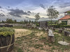
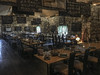
The above images may not be of the site on this page, but were taken nearby. They are loaded from Flickr so please click on them for image credits.
Click here to see more info for this site
Nearby sites
Click here to view sites on an interactive map of the areaKey: Red: member's photo, Blue: 3rd party photo, Yellow: other image, Green: no photo - please go there and take one, Grey: site destroyed
Download sites to:
KML (Google Earth)
GPX (GPS waypoints)
CSV (Garmin/Navman)
CSV (Excel)
To unlock full downloads you need to sign up as a Contributory Member. Otherwise downloads are limited to 50 sites.
Turn off the page maps and other distractions
Nearby sites listing. In the following links * = Image available
22.5km W 270° Arauzona Hillfort* Hillfort
22.7km NW 306° Varvaria* Hillfort
32.8km SSE 159° Sutilija Hillfort* Hillfort
39.6km NW 305° Asseria Hillfort* Hillfort
43.8km SE 140° Split Archaeological Museum* Museum
44.3km SE 132° Solin Town Gate* Ancient Village or Settlement
44.3km SE 132° Salona Town wall* Hillfort
44.3km SE 138° Diocletian's Palace* Ancient Palace
45.4km SE 127° Klis Hillfort* Hillfort
53.9km ESE 106° Cetina Valley Ancient Village or Settlement
59.6km WNW 295° Possible Illyrian site near Raštane Donj Ancient Village or Settlement
60.0km SSE 147° Gradina Rat Hillfort
60.0km WNW 295° Vrcevo Hill Hillfort
65.2km SE 144° Brac Island* Ancient Village or Settlement
73.2km SE 145° Zmajeva Spilja* Cave or Rock Shelter
73.6km NW 312° Nin Temple* Ancient Temple
74.2km SSE 157° Vira (Hvar)* Barrow Cemetery
76.1km WNW 297° Zadar Museum* Museum
76.2km SSE 157° Fortica* Hillfort
76.3km SSE 157° Hvar Museum* Museum
76.5km SSE 157° Hvar Castle Museum* Museum
79.3km NW 310° Kosa Tumuli 1* Round Barrow(s)
79.9km NW 310° Kosa Tumuli 2* Round Barrow(s)
80.1km NW 310° Kosa Tumuli 8* Round Barrow(s)
80.2km NW 310° Kosa Tumuli 9* Round Barrow(s)
View more nearby sites and additional images


 We would like to know more about this location. Please feel free to add a brief description and any relevant information in your own language.
 Wir möchten mehr über diese Stätte erfahren. Bitte zögern Sie nicht, eine kurze Beschreibung und relevante Informationen in Deutsch hinzuzufügen.
 Nous aimerions en savoir encore un peu sur les lieux. S'il vous plaît n'hesitez pas à ajouter une courte description et tous les renseignements pertinents dans votre propre langue.
 Quisieramos informarnos un poco más de las lugares. No dude en añadir una breve descripción y otros datos relevantes en su propio idioma.