<< Our Photo Pages >> Tychowo - Głaz Trygława - Natural Stone / Erratic / Other Natural Feature in Poland in Zachodniopomorskie
Submitted by SolarMegalith on Monday, 23 June 2008 Page Views: 4506
Natural PlacesSite Name: Tychowo - Głaz Trygława Alternative Name: Trygław StoneCountry: Poland
NOTE: This site is 20.17 km away from the location you searched for.
Voivodeship: Zachodniopomorskie Type: Natural Stone / Erratic / Other Natural Feature
Nearest Town: Białogard Nearest Village: Tychowo
Latitude: 53.928060N Longitude: 16.256200E
Condition:
| 5 | Perfect |
| 4 | Almost Perfect |
| 3 | Reasonable but with some damage |
| 2 | Ruined but still recognisable as an ancient site |
| 1 | Pretty much destroyed, possibly visible as crop marks |
| 0 | No data. |
| -1 | Completely destroyed |
| 5 | Superb |
| 4 | Good |
| 3 | Ordinary |
| 2 | Not Good |
| 1 | Awful |
| 0 | No data. |
| 5 | Can be driven to, probably with disabled access |
| 4 | Short walk on a footpath |
| 3 | Requiring a bit more of a walk |
| 2 | A long walk |
| 1 | In the middle of nowhere, a nightmare to find |
| 0 | No data. |
| 5 | co-ordinates taken by GPS or official recorded co-ordinates |
| 4 | co-ordinates scaled from a detailed map |
| 3 | co-ordinates scaled from a bad map |
| 2 | co-ordinates of the nearest village |
| 1 | co-ordinates of the nearest town |
| 0 | no data |
Internal Links:
External Links:
I have visited· I would like to visit
SolarMegalith has visited here
")
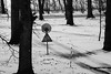
The stone is located in the middle of the modern cemetery.
You may be viewing yesterday's version of this page. To see the most up to date information please register for a free account.
Do not use the above information on other web sites or publications without permission of the contributor.
Nearby Images from Flickr

The above images may not be of the site on this page, but were taken nearby. They are loaded from Flickr so please click on them for image credits.
Click here to see more info for this site
Nearby sites
Click here to view sites on an interactive map of the areaKey: Red: member's photo, Blue: 3rd party photo, Yellow: other image, Green: no photo - please go there and take one, Grey: site destroyed
Download sites to:
KML (Google Earth)
GPX (GPS waypoints)
CSV (Garmin/Navman)
CSV (Excel)
To unlock full downloads you need to sign up as a Contributory Member. Otherwise downloads are limited to 50 sites.
Turn off the page maps and other distractions
Nearby sites listing. In the following links * = Image available
18.6km NE 43° Grzybnica* Stone Circle
26.6km E 87° Grodzisko Porost Promontory Fort / Cliff Castle
30.3km ENE 71° Grodzisko Stare Borne Hillfort
30.3km SW 232° Grodzisko Cieszeniewo Hillfort
31.5km ENE 69° Kurhany Żydowo* Barrow Cemetery
33.3km NE 52° Polanów Sacred Mountain* Holy Well or Sacred Spring
40.0km WNW 299° Kurhany Bardy Barrow Cemetery
40.1km NNE 33° Borkowo Dolmen IV* Chambered Tomb
40.2km NNE 34° Borkowo Long Barrow* Long Barrow
40.2km NNE 34° Borkowo Barrow Cemetery Round Barrow(s)
40.2km NNE 34° Borkowo Dolmen II.* Chambered Tomb
40.2km NNE 34° Borkowo Dolmen (Borkowo)* Chambered Tomb
41.3km NE 43° Grodzisko Krąg* Hillfort
44.6km WSW 239° Grodzisko Lipce Hillfort
45.0km SE 141° Grodzisko Wilcze Laski Hillfort
47.7km SW 217° Grodzisko Żółte Promontory Fort / Cliff Castle
48.9km WSW 252° Sosnkowo Chambered Tombs Chambered Tomb
49.2km WSW 242° Bełczna Chambered Tombs Chambered Tomb
50.8km W 278° Grodzisko Górawino Hillfort
56.8km SSW 202° Grodzisko Lubieszewo Hillfort
56.9km WSW 258° Łabuń Wielki Chambered Tombs 1-3 Chambered Tomb
60.0km WNW 283° Gosław Dolmen 2 Chambered Tomb
60.0km NE 39° Kurhany Bzowo Barrow Cemetery
60.1km WNW 283° Gosław Dolmen 1 Chambered Tomb
61.9km NE 40° Grodzisko Kczewo Hillfort
View more nearby sites and additional images


 We would like to know more about this location. Please feel free to add a brief description and any relevant information in your own language.
 Wir möchten mehr über diese Stätte erfahren. Bitte zögern Sie nicht, eine kurze Beschreibung und relevante Informationen in Deutsch hinzuzufügen.
 Nous aimerions en savoir encore un peu sur les lieux. S'il vous plaît n'hesitez pas à ajouter une courte description et tous les renseignements pertinents dans votre propre langue.
 Quisieramos informarnos un poco más de las lugares. No dude en añadir una breve descripción y otros datos relevantes en su propio idioma.