<< Text Pages >> Sisak - Ancient Village or Settlement in Croatia
Submitted by davidmorgan on Tuesday, 02 February 2016 Page Views: 2579
Multi-periodSite Name: Sisak Alternative Name: SegesticaCountry: Croatia
NOTE: This site is 62.157 km away from the location you searched for.
Type: Ancient Village or Settlement
Nearest Town: Sisak
Latitude: 45.484222N Longitude: 16.372096E
Condition:
| 5 | Perfect |
| 4 | Almost Perfect |
| 3 | Reasonable but with some damage |
| 2 | Ruined but still recognisable as an ancient site |
| 1 | Pretty much destroyed, possibly visible as crop marks |
| 0 | No data. |
| -1 | Completely destroyed |
| 5 | Superb |
| 4 | Good |
| 3 | Ordinary |
| 2 | Not Good |
| 1 | Awful |
| 0 | No data. |
| 5 | Can be driven to, probably with disabled access |
| 4 | Short walk on a footpath |
| 3 | Requiring a bit more of a walk |
| 2 | A long walk |
| 1 | In the middle of nowhere, a nightmare to find |
| 0 | No data. |
| 5 | co-ordinates taken by GPS or official recorded co-ordinates |
| 4 | co-ordinates scaled from a detailed map |
| 3 | co-ordinates scaled from a bad map |
| 2 | co-ordinates of the nearest village |
| 1 | co-ordinates of the nearest town |
| 0 | no data |
Internal Links:
External Links:
Ancient Settlement in Croatia
A late Iron Age settlement taken over by the Roman Empire.
You may be viewing yesterday's version of this page. To see the most up to date information please register for a free account.
Do not use the above information on other web sites or publications without permission of the contributor.
Nearby Images from Flickr


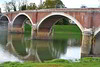
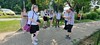
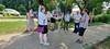

The above images may not be of the site on this page, but were taken nearby. They are loaded from Flickr so please click on them for image credits.
Click here to see more info for this site
Nearby sites
Click here to view sites on an interactive map of the areaKey: Red: member's photo, Blue: 3rd party photo, Yellow: other image, Green: no photo - please go there and take one, Grey: site destroyed
Download sites to:
KML (Google Earth)
GPX (GPS waypoints)
CSV (Garmin/Navman)
CSV (Excel)
To unlock full downloads you need to sign up as a Contributory Member. Otherwise downloads are limited to 50 sites.
Turn off the page maps and other distractions
Nearby sites listing. In the following links * = Image available
47.6km NW 320° Zagreb Archeological Museum* Museum
85.4km NNW 333° Krapina Cave and Neanderthal Museum* Cave or Rock Shelter
91.9km N 358° Varazdin Museum* Museum
132.1km ESE 105° Galovo Ancient Village or Settlement
134.7km NNW 334° The Devil Stones (Maribor)* Natural Stone / Erratic / Other Natural Feature
153.0km WNW 296° Čolnišče Prehistoric Trap* Ancient Village or Settlement
156.9km NNW 328° Lochstein Wuggitz Holed Stone
158.4km SSW 210° Nin Temple* Ancient Temple
158.8km SSW 212° Venac Hillfort* Hillfort
159.1km SSW 212° Kosa Tumuli 8* Round Barrow(s)
159.2km SSW 212° Kosa Tumuli 9* Round Barrow(s)
159.2km SSW 212° Kosa Tumuli 2* Round Barrow(s)
159.3km SSW 212° Kosa Tumuli 1* Round Barrow(s)
163.2km WSW 256° Beli wall petroglyph* Rock Art
163.4km WSW 256° Tramuntana Dolmen 1* Burial Chamber or Dolmen
163.5km WSW 256° Tramuntana Dolmen 2* Burial Chamber or Dolmen
164.3km WSW 256° Tramuntana Well* Holy Well or Sacred Spring
164.3km WSW 256° Tramuntana Portal Tomb* Portal Tomb
168.2km SW 214° Prahulje Tumulus* Artificial Mound
173.1km SSW 199° Asseria Hillfort* Hillfort
177.1km SSW 211° Zadar Museum* Museum
178.4km SSW 194° Varvaria* Hillfort
179.1km SSW 206° Vrcevo Hill Hillfort
179.4km SSW 206° Possible Illyrian site near Raštane Donj Ancient Village or Settlement
180.0km WSW 257° Kunci Hillfort* Hillfort
View more nearby sites and additional images


 We would like to know more about this location. Please feel free to add a brief description and any relevant information in your own language.
 Wir möchten mehr über diese Stätte erfahren. Bitte zögern Sie nicht, eine kurze Beschreibung und relevante Informationen in Deutsch hinzuzufügen.
 Nous aimerions en savoir encore un peu sur les lieux. S'il vous plaît n'hesitez pas à ajouter une courte description et tous les renseignements pertinents dans votre propre langue.
 Quisieramos informarnos un poco más de las lugares. No dude en añadir una breve descripción y otros datos relevantes en su propio idioma.