<< Our Photo Pages >> Kamchatka Geological Museum - Museum in Russia
Submitted by DrewParsons on Tuesday, 17 May 2016 Page Views: 2959
MuseumsSite Name: Kamchatka Geological MuseumCountry: Russia
NOTE: This site is 165.088 km away from the location you searched for.
Type: Museum
Nearest Town: Kamchatka
Latitude: 53.043030N Longitude: 158.620790E
Condition:
| 5 | Perfect |
| 4 | Almost Perfect |
| 3 | Reasonable but with some damage |
| 2 | Ruined but still recognisable as an ancient site |
| 1 | Pretty much destroyed, possibly visible as crop marks |
| 0 | No data. |
| -1 | Completely destroyed |
| 5 | Superb |
| 4 | Good |
| 3 | Ordinary |
| 2 | Not Good |
| 1 | Awful |
| 0 | No data. |
| 5 | Can be driven to, probably with disabled access |
| 4 | Short walk on a footpath |
| 3 | Requiring a bit more of a walk |
| 2 | A long walk |
| 1 | In the middle of nowhere, a nightmare to find |
| 0 | No data. |
| 5 | co-ordinates taken by GPS or official recorded co-ordinates |
| 4 | co-ordinates scaled from a detailed map |
| 3 | co-ordinates scaled from a bad map |
| 2 | co-ordinates of the nearest village |
| 1 | co-ordinates of the nearest town |
| 0 | no data |
Internal Links:
External Links:
I have visited· I would like to visit
DrewParsons has visited here
")
Kamchatka Geological Museum (Геологический музей) is located in Petropavlovsk Kamchatka at ul. Beringa, 117, Petropavlovsk-Kamchatskiy, Kamchatka Krai, Russia, 683016. The museum focuses on the geology of the region although there are a few prehistoric items on display.
You may be viewing yesterday's version of this page. To see the most up to date information please register for a free account.
")
")
")
")
Do not use the above information on other web sites or publications without permission of the contributor.
Nearby Images from Flickr
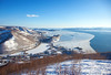
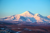
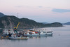
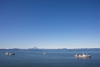
The above images may not be of the site on this page, but were taken nearby. They are loaded from Flickr so please click on them for image credits.
Click here to see more info for this site
Nearby sites
Click here to view sites on an interactive map of the areaKey: Red: member's photo, Blue: 3rd party photo, Yellow: other image, Green: no photo - please go there and take one, Grey: site destroyed
Download sites to:
KML (Google Earth)
GPX (GPS waypoints)
CSV (Garmin/Navman)
CSV (Excel)
To unlock full downloads you need to sign up as a Contributory Member. Otherwise downloads are limited to 50 sites.
Turn off the page maps and other distractions
Nearby sites listing. In the following links * = Image available
868.7km NNW 330° Magadan Regional Museum* Museum
1243.4km NNW 335° Berelekh* Ancient Village or Settlement
1400.6km SW 230° Tobinitai* Ancient Village or Settlement
1430.1km SW 227° Wonnemoto Chashi* Hillfort
1437.5km SW 229° Ichani Karikariusu Chashi* Hillfort
1437.7km SW 229° Ichani Karikariusu* Ancient Village or Settlement
1438.0km SW 231° Shuen* Henge
1440.1km SW 231° OkushibetsuGawa* Stone Circle
1451.9km SW 232° Moyoro Kaizuka* Ancient Village or Settlement
1452.4km SW 232° KatsuragaOka Toride* Hillfort
1454.1km SW 233° Tokor Chashi* Hillfort
1456.3km SW 233° SakaeUra Iseki* Ancient Village or Settlement
1456.4km SW 232° Abashiri prison* Modern Stone Circle etc
1459.3km SW 233° Tokoro Iseki* Ancient Village or Settlement
1506.4km SW 228° Shika-otoshi-no Chashi* Hillfort
1527.0km SW 232° Yuk'epira Chashi* Hillfort
1534.2km SW 229° Charanke Chashi* Hillfort
1534.3km SW 229° Mosirya Chashi* Hillfort
1576.2km SW 230° Otafunbe Chashi* Hillfort
1588.3km SW 236° Kamui-Kotan stone circle* Stone Circle
1601.7km SW 236° Otoe* Stone Circle
1605.9km SW 235° Nokanan henge* Henge
1619.7km SW 236° Hokkaidō Children's Land* Modern Stone Circle etc
1655.9km W 277° Dolmens Bureinski reserve* Chambered Tomb
1672.0km W 263° Sikachi-Alyan Petroglyphs* Rock Art
View more nearby sites and additional images


 We would like to know more about this location. Please feel free to add a brief description and any relevant information in your own language.
 Wir möchten mehr über diese Stätte erfahren. Bitte zögern Sie nicht, eine kurze Beschreibung und relevante Informationen in Deutsch hinzuzufügen.
 Nous aimerions en savoir encore un peu sur les lieux. S'il vous plaît n'hesitez pas à ajouter une courte description et tous les renseignements pertinents dans votre propre langue.
 Quisieramos informarnos un poco más de las lugares. No dude en añadir una breve descripción y otros datos relevantes en su propio idioma.