

<< Our Photo Pages >> Australian Standing Stones - Modern Stone Circle etc in Australia
Submitted by CircusKate on Tuesday, 02 August 2011 Page Views: 5814
Modern SitesSite Name: Australian Standing StonesCountry: Australia Type: Modern Stone Circle etc
Nearest Town: Glen Innes Nearest Village: Glen Innes
Latitude: 29.7413S Longitude: 151.751800E
Condition:
| 5 | Perfect |
| 4 | Almost Perfect |
| 3 | Reasonable but with some damage |
| 2 | Ruined but still recognisable as an ancient site |
| 1 | Pretty much destroyed, possibly visible as crop marks |
| 0 | No data. |
| -1 | Completely destroyed |
| 5 | Superb |
| 4 | Good |
| 3 | Ordinary |
| 2 | Not Good |
| 1 | Awful |
| 0 | No data. |
| 5 | Can be driven to, probably with disabled access |
| 4 | Short walk on a footpath |
| 3 | Requiring a bit more of a walk |
| 2 | A long walk |
| 1 | In the middle of nowhere, a nightmare to find |
| 0 | No data. |
| 5 | co-ordinates taken by GPS or official recorded co-ordinates |
| 4 | co-ordinates scaled from a detailed map |
| 3 | co-ordinates scaled from a bad map |
| 2 | co-ordinates of the nearest village |
| 1 | co-ordinates of the nearest town |
| 0 | no data |
Internal Links:
External Links:
I have visited· I would like to visit
Shay visited on 21st Jun 2017 - their rating: Cond: 5 Amb: 4 Access: 4
")
You may be viewing yesterday's version of this page. To see the most up to date information please register for a free account.
")
Do not use the above information on other web sites or publications without permission of the contributor.
TheCaptain has found this location on Google Street View:
Nearby Images from Flickr


The above images may not be of the site on this page, but were taken nearby. They are loaded from Flickr so please click on them for image credits.
Click here to see more info for this site
Nearby sites
Click here to view sites on an interactive map of the areaKey: Red: member's photo, Blue: 3rd party photo, Yellow: other image, Green: no photo - please go there and take one, Grey: site destroyed
Download sites to:
KML (Google Earth)
GPX (GPS waypoints)
CSV (Garmin/Navman)
CSV (Excel)
To unlock full downloads you need to sign up as a Contributory Member. Otherwise downloads are limited to 50 sites.
Turn off the page maps and other distractions
Nearby sites listing. In the following links * = Image available
34.2km E 101° 12-5-0056 Stone Row / Alignment
46.1km ENE 70° 12-5-0047 Stone Row / Alignment
67.1km SW 220° 20-3-0015 Stone Row / Alignment
88.9km NE 37° 12-2-0028 Stone Row / Alignment
109.9km SW 228° 20-2-0005 Stone Row / Alignment
110.0km NNE 18° 03-5-0010 Stone Row / Alignment
231.3km NNE 29° Humming Stone Beaudesert (Summstein) Modern Stone Circle etc
291.9km SW 233° 28-2-0005 Stone Row / Alignment
328.0km SSW 194° 37-5-0206 Stone Row / Alignment
358.4km SSW 191° 37-6-0471 Stone Row / Alignment
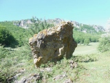
369.3km S 191° Wollemi National Park Rock Art Rock Art
389.5km S 189° 45-3-2147 Stone Row / Alignment
412.8km S 187° Calga Springs site Rock Art
412.9km S 186° Girrakool Man Rock Art
415.2km S 186° Bulgandry engravings Rock Art
417.5km S 186° Woy Woy site Rock Art
429.2km S 186° Resolute Aboriginal Carvings Rock Art
429.6km S 186° Echidna Engravings Rock Art
430.6km S 186° Basin Track Engravings Rock Art
432.8km S 188° Berowra Waters Petroglyphs Rock Art
433.8km WSW 245° 27-2-0004 Stone Row / Alignment
434.3km S 186° West Head Road engravings Rock Art
436.4km S 186° Emu-In-the-Sky Rock Art
440.1km S 187° Terrey Hills Emu Rock Art
440.1km S 187° Gibberagong Rock Art
View more nearby sites and additional images


 We would like to know more about this location. Please feel free to add a brief description and any relevant information in your own language.
 Wir möchten mehr über diese Stätte erfahren. Bitte zögern Sie nicht, eine kurze Beschreibung und relevante Informationen in Deutsch hinzuzufügen.
 Nous aimerions en savoir encore un peu sur les lieux. S'il vous plaît n'hesitez pas à ajouter une courte description et tous les renseignements pertinents dans votre propre langue.
 Quisieramos informarnos un poco más de las lugares. No dude en añadir una breve descripción y otros datos relevantes en su propio idioma.