<< Our Photo Pages >> Gräberfeld Traisental - Barrow Cemetery in Austria
Submitted by Harald_Platta on Thursday, 20 October 2016 Page Views: 3853
Multi-periodSite Name: Gräberfeld TraisentalCountry: Austria Type: Barrow Cemetery
Nearest Town: Nußdorf ob der Traisen
Latitude: 48.351959N Longitude: 15.716376E
Condition:
| 5 | Perfect |
| 4 | Almost Perfect |
| 3 | Reasonable but with some damage |
| 2 | Ruined but still recognisable as an ancient site |
| 1 | Pretty much destroyed, possibly visible as crop marks |
| 0 | No data. |
| -1 | Completely destroyed |
| 5 | Superb |
| 4 | Good |
| 3 | Ordinary |
| 2 | Not Good |
| 1 | Awful |
| 0 | No data. |
| 5 | Can be driven to, probably with disabled access |
| 4 | Short walk on a footpath |
| 3 | Requiring a bit more of a walk |
| 2 | A long walk |
| 1 | In the middle of nowhere, a nightmare to find |
| 0 | No data. |
| 5 | co-ordinates taken by GPS or official recorded co-ordinates |
| 4 | co-ordinates scaled from a detailed map |
| 3 | co-ordinates scaled from a bad map |
| 2 | co-ordinates of the nearest village |
| 1 | co-ordinates of the nearest town |
| 0 | no data |
Internal Links:
External Links:
")
The valley contains the cemeteries Franzenhausen I, Franzenhausen II and Reichersdorf. The Bronze Age grave fields are among the largest ones in Austria. Most graves stem from the Urnfield Culture. The cemetery was used until the Pre-Roman Iron Age.
Literature:
[01] Ritter, V.: Grabrituale und Gesellschaft Brandbestattung in der Ur- und Frühgeschichte und in historischer Zeit. Religiöse, kulturelle und soziale Hintergründe - Die frühbronzezeitlichen Brandbestattungen von Franzhausen II und Ratzersdorf im Unteren Traisental (2008).
[02] Urban, O.H.: Der lange Weg zur Geschichte. Die Urgeschichte Österreichs (2003).
You may be viewing yesterday's version of this page. To see the most up to date information please register for a free account.
Do not use the above information on other web sites or publications without permission of the contributor.
Nearby Images from Flickr

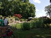
The above images may not be of the site on this page, but were taken nearby. They are loaded from Flickr so please click on them for image credits.
Click here to see more info for this site
Nearby sites
Click here to view sites on an interactive map of the areaKey: Red: member's photo, Blue: 3rd party photo, Yellow: other image, Green: no photo - please go there and take one, Grey: site destroyed
Download sites to:
KML (Google Earth)
GPX (GPS waypoints)
CSV (Garmin/Navman)
CSV (Excel)
To unlock full downloads you need to sign up as a Contributory Member. Otherwise downloads are limited to 50 sites.
Turn off the page maps and other distractions
Nearby sites listing. In the following links * = Image available
1.5km W 272° Urzeitmuseum* Museum
23.4km W 262° Venus of Willendorf* Ancient Village or Settlement
24.4km W 270° Gars-Thunau Hillfort* Hillfort
31.4km N 356° Mold and Rosenburg Ancient Settlements Ancient Village or Settlement
33.4km E 84° Hügelgrab Löwenberg* Round Barrow(s)
38.9km ENE 69° Geitzendorf* Barrow Cemetery
40.3km ENE 68° Leeberg* Artificial Mound
41.8km SSE 147° Hafnerberg Steinkreise Stone Circle
42.1km SSE 149° Fuxbauer Kalendarium Holed Stone
42.3km SSE 149° Hafnerberg Visurhügel 1 Round Barrow(s)
42.3km NNE 14° Kalenderstein von Leodagger* Rock Art
42.3km SSE 149° Hafnerberg Lochstein 2 Holed Stone
42.3km SSE 148° Hafnerberg Visurhügel 2 Round Barrow(s)
42.3km SSE 149° Hafnerberg Felsnadel Standing Stone (Menhir)
42.4km SSE 149° Hafnerberg Lochstein 1 Holed Stone
44.0km ENE 75° Niederhollabrunn Leeberg Round Barrow(s)
44.9km SSE 147° Peilstein Berg Natural Stone / Erratic / Other Natural Feature
45.2km ENE 73° Niederfellabrunn Leeberg Round Barrow(s)
49.8km N 355° Summstein Geras* Modern Stone Circle etc
50.3km ESE 109° Naturhistorisches Museum Wien* Museum
51.5km ESE 102° Summstein Wasserpark* Modern Stone Circle etc
52.3km NNE 21° Heiliger Stein (Mitterretzbach)* Rock Art
54.3km WNW 298° Gross Gerungs Steinpyramide* Pyramid / Mastaba
57.7km E 84° Keltenstein Ulrichskirchen* Holed Stone
58.7km WNW 298° Weltkugel* Natural Stone / Erratic / Other Natural Feature
View more nearby sites and additional images


 We would like to know more about this location. Please feel free to add a brief description and any relevant information in your own language.
 Wir möchten mehr über diese Stätte erfahren. Bitte zögern Sie nicht, eine kurze Beschreibung und relevante Informationen in Deutsch hinzuzufügen.
 Nous aimerions en savoir encore un peu sur les lieux. S'il vous plaît n'hesitez pas à ajouter une courte description et tous les renseignements pertinents dans votre propre langue.
 Quisieramos informarnos un poco más de las lugares. No dude en añadir una breve descripción y otros datos relevantes en su propio idioma.