<< Text Pages >> Grodzisko Otok - Hillfort in Poland in Dolnoslaskie
Submitted by SolarMegalith on Sunday, 01 May 2011 Page Views: 3921
Iron Age and Later PrehistorySite Name: Grodzisko OtokCountry: Poland
NOTE: This site is 14.179 km away from the location you searched for.
Voivodeship: Dolnoslaskie Type: Hillfort
Nearest Town: Bolesławiec
Latitude: 51.230380N Longitude: 15.510030E
Condition:
| 5 | Perfect |
| 4 | Almost Perfect |
| 3 | Reasonable but with some damage |
| 2 | Ruined but still recognisable as an ancient site |
| 1 | Pretty much destroyed, possibly visible as crop marks |
| 0 | No data. |
| -1 | Completely destroyed |
| 5 | Superb |
| 4 | Good |
| 3 | Ordinary |
| 2 | Not Good |
| 1 | Awful |
| 0 | No data. |
| 5 | Can be driven to, probably with disabled access |
| 4 | Short walk on a footpath |
| 3 | Requiring a bit more of a walk |
| 2 | A long walk |
| 1 | In the middle of nowhere, a nightmare to find |
| 0 | No data. |
| 5 | co-ordinates taken by GPS or official recorded co-ordinates |
| 4 | co-ordinates scaled from a detailed map |
| 3 | co-ordinates scaled from a bad map |
| 2 | co-ordinates of the nearest village |
| 1 | co-ordinates of the nearest town |
| 0 | no data |
Internal Links:
External Links:
Hillfort in Dolnoslaskie
Grodzisko dated for 9th-10th century AD is located 1 km SW from village of Otok.
You may be viewing yesterday's version of this page. To see the most up to date information please register for a free account.
Do not use the above information on other web sites or publications without permission of the contributor.
Nearby Images from Flickr
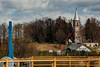
The above images may not be of the site on this page, but were taken nearby. They are loaded from Flickr so please click on them for image credits.
Click here to see more info for this site
Nearby sites
Click here to view sites on an interactive map of the areaKey: Red: member's photo, Blue: 3rd party photo, Yellow: other image, Green: no photo - please go there and take one, Grey: site destroyed
Download sites to:
KML (Google Earth)
GPX (GPS waypoints)
CSV (Garmin/Navman)
CSV (Excel)
To unlock full downloads you need to sign up as a Contributory Member. Otherwise downloads are limited to 50 sites.
Turn off the page maps and other distractions
Nearby sites listing. In the following links * = Image available
26.3km WSW 252° Kurhany Białogórze Barrow Cemetery
34.7km WSW 240° Grodzisko Sulików Hillfort
35.6km WSW 250° Grodzisko Tylice Hillfort
36.0km WSW 256° Unknown wooden sculpture* Sculptured Stone
41.7km WSW 241° Niedów Cup-Marked Stone Rock Art
50.2km W 262° Biesig Opferstein Natural Stone / Erratic / Other Natural Feature
54.2km N 9° Grodzisko Solniki Hillfort
57.0km SSW 204° Skalní hřib u Jindřichova* Natural Stone / Erratic / Other Natural Feature
58.1km WSW 258° Bielplatz Wallburg Misc. Earthwork
58.3km WSW 255° Geldkeller Felsen* Rock Outcrop
58.5km WSW 255° Schafberg Siedlung Ancient Village or Settlement
58.8km ESE 105° Grodzisko Mierczyce* Hillfort
62.7km SSW 202° Čertův Kámen* Natural Stone / Erratic / Other Natural Feature
67.2km SE 129° Krzyż Pokutny Cisów* Ancient Cross
67.6km WNW 296° Summstein Weißwasser Modern Stone Circle etc
68.7km SW 232° Berg Oybin Ancient Village or Settlement
68.9km W 269° Pliesskowitz Teufelsstein Natural Stone / Erratic / Other Natural Feature
69.7km W 266° Kubschuetz Schalenstein Rock Art
69.9km W 260° Teufelstisch Czorneboh Natural Stone / Erratic / Other Natural Feature
71.1km WSW 253° Guettlerbueschl Chambered Tomb
71.7km SW 225° Bezčasí* Modern Stone Circle etc
71.8km W 266° Zieschuetz Schalenstein Rock Art
72.4km ESE 120° Grodzisko Nowy Jaworów* Hillfort
72.5km W 269° Gottlobsberg Schalensteine Rock Art
75.8km WSW 257° Kaelbersteine Natural Stone / Erratic / Other Natural Feature
View more nearby sites and additional images


 We would like to know more about this location. Please feel free to add a brief description and any relevant information in your own language.
 Wir möchten mehr über diese Stätte erfahren. Bitte zögern Sie nicht, eine kurze Beschreibung und relevante Informationen in Deutsch hinzuzufügen.
 Nous aimerions en savoir encore un peu sur les lieux. S'il vous plaît n'hesitez pas à ajouter une courte description et tous les renseignements pertinents dans votre propre langue.
 Quisieramos informarnos un poco más de las lugares. No dude en añadir una breve descripción y otros datos relevantes en su propio idioma.