

<< Text Pages >> Grodzisko Solniki - Hillfort in Poland in Lubuskie
Submitted by SolarMegalith on Friday, 26 October 2018 Page Views: 719
Iron Age and Later PrehistorySite Name: Grodzisko SolnikiCountry: Poland
NOTE: This site is 17.047 km away from the location you searched for.
Voivodeship: Lubuskie Type: Hillfort
Nearest Town: Kożuchów
Latitude: 51.711728N Longitude: 15.630262E
Condition:
| 5 | Perfect |
| 4 | Almost Perfect |
| 3 | Reasonable but with some damage |
| 2 | Ruined but still recognisable as an ancient site |
| 1 | Pretty much destroyed, possibly visible as crop marks |
| 0 | No data. |
| -1 | Completely destroyed |
| 5 | Superb |
| 4 | Good |
| 3 | Ordinary |
| 2 | Not Good |
| 1 | Awful |
| 0 | No data. |
| 5 | Can be driven to, probably with disabled access |
| 4 | Short walk on a footpath |
| 3 | Requiring a bit more of a walk |
| 2 | A long walk |
| 1 | In the middle of nowhere, a nightmare to find |
| 0 | No data. |
| 5 | co-ordinates taken by GPS or official recorded co-ordinates |
| 4 | co-ordinates scaled from a detailed map |
| 3 | co-ordinates scaled from a bad map |
| 2 | co-ordinates of the nearest village |
| 1 | co-ordinates of the nearest town |
| 0 | no data |
Internal Links:
External Links:
Hillfort in Lubuskie
This multi-period hillfort is located on a small hill in the northern part of Wzgórza Dalkowskie (Dalkowskie Hills). The excavations revealed Iron Age occupation of the Lusatian culture, as well as early medieval deposits from the Tribal period.
Read more at atlasgrodzisk.pl.
You may be viewing yesterday's version of this page. To see the most up to date information please register for a free account.
Do not use the above information on other web sites or publications without permission of the contributor.
Nearby Images from Flickr
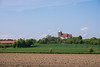
The above images may not be of the site on this page, but were taken nearby. They are loaded from Flickr so please click on them for image credits.
Click here to see more info for this site
Nearby sites
Click here to view sites on an interactive map of the areaKey: Red: member's photo, Blue: 3rd party photo, Yellow: other image, Green: no photo - please go there and take one, Grey: site destroyed
Download sites to:
KML (Google Earth)
GPX (GPS waypoints)
CSV (Garmin/Navman)
CSV (Excel)
To unlock full downloads you need to sign up as a Contributory Member. Otherwise downloads are limited to 50 sites.
Turn off the page maps and other distractions
Nearby sites listing. In the following links * = Image available
54.2km S 189° Grodzisko Otok Hillfort
67.3km WNW 293° Krzyże Pokutne Gubin Ancient Cross
68.1km NE 53° Grodzisko Reńsko* Hillfort
68.5km ESE 105° Kurhany Psary Barrow Cemetery
70.1km SSW 209° Kurhany Białogórze Barrow Cemetery
71.6km ESE 114° Grodzisko Słup Hillfort
72.5km ESE 114° Kurhan Słup Round Barrow(s)
73.3km WSW 251° Summstein Weißwasser Modern Stone Circle etc
74.0km NE 56° Grodzisko Stary Białcz* Hillfort
74.5km ENE 62° Grodzisko Przysieka Polska* Hillfort
75.1km WNW 302° Wellmitz Steinkreuze Ancient Cross
75.8km SW 215° Unknown wooden sculpture* Sculptured Stone
76.2km ENE 74° Grodzisko Łoniewo* Promontory Fort / Cliff Castle
77.8km SSW 213° Grodzisko Tylice Hillfort
78.7km NE 51° Kurhany Łęki Małe* Barrow Cemetery
80.5km SSW 209° Grodzisko Sulików Hillfort
81.1km NE 55° Grodzisko Bonikowo* Hillfort
83.9km SW 224° Biesig Opferstein Natural Stone / Erratic / Other Natural Feature
84.1km SE 145° Grodzisko Mierczyce* Hillfort
84.3km NNE 21° Grudna Burial Mound Barrow Cemetery
85.2km WNW 301° Kobbelner Stein* Natural Stone / Erratic / Other Natural Feature
85.9km ENE 71° Grodzisko Czerwona Wieś Hillfort
86.2km NE 42° Grodzisko Dakowy Mokre* Hillfort
86.4km SSW 211° Niedów Cup-Marked Stone Rock Art
87.0km WNW 300° Kieselwitz Teufelsstein* Natural Stone / Erratic / Other Natural Feature
View more nearby sites and additional images


 We would like to know more about this location. Please feel free to add a brief description and any relevant information in your own language.
 Wir möchten mehr über diese Stätte erfahren. Bitte zögern Sie nicht, eine kurze Beschreibung und relevante Informationen in Deutsch hinzuzufügen.
 Nous aimerions en savoir encore un peu sur les lieux. S'il vous plaît n'hesitez pas à ajouter une courte description et tous les renseignements pertinents dans votre propre langue.
 Quisieramos informarnos un poco más de las lugares. No dude en añadir una breve descripción y otros datos relevantes en su propio idioma.