<< Our Photo Pages >> Stødi sacrificial site - Natural Stone / Erratic / Other Natural Feature in Norway in Nordland
Submitted by kenntha88 on Tuesday, 03 November 2009 Page Views: 4443
Natural PlacesSite Name: Stødi sacrificial siteCountry: Norway
NOTE: This site is 212.473 km away from the location you searched for.
Fylke: Nordland Type: Natural Stone / Erratic / Other Natural Feature
Nearest Town: Bodø Nearest Village: Mo i Rana
Latitude: 66.568322N Longitude: 15.337429E
Condition:
| 5 | Perfect |
| 4 | Almost Perfect |
| 3 | Reasonable but with some damage |
| 2 | Ruined but still recognisable as an ancient site |
| 1 | Pretty much destroyed, possibly visible as crop marks |
| 0 | No data. |
| -1 | Completely destroyed |
| 5 | Superb |
| 4 | Good |
| 3 | Ordinary |
| 2 | Not Good |
| 1 | Awful |
| 0 | No data. |
| 5 | Can be driven to, probably with disabled access |
| 4 | Short walk on a footpath |
| 3 | Requiring a bit more of a walk |
| 2 | A long walk |
| 1 | In the middle of nowhere, a nightmare to find |
| 0 | No data. |
| 5 | co-ordinates taken by GPS or official recorded co-ordinates |
| 4 | co-ordinates scaled from a detailed map |
| 3 | co-ordinates scaled from a bad map |
| 2 | co-ordinates of the nearest village |
| 1 | co-ordinates of the nearest town |
| 0 | no data |
Internal Links:
External Links:
I have visited· I would like to visit
SolarMegalith would like to visit
")
This same sacrificial site is located on the high-elevation mountain plains on Saltfjellet, close to the small railway station at Stødi.
It consist of three huge natural boulders located with just some few metres in space between them. One of the boulders have a broad natural crack running trough it.
Some years ago, there were still visible stone rings very close to the stones. The Sami used this site for sacrifice and religious activity as late as the 1800s. But it is difficult to know when the site was first put to use.
The boulders are easy to see from miles away doe to the lack of vegetation and the flat landscape! They are easy to see even from the highway about 1 km to the east. The site is just some few miles from the border to Sweden, it is also just some few miles from the arctic circle.
You may be viewing yesterday's version of this page. To see the most up to date information please register for a free account.
")
")
")
")
Do not use the above information on other web sites or publications without permission of the contributor.
Nearby Images from Flickr


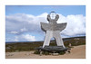
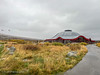
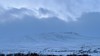
The above images may not be of the site on this page, but were taken nearby. They are loaded from Flickr so please click on them for image credits.
Click here to see more info for this site
Nearby sites
Click here to view sites on an interactive map of the areaKey: Red: member's photo, Blue: 3rd party photo, Yellow: other image, Green: no photo - please go there and take one, Grey: site destroyed
Download sites to:
KML (Google Earth)
GPX (GPS waypoints)
CSV (Garmin/Navman)
CSV (Excel)
To unlock full downloads you need to sign up as a Contributory Member. Otherwise downloads are limited to 50 sites.
Turn off the page maps and other distractions
Nearby sites listing. In the following links * = Image available
63.6km WNW 294° Fykan Carvings* Carving
72.3km NNW 332° Øvre Kvikstad* Standing Stone (Menhir)
73.5km N 2° Leivset sacrificial site* Natural Stone / Erratic / Other Natural Feature
75.2km NNW 347° Kvistadvika settlement* Ancient Village or Settlement
76.1km N 349° Ljønes burial site* Barrow Cemetery
77.1km WNW 294° Eidbukta Cemetery* Barrow Cemetery
78.7km NNW 337° Tuv Storåsen* Standing Stones
79.9km NNW 338° Saltstraumen* Barrow Cemetery
82.0km N 350° Mjønes burial site* Barrow Cemetery
82.1km NNW 341° Godøynes* Barrow Cemetery
84.6km WNW 288° Nedre Vall Standing Stone* Standing Stone (Menhir)
85.7km NNW 338° Fenes* Standing Stone (Menhir)
85.8km WNW 299° Dalen Gravfelt* Standing Stone (Menhir)
86.2km WNW 286° Åmøy Carvings* Carving
88.7km NNW 335° Vågøynes monument* Standing Stones
89.6km NNW 333° Nordland Museum, Bodø* Museum
89.6km NNW 333° Bodø Standing Stone* Standing Stone (Menhir)
89.9km NNW 334° Opplia* Standing Stone (Menhir)
101.7km N 6° Daumannvikflåget* Natural Stone / Erratic / Other Natural Feature
128.1km N 10° Mørsvikbotn sacrificial site* Natural Stone / Erratic / Other Natural Feature
129.2km WSW 251° Gleinsneset Cemetery* Barrow Cemetery
129.8km WSW 251° Valhaugen* Round Barrow(s)
149.9km N 8° Sagelv* Carving
151.0km N 355° Gjerdet* Round Barrow(s)
151.4km N 356° Sandvågen altar* Carving
View more nearby sites and additional images


 We would like to know more about this location. Please feel free to add a brief description and any relevant information in your own language.
 Wir möchten mehr über diese Stätte erfahren. Bitte zögern Sie nicht, eine kurze Beschreibung und relevante Informationen in Deutsch hinzuzufügen.
 Nous aimerions en savoir encore un peu sur les lieux. S'il vous plaît n'hesitez pas à ajouter une courte description et tous les renseignements pertinents dans votre propre langue.
 Quisieramos informarnos un poco más de las lugares. No dude en añadir una breve descripción y otros datos relevantes en su propio idioma.