

<< Our Photo Pages >> Morgantina - Ancient Village or Settlement in Italy in Sicily (Sicilia)
Submitted by KaiHofmann on Wednesday, 02 March 2011 Page Views: 5798
Multi-periodSite Name: Morgantina Alternative Name: MurgantiaCountry: Italy
NOTE: This site is 27.946 km away from the location you searched for.
Region: Sicily (Sicilia) Type: Ancient Village or Settlement
Nearest Town: Aidone Nearest Village: Aidone
Latitude: 37.430185N Longitude: 14.479702E
Condition:
| 5 | Perfect |
| 4 | Almost Perfect |
| 3 | Reasonable but with some damage |
| 2 | Ruined but still recognisable as an ancient site |
| 1 | Pretty much destroyed, possibly visible as crop marks |
| 0 | No data. |
| -1 | Completely destroyed |
| 5 | Superb |
| 4 | Good |
| 3 | Ordinary |
| 2 | Not Good |
| 1 | Awful |
| 0 | No data. |
| 5 | Can be driven to, probably with disabled access |
| 4 | Short walk on a footpath |
| 3 | Requiring a bit more of a walk |
| 2 | A long walk |
| 1 | In the middle of nowhere, a nightmare to find |
| 0 | No data. |
| 5 | co-ordinates taken by GPS or official recorded co-ordinates |
| 4 | co-ordinates scaled from a detailed map |
| 3 | co-ordinates scaled from a bad map |
| 2 | co-ordinates of the nearest village |
| 1 | co-ordinates of the nearest town |
| 0 | no data |
Internal Links:
External Links:
")
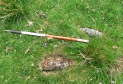
Morgantina was an ancient settlement of different peoples. The first were the indigenous Sikel population (1000 BCE). Later the Greek settled at this site. Many ruins and a Greek theatre could be visited.
You may be viewing yesterday's version of this page. To see the most up to date information please register for a free account.
")
")
")
")
")
")
")
")
")
")
")
")
")
")
")
")
")
Do not use the above information on other web sites or publications without permission of the contributor.
Click here to see more info for this site
Nearby sites
Click here to view sites on an interactive map of the areaKey: Red: member's photo, Blue: 3rd party photo, Yellow: other image, Green: no photo - please go there and take one, Grey: site destroyed
Download sites to:
KML (Google Earth)
GPX (GPS waypoints)
CSV (Garmin/Navman)
CSV (Excel)
To unlock full downloads you need to sign up as a Contributory Member. Otherwise downloads are limited to 50 sites.
Turn off the page maps and other distractions
Nearby sites listing. In the following links * = Image available
14.7km WSW 241° Villa imperiale del Casale* Ancient Palace
23.2km SSW 211° Monte Bubbonia* Chambered Tomb
45.3km SSW 206° Archaeological museum (Gela)* Museum
45.5km SSW 209° Bagni Greci* Ancient Village or Settlement
45.9km SSW 210° Capo Soprano* Hillfort
47.7km SE 136° The neviere of Buccheri* Artificial Mound
55.4km SE 138° Akrai* Ancient Village or Settlement
55.9km SE 138° Santoni* Carving
57.7km SE 124° Pantalica Rock Cut Tombs* Rock Cut Tomb
58.4km SE 124° The Anaktoron Palace* Ancient Palace
62.1km S 183° Kamarina Ancient Village or Settlement
64.3km SSE 151° Cava dei Servi* Burial Chamber or Dolmen
65.7km NNW 343° Halaesa* Ancient Village or Settlement
65.8km SE 142° Castelluccio Necropolis Rock Cut Tomb
67.0km ESE 112° Megara Hyblaea* Ancient Village or Settlement
71.6km SSE 154° Cava D'Ispica* Rock Cut Tomb
72.1km SSE 149° Cava Lazzaro* Burial Chamber or Dolmen
72.3km SE 138° Noto antica* Ancient Village or Settlement
78.6km NNW 330° Cefalu Temple of Artemis* Ancient Temple
78.8km W 260° Temple of Demeter* Ancient Temple
79.3km W 259° Temple of Juno* Ancient Temple
79.4km NE 38° Megaliti dell'Argimusco* Natural Stone / Erratic / Other Natural Feature
79.9km W 259° Temple of Concordia* Ancient Temple
80.1km W 259° Tomb of Theron* Ancient Temple
80.1km W 260° Ekklesiasterion of Phalaris* Ancient Village or Settlement
View more nearby sites and additional images


 We would like to know more about this location. Please feel free to add a brief description and any relevant information in your own language.
 Wir möchten mehr über diese Stätte erfahren. Bitte zögern Sie nicht, eine kurze Beschreibung und relevante Informationen in Deutsch hinzuzufügen.
 Nous aimerions en savoir encore un peu sur les lieux. S'il vous plaît n'hesitez pas à ajouter une courte description et tous les renseignements pertinents dans votre propre langue.
 Quisieramos informarnos un poco más de las lugares. No dude en añadir una breve descripción y otros datos relevantes en su propio idioma.