<< Our Photo Pages >> Cava dei Servi - Burial Chamber or Dolmen in Italy in Sicily (Sicilia)
Submitted by Salvatore on Sunday, 05 December 2010 Page Views: 7604
Neolithic and Bronze AgeSite Name: Cava dei Servi Alternative Name:Country: Italy
NOTE: This site is 8.406 km away from the location you searched for.
Region: Sicily (Sicilia) Type: Burial Chamber or Dolmen
Nearest Town: Ragusa Nearest Village: Frigintini
Latitude: 36.921630N Longitude: 14.825020E
Condition:
| 5 | Perfect |
| 4 | Almost Perfect |
| 3 | Reasonable but with some damage |
| 2 | Ruined but still recognisable as an ancient site |
| 1 | Pretty much destroyed, possibly visible as crop marks |
| 0 | No data. |
| -1 | Completely destroyed |
| 5 | Superb |
| 4 | Good |
| 3 | Ordinary |
| 2 | Not Good |
| 1 | Awful |
| 0 | No data. |
| 5 | Can be driven to, probably with disabled access |
| 4 | Short walk on a footpath |
| 3 | Requiring a bit more of a walk |
| 2 | A long walk |
| 1 | In the middle of nowhere, a nightmare to find |
| 0 | No data. |
| 5 | co-ordinates taken by GPS or official recorded co-ordinates |
| 4 | co-ordinates scaled from a detailed map |
| 3 | co-ordinates scaled from a bad map |
| 2 | co-ordinates of the nearest village |
| 1 | co-ordinates of the nearest town |
| 0 | no data |
Be the first person to rate this site - see the 'Contribute!' box in the right hand menu.
Internal Links:
External Links:
")
The place, some kilometres south of the hamlet of San Giacomo, opens onto a Nature Reserve which contains the most exceptional (an understatement) prehistoric finds. The geological conformation of this area is rather varied, comprising an alternation of biocalcarenite (Lecce stone) cemented to grey-white macro-foraminiferous rock, in irregular banks from 50cms to 2–3ms in thickness, and cream-white marnous calcarenite (limestone) which are thinly consolidated. They form the Irminio Member of the Ragusa formation; the upper member, the structure being in two parts, is divided (the lower part, the Leonardo Member, does not come to the surface in the area).
The clayey marnous terrain, highly erosive, is modelled into gently undulating sub-surface flatland giving origin to low hills which formed between the Upper Oligocene Age and the Lower Miocene Age (between twenty-six and twenty million years ago).
The erosive action of water determined very steep and deep ravines that characterise most of the territory around Ragusa and Syracuse, so giving a reason for the existence of inaccessible and aspen caves which have from time unknown given refuge to groups of humans.
In Cava dei Servi, the depression that has been formed by the torrents has made it impossible to reach a small headland, where a prehistoric acropolis probably once stood. The promontory is surrounded by steep rock faces that were connected to the mountain by a narrow and well-defined passage.
The hump was the site of human settlements from the early Bronze Age to the Pantalica 1 period (around 1250–1000 B.C.) [Ref 9]; the era to which the innumerable small artificial grotto sepulchres that are hollowed out in the side of the rock faces belong [10]. There are, moreover, documented enchytrismós burials (inside large urns) and ceramic objects which will have made up the funeral dowry of the dead [11]. This area, which is not far from the Mount Lauro embankment, gave rise to interest as far back as the Copper Age because, as in the Iblean region, it guaranteed excellent commercial opportunities thanks to the quarrying of flint. Flint was easy to transport downhill along the waterways of the Tellaro and Anapo Rivers [12].
A medium-sized slab construction dominates a landscape that cannot but arouse mystic sensations. It is to be found on top of an overhanging rock, along one of the less tortuous paths of the quarry, few metres higher than the only track that leads to the gorge. The semi-oval monument is formed by four rectangular slabs fixed into the ground. Another three slabs are on top, leaning in such a way they reduce the surface and form a false dome. Two large parallelepiped boulders complete the construction.
The four upright stones that determine the curve are more or less uniform in measurement, which proves building abilities aimed at creating corresponding bonding of each construction element of the manufactured product. Hence, stability is guaranteed. The three inclining slabs that were placed on top, instead, have more irregular dimensions as, not having any stability function, precision would have been superfluous.
Inside the chamber there is a large chalky slab that has been fractured in four places. It would seem it was the vault stone of the monument and that it crashed to the ground due to progressive sliding of the structure. Along with some findings underneath, which we shall discuss further on, its dimensions seem to consolidate the coffer theory. All the pieces on the ground, in fact, would have been part of a large monolith, squared in front to fit the closure hatch. The blocks to the side served as jams, reinforcing a part that was rather under pressure because of frequent opening. The lay-out of the stones gave shape to a construction of about 3.00 sq ms that had been set into the slope of the hill to make burial easier.
A lucky chance, to say the least, led me to determine the function and chronology of this unique piece of work; thanks to numerous human bone fragments [13] (the only organic clues so far found inside a Mediterranean dolmen) and to some splinters of Castelluccian (Early Bronze Age) ceramics [14]. The anthropological remains have confirmed the burial purpose of the artefact, while the, though few, earthenware fragments have legitimised dating them back to the early Bronze Age.
The positioning around a rocky cemetery confirms the belief that we are not dealing with an attempt to better a particularly demanding and dangerous architectural structure, like the small artificial grotto [15], but we are faced with absolutely unique elaborations.
The location, therefore, will have also had a dolmen necropolis. This is not such a farfetched hypothesis if you listen to the tales of some of the workers of the area: some years before my reconnaissance exploration, a large number of those tombs, complete with skeletons and funeral dowries, were wrecked and dispersed by the violent action of bulldozers employed for the construction of a road alongside the Nature Reserve. Irreparable damage was done. It will have deprived us of very much data together with making things difficult for us to compare specimens with some existing dolmens in the Iberian peninsular, in Sardinia and in Apulia that had been built in the same way.
Structures that have been found in nearby Malta also lead us to suppose a common origin of the phenomenon. The mystery that hangs over the Sicilian dolmen builders could be revealed right here. The advanced Tarxien Civilisation [16] of the little archipelago in the south of Sicily suddenly disappeared around four thousand five hundred years ago. Themistocles Zammit, a Maltese archaeologist of the early 1900s, hypothesizes the exceptional event was perhaps, indeed probably, due to a devastating plague that wiped out the inhabitants of the small islands: another ethnic group arrived there many centuries later. The traces of the new population, however, came to light immediately after the first. These traces were first come across in the Tarxien “cremation cemetery”, hence the name Cemetery Culture of Tarxien.
There must have been a good and proper invasion therefore, perpetrated by people who at first were thought to have come from the Aeolian Islands, due to the resemblance of their pottery with that of Capo Graziano [17]. However, we do not find the more elaborate vase shapes of the Tarxien Cemetery in Lipari and, moreover, the decorations are different [18]. This would exclude the invaders being from there.
The finding of some Tarxien Cemetery style pottery inside two Maltese dolmens (an architectural design foreign to the Aeolians), was part of putting an end to the doubt, once and for all, that the people came from the Aeolian Islands. Hence, the small megaliths of Malta and Gozo are attributed to the people of the Tarxien Cemetery [19]. The fact that these monuments were used as tombs though remains but a guess, perhaps becoming a certainty after the discoveries of the Cava dei Servi dolmen, the shape of which, moreover, brings to mind similar structures present in a vast area of the Mediterranean.
Technical data sheet of the monument
height of lower slab (1st on right): 0.89ms
width of lower slab (1st on right): 0.89ms
thickness of lower slab (1st on right): 0.22ms
height of lower slab (2nd on right): 0.99ms
width of lower slab (2nd on right): 0.61ms
thickness of lower slab (2nd on right): 0.28ms
height of lower slab (3rd on right): 0.88ms
width of lower slab (3rd on right): 1.08ms
thickness of lower slab (3rd on right): 0.20ms
height of lower slab (4th on right): 0.93ms
width of lower slab (4th on right): 0.88ms
thickness of lower slab (4th on right): 0.18ms
length of upper slab (1st on right): 0.85ms
width of upper slab (1st on right): 0.69ms
thickness of upper slab (1st on right): 0.20ms
length of upper slab (2nd on right): 0.46ms
width of upper slab (2nd on right): 0.43ms
thickness of upper slab (2nd on right): 0.19ms
length of upper slab (3rd on right): 0.63ms
width of upper slab (3rd on right): 1.15ms
thickness of upper slab (3rd on right): 0.20ms
height of front right block 1.17ms
width of front right block 0.77ms
thickness of front right block 0.62ms
height of front left block 0.80ms
width of front left block 0.60ms
thickness of front left block 0.80ms
orientation (opening) 65° NE
Geographical map reference I.G.M. 1/25.000 – F° 276 I NE
References:
9 M. Del Campo/G. Scrofani, Insediamenti preistorici nella Cava dei Servi, in «Un quinquennio di attività archeologica nella provincia di Siracusa», 1971, pp.20-21.
10 G. Di Stefano, Piccola guida delle stazioni preistoriche degli Iblei, op. cit. pp.85 on.
11 G. Di Stefano, Cava dei Servi, in Studi Etruschi, vol. XLVI (III series), p. 577.
12 L. Guzzardi, Civiltà indigene e città greche nella regione iblea, op. cit., p. 17.
13 The bone remains belonged to two individuals, one adult and the other still a youngster. Owing to the unusual thickness, the cranial fragments have diagnostically resulted in showing the adult suffered a clinical pathology that is fairly common in our area; thalassaemia (Mediterranean anaemia).
14 The Culture of Castelluccio (from the name of the site situated some twenty kilometres from Noto), goes back to the first phase of the Bronze Age (Early Bronze Age). It would seem the population of Castelluccio came from central Anatolia, because of the evident similarities between Sicilian pottery of this Sicilian cultural facies and its contemporary in the Middle-East, called «Cappadocia»; cf. L. Bernabò Brea, La Sicilia prima dei Greci, op. cit., pp.109-110.
15 Cf. G. Di Stefano, La collezione preistorica della “Grotta Lazzaro” nel museo civico di Modica, op. cit., p. 108; cf. also P. Orsi, Miniere di selce e sepolcri eneolitici a Monte Tabuto e …, op. cit., p. 203.
16 Locality in the east of Malta, dug out from the Zammit between 1915 and 1917. We are dealing with a complex of four temples that cover an area of 5,300sq. ms., inside of which the lower half of a gigantic statue representing the local divinity was found. The Bronze Age invaders used the ruins of the previous temples as a cremation necropolis. Other minor temple complexes are to be found in Hagiar Kim, Mnaidra, Mgiarr, Sorba on the main island, and Gigantija in Gozo.
17 A village situated on the headland of the same name on Filicudi, an Aeolian island, from which a Culture of the Early Bronze Age takes its name. A rather coarse type of pottery characterises it. The ceramics are decorated with interspersed linear incisions, sometimes from patterns, either geometrical or floral, which are got from pressing the artefact while still humid.
18 Cf. J. D. Evans, Segreti dell’Antica Malta, op. cit. p. 177 on.
19 Cf. J. D. Evans, ibidem.
This article continues with a look at the Cava Lazzaro Dolmen.
Information from Salvatore Piccolo's book,
"Antiche Pietre. La cultura dei dolmen nella preistoria della Sicilia sud-orientale",
Morrone editore, Siracusa 2007.
You may be viewing yesterday's version of this page. To see the most up to date information please register for a free account.
Do not use the above information on other web sites or publications without permission of the contributor.
Nearby Images from Flickr
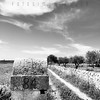
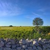


The above images may not be of the site on this page, but were taken nearby. They are loaded from Flickr so please click on them for image credits.
Click here to see more info for this site
Nearby sites
Click here to view sites on an interactive map of the areaKey: Red: member's photo, Blue: 3rd party photo, Yellow: other image, Green: no photo - please go there and take one, Grey: site destroyed
Download sites to:
KML (Google Earth)
GPX (GPS waypoints)
CSV (Garmin/Navman)
CSV (Excel)
To unlock full downloads you need to sign up as a Contributory Member. Otherwise downloads are limited to 50 sites.
Turn off the page maps and other distractions
Nearby sites listing. In the following links * = Image available
7.7km S 172° Cava D'Ispica* Rock Cut Tomb
8.4km SE 128° Cava Lazzaro* Burial Chamber or Dolmen
10.6km ENE 65° Castelluccio Necropolis Rock Cut Tomb
16.2km NNE 24° Santoni* Carving
16.4km NNE 22° Akrai* Ancient Village or Settlement
17.8km E 81° Noto antica* Ancient Village or Settlement
22.4km N 7° The neviere of Buccheri* Artificial Mound
29.3km NE 35° Pantalica Rock Cut Tombs* Rock Cut Tomb
29.6km E 88° Dolmen di Avola* Natural Stone / Erratic / Other Natural Feature
29.6km NE 37° The Anaktoron Palace* Ancient Palace
34.0km W 261° Kamarina Ancient Village or Settlement
41.3km ENE 69° Syracuse Temple of Olympian Zeus Ancient Temple
43.5km ENE 67° Syracuse Archaeological Park* Museum
44.3km ENE 70° Ortigia Temple of Athena* Ancient Temple
44.5km ENE 69° Ortigia Temple of Apollo* Ancient Temple
44.5km ENE 68° Paolo Orsi Museo Archeologico Museum
44.6km NE 45° Megara Hyblaea* Ancient Village or Settlement
52.8km WNW 288° Archaeological museum (Gela)* Museum
55.4km WNW 288° Bagni Greci* Ancient Village or Settlement
55.9km WNW 288° Capo Soprano* Hillfort
56.4km NW 311° Monte Bubbonia* Chambered Tomb
64.3km NNW 332° Morgantina* Ancient Village or Settlement
65.7km NW 319° Villa imperiale del Casale* Ancient Palace
106.7km SSW 208° Ghajn Damma Stone Row* Stone Row / Alignment
107.3km SSW 208° Ghajn Damma Stones* Standing Stones
View more nearby sites and additional images


 We would like to know more about this location. Please feel free to add a brief description and any relevant information in your own language.
 Wir möchten mehr über diese Stätte erfahren. Bitte zögern Sie nicht, eine kurze Beschreibung und relevante Informationen in Deutsch hinzuzufügen.
 Nous aimerions en savoir encore un peu sur les lieux. S'il vous plaît n'hesitez pas à ajouter une courte description et tous les renseignements pertinents dans votre propre langue.
 Quisieramos informarnos un poco más de las lugares. No dude en añadir una breve descripción y otros datos relevantes en su propio idioma.