


<< Our Photo Pages >> Dolní Chabry v Praze - Standing Stone (Menhir) in Czech Republic in Bohemia
Submitted by AlexHunger on Wednesday, 17 May 2006 Page Views: 6558
Neolithic and Bronze AgeSite Name: Dolní Chabry v Praze Alternative Name: Zkamenělý slouhaCountry: Czech Republic Region: Bohemia Type: Standing Stone (Menhir)
Nearest Town: Praha Nearest Village: Dolní Chabry
Latitude: 50.143185N Longitude: 14.451852E
Condition:
| 5 | Perfect |
| 4 | Almost Perfect |
| 3 | Reasonable but with some damage |
| 2 | Ruined but still recognisable as an ancient site |
| 1 | Pretty much destroyed, possibly visible as crop marks |
| 0 | No data. |
| -1 | Completely destroyed |
| 5 | Superb |
| 4 | Good |
| 3 | Ordinary |
| 2 | Not Good |
| 1 | Awful |
| 0 | No data. |
| 5 | Can be driven to, probably with disabled access |
| 4 | Short walk on a footpath |
| 3 | Requiring a bit more of a walk |
| 2 | A long walk |
| 1 | In the middle of nowhere, a nightmare to find |
| 0 | No data. |
| 5 | co-ordinates taken by GPS or official recorded co-ordinates |
| 4 | co-ordinates scaled from a detailed map |
| 3 | co-ordinates scaled from a bad map |
| 2 | co-ordinates of the nearest village |
| 1 | co-ordinates of the nearest town |
| 0 | no data |
Internal Links:
External Links:
I have visited· I would like to visit
blackfox would like to visit
")
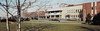
Standing Stone on Ládevská Street.
You may be viewing yesterday's version of this page. To see the most up to date information please register for a free account.
Do not use the above information on other web sites or publications without permission of the contributor.
davidmorgan has found this location on Google Street View:
Nearby Images from Flickr


The above images may not be of the site on this page, but were taken nearby. They are loaded from Flickr so please click on them for image credits.
Click here to see more info for this site
Nearby sites
Click here to view sites on an interactive map of the areaKey: Red: member's photo, Blue: 3rd party photo, Yellow: other image, Green: no photo - please go there and take one, Grey: site destroyed
Download sites to:
KML (Google Earth)
GPX (GPS waypoints)
CSV (Garmin/Navman)
CSV (Excel)
To unlock full downloads you need to sign up as a Contributory Member. Otherwise downloads are limited to 50 sites.
Turn off the page maps and other distractions
Nearby sites listing. In the following links * = Image available
5.8km SW 222° Terrronská St. Long Houses* Ancient Village or Settlement
6.4km WNW 298° Levý Hradec hillfort Hillfort
6.6km SSW 207° Libenice Stela* Standing Stone (Menhir)
6.9km SSW 212° Prague Castle Obelisk* Modern Stone Circle etc
7.5km SW 215° Prague's stone* Standing Stone (Menhir)
7.6km W 261° Horomerice Menhir* Standing Stone (Menhir)
8.7km E 91° Vinoř Rondel* Causewayed Enclosure
9.0km SSW 195° Menhir in Karlach Park* Standing Stone (Menhir)
9.1km SSW 195° Vysehrad Devil's stone* Standing Stone (Menhir)
9.1km SSW 194° Rotunda Stone* Standing Stone (Menhir)
9.1km SSW 196° Basilica Stone* Standing Stone (Menhir)
9.2km SSW 193° Stone of the New birth* Standing Stone (Menhir)
9.4km NW 305° Chýnov Barrow Cemetery* Barrow Cemetery
10.1km WNW 299° Krliš Barrow* Barrow Cemetery
10.1km NW 308° Čestmír Barrow* Barrow Cemetery
18.0km SW 222° Zbuzany Stone* Standing Stone (Menhir)
19.2km S 187° Šance (Ramparts)* Hillfort
20.3km S 189° Oppidum Závist* Hillfort
20.7km ESE 109° Úvaly Stonehenge* Modern Stone Circle etc
21.4km WNW 301° Kamenný Most Menhir* Standing Stone (Menhir)
22.1km SE 127° Prehistoric hillfort Březí* Hillfort
23.2km N 4° Mělník Modern Menhir* Modern Stone Circle etc
25.0km WNW 288° Jemníky Menhir* Standing Stone (Menhir)
26.1km W 278° Vinařice Menhir* Standing Stone (Menhir)
26.9km W 263° Velká Dobrá Stone* Standing Stone (Menhir)
View more nearby sites and additional images


 We would like to know more about this location. Please feel free to add a brief description and any relevant information in your own language.
 Wir möchten mehr über diese Stätte erfahren. Bitte zögern Sie nicht, eine kurze Beschreibung und relevante Informationen in Deutsch hinzuzufügen.
 Nous aimerions en savoir encore un peu sur les lieux. S'il vous plaît n'hesitez pas à ajouter une courte description et tous les renseignements pertinents dans votre propre langue.
 Quisieramos informarnos un poco más de las lugares. No dude en añadir una breve descripción y otros datos relevantes en su propio idioma.