<< Our Photo Pages >> Neuenfeld Dolmen 3 - Burial Chamber or Dolmen in Germany in Brandenburg, Berlin
Submitted by holger_rix on Sunday, 10 June 2012 Page Views: 2111
Neolithic and Bronze AgeSite Name: Neuenfeld Dolmen 3Country: Germany
NOTE: This site is 0.896 km away from the location you searched for.
Land: Brandenburg, Berlin Type: Burial Chamber or Dolmen
Latitude: 53.407182N Longitude: 14.037343E
Condition:
| 5 | Perfect |
| 4 | Almost Perfect |
| 3 | Reasonable but with some damage |
| 2 | Ruined but still recognisable as an ancient site |
| 1 | Pretty much destroyed, possibly visible as crop marks |
| 0 | No data. |
| -1 | Completely destroyed |
| 5 | Superb |
| 4 | Good |
| 3 | Ordinary |
| 2 | Not Good |
| 1 | Awful |
| 0 | No data. |
| 5 | Can be driven to, probably with disabled access |
| 4 | Short walk on a footpath |
| 3 | Requiring a bit more of a walk |
| 2 | A long walk |
| 1 | In the middle of nowhere, a nightmare to find |
| 0 | No data. |
| 5 | co-ordinates taken by GPS or official recorded co-ordinates |
| 4 | co-ordinates scaled from a detailed map |
| 3 | co-ordinates scaled from a bad map |
| 2 | co-ordinates of the nearest village |
| 1 | co-ordinates of the nearest town |
| 0 | no data |
Internal Links:
External Links:
I have visited· I would like to visit
Boeddel visited on 6th Jan 2017 - their rating: Cond: 1 Amb: 4 Access: 3
")
You may be viewing yesterday's version of this page. To see the most up to date information please register for a free account.
")
")
")
Do not use the above information on other web sites or publications without permission of the contributor.
Nearby Images from Flickr
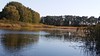


The above images may not be of the site on this page, but were taken nearby. They are loaded from Flickr so please click on them for image credits.
Click here to see more info for this site
Nearby sites
Click here to view sites on an interactive map of the areaKey: Red: member's photo, Blue: 3rd party photo, Yellow: other image, Green: no photo - please go there and take one, Grey: site destroyed
Download sites to:
KML (Google Earth)
GPX (GPS waypoints)
CSV (Garmin/Navman)
CSV (Excel)
To unlock full downloads you need to sign up as a Contributory Member. Otherwise downloads are limited to 50 sites.
Turn off the page maps and other distractions
Nearby sites listing. In the following links * = Image available
15m WNW 297° Neuenfeld Dolmen 2* Burial Chamber or Dolmen
311m WNW 298° Neuenfeld Dolmen 1* Burial Chamber or Dolmen
1.7km S 191° Teufelsstein Carmzow* Rock Art
2.2km NW 317° Wegestein Neuenfeld* Marker Stone
2.9km NW 310° Schälchenstein und Grabhügel Neuenfeld* Rock Art
3.5km NW 318° Fundplatz 17920* Round Barrow(s)
3.6km SSE 149° Hügelgrab Carmzow 1* Round Barrow(s)
4.0km W 268° Schoenfeld Dauer Steingrab* Chambered Tomb
4.1km ENE 63° Hügelgrab Caselow Forst* Round Barrow(s)
4.4km W 269° Burgwall Schönfeld Uckermark* Hillfort
4.6km ENE 61° Caselow Forst Schalenstein 8* Rock Art
4.7km ENE 61° Caselow Forst Schalenstein 7* Rock Art
5.0km SSE 157° Carmzow Steingrab Chambered Tomb
5.0km WNW 289° Hügelgrab Schönfeld Uckermark* Round Barrow(s)
5.0km ENE 60° Caselow Forst Schalenstein 6* Rock Art
5.1km NE 53° Caselow Forst Schalenstein 5* Rock Art
5.3km ENE 57° Caselow Forst Schalenstein 4* Rock Art
5.4km ESE 116° Hügelgrab Krebssee* Round Barrow(s)
5.4km NW 306° Großsteingrab Damerow* Long Barrow
5.5km NE 48° Caselow Forst Schalenstein 2* Rock Art
5.7km NE 48° Caselow Forst Schalenstein 1* Rock Art
5.8km E 98° Mahlstein Stadtmauer Brüssow* Ancient Mine, Quarry or other Industry
5.8km ESE 122° Bruessow Hammelstall Steinkiste* Cist
5.8km ENE 58° Caselow Forst Schalenstein 3* Rock Art
5.8km NE 38° Burgwall Fahrenwalde* Hillfort
View more nearby sites and additional images


 We would like to know more about this location. Please feel free to add a brief description and any relevant information in your own language.
 Wir möchten mehr über diese Stätte erfahren. Bitte zögern Sie nicht, eine kurze Beschreibung und relevante Informationen in Deutsch hinzuzufügen.
 Nous aimerions en savoir encore un peu sur les lieux. S'il vous plaît n'hesitez pas à ajouter une courte description et tous les renseignements pertinents dans votre propre langue.
 Quisieramos informarnos un poco más de las lugares. No dude en añadir una breve descripción y otros datos relevantes en su propio idioma.