<< Our Photo Pages >> Burgwall Blankenburg Uckermark - Hillfort in Germany in Brandenburg, Berlin
Submitted by Boeddel on Wednesday, 25 January 2017 Page Views: 1382
Iron Age and Later PrehistorySite Name: Burgwall Blankenburg Uckermark Alternative Name: WallbergCountry: Germany Land: Brandenburg, Berlin Type: Hillfort
Nearest Town: Prenzlau
Latitude: 53.218674N Longitude: 13.941752E
Condition:
| 5 | Perfect |
| 4 | Almost Perfect |
| 3 | Reasonable but with some damage |
| 2 | Ruined but still recognisable as an ancient site |
| 1 | Pretty much destroyed, possibly visible as crop marks |
| 0 | No data. |
| -1 | Completely destroyed |
| 5 | Superb |
| 4 | Good |
| 3 | Ordinary |
| 2 | Not Good |
| 1 | Awful |
| 0 | No data. |
| 5 | Can be driven to, probably with disabled access |
| 4 | Short walk on a footpath |
| 3 | Requiring a bit more of a walk |
| 2 | A long walk |
| 1 | In the middle of nowhere, a nightmare to find |
| 0 | No data. |
| 5 | co-ordinates taken by GPS or official recorded co-ordinates |
| 4 | co-ordinates scaled from a detailed map |
| 3 | co-ordinates scaled from a bad map |
| 2 | co-ordinates of the nearest village |
| 1 | co-ordinates of the nearest town |
| 0 | no data |
Internal Links:
External Links:
I have visited· I would like to visit
Boeddel visited on 24th Jan 2017 - their rating: Cond: 2 Amb: 3 Access: 4
")
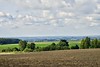
On a natural elevation, surrounded by water, the Slavs have artificially filled up the mountain and built their fortress on it.
The knights of Blankenburg, who came in the 13th century from the Harz and took over the fortress.
You may be viewing yesterday's version of this page. To see the most up to date information please register for a free account.
")
")
")
")
Do not use the above information on other web sites or publications without permission of the contributor.
Nearby Images from Flickr


The above images may not be of the site on this page, but were taken nearby. They are loaded from Flickr so please click on them for image credits.
Click here to see more info for this site
Nearby sites
Click here to view sites on an interactive map of the areaKey: Red: member's photo, Blue: 3rd party photo, Yellow: other image, Green: no photo - please go there and take one, Grey: site destroyed
Download sites to:
KML (Google Earth)
GPX (GPS waypoints)
CSV (Garmin/Navman)
CSV (Excel)
To unlock full downloads you need to sign up as a Contributory Member. Otherwise downloads are limited to 50 sites.
Turn off the page maps and other distractions
Nearby sites listing. In the following links * = Image available
1.9km S 176° Slawensiedlung Melzow* Ancient Village or Settlement
2.0km S 191° Hügelgräber Kleiner Rathsburgsee* Round Barrow(s)
2.2km S 174° Hügelgrab Großer Rathsburgsee* Round Barrow(s)
2.2km S 190° Hügelgrab Dreiecksee* Round Barrow(s)
2.4km S 176° Hügelgrab Kleiner Borgsee* Round Barrow(s)
3.3km WNW 294° Seehausen Dolmen* Burial Chamber or Dolmen
3.5km S 177° Meichow* Cist
3.8km SSW 197° Hügelgrab Kesper Bruch* Round Barrow(s)
4.9km NNE 26° Schälchenstein Weselitz* Rock Art
5.5km N 357° Findling Bietikow* Natural Stone / Erratic / Other Natural Feature
6.0km WSW 257° Slawenburg am Potzlower See* Ancient Village or Settlement
6.3km NE 48° Mahlsteinmuseum Neu Kleinow* Museum
6.3km NW 317° Sagenstein Weißen Berge* Natural Stone / Erratic / Other Natural Feature
6.6km ENE 59° Hügelgrab Lützlow* Round Barrow(s)
6.7km NNE 24° Kultplatz auf dem Bollenberg* Ancient Temple
6.9km WNW 290° Riesenstein Strehlow* Rock Art
7.1km SSW 199° Melzow Cist* Cist
7.9km WSW 250° Phallusstein beim Potzlower Seenblick* Standing Stone (Menhir)
7.9km ENE 78° Luetzlow Dolmen (modern)* Modern Stone Circle etc
8.7km S 176° Schmiedeberg Modern Dolmen* Modern Stone Circle etc
8.8km S 178° Schmiedeberg Dolmen* Burial Chamber or Dolmen
10.4km NNE 14° Burgwall Drense* Hillfort
10.6km SW 222° Pechberg Huegelgrab* Round Barrow(s)
11.3km NNW 332° Haus am Seeweg in Prenzlau* Ancient Mine, Quarry or other Industry
11.5km NNW 332° Mahlsteine Stadtmauer Prenzlau Uckerwiek* Ancient Mine, Quarry or other Industry
View more nearby sites and additional images


 We would like to know more about this location. Please feel free to add a brief description and any relevant information in your own language.
 Wir möchten mehr über diese Stätte erfahren. Bitte zögern Sie nicht, eine kurze Beschreibung und relevante Informationen in Deutsch hinzuzufügen.
 Nous aimerions en savoir encore un peu sur les lieux. S'il vous plaît n'hesitez pas à ajouter une courte description et tous les renseignements pertinents dans votre propre langue.
 Quisieramos informarnos un poco más de las lugares. No dude en añadir una breve descripción y otros datos relevantes en su propio idioma.