<< Our Photo Pages >> Shōjigayatsu Yokoana - Rock Cut Tomb in Japan in Honshū
Submitted by Aska on Monday, 09 January 2012 Page Views: 2189
Iron Age and Later PrehistorySite Name: Shōjigayatsu Yokoana Alternative Name: 障子ヶ谷横穴 Shojigayatsu YokoanaCountry: Japan
NOTE: This site is 6.522 km away from the location you searched for.
Region: Honshū Type: Rock Cut Tomb
Nearest Town: Futtsu (Chiba pref.) Nearest Village: Ainoyatsu 相野谷
Latitude: 35.301800N Longitude: 139.884990E
Condition:
| 5 | Perfect |
| 4 | Almost Perfect |
| 3 | Reasonable but with some damage |
| 2 | Ruined but still recognisable as an ancient site |
| 1 | Pretty much destroyed, possibly visible as crop marks |
| 0 | No data. |
| -1 | Completely destroyed |
| 5 | Superb |
| 4 | Good |
| 3 | Ordinary |
| 2 | Not Good |
| 1 | Awful |
| 0 | No data. |
| 5 | Can be driven to, probably with disabled access |
| 4 | Short walk on a footpath |
| 3 | Requiring a bit more of a walk |
| 2 | A long walk |
| 1 | In the middle of nowhere, a nightmare to find |
| 0 | No data. |
| 5 | co-ordinates taken by GPS or official recorded co-ordinates |
| 4 | co-ordinates scaled from a detailed map |
| 3 | co-ordinates scaled from a bad map |
| 2 | co-ordinates of the nearest village |
| 1 | co-ordinates of the nearest town |
| 0 | no data |
Internal Links:
External Links:
")
Other rock cut tombs on the nearby ridge also seem to have carvings : Kitaneyatsu Yokoana (北根谷横穴), Omote Yokoana (表横穴).
You may be viewing yesterday's version of this page. To see the most up to date information please register for a free account.
")
Do not use the above information on other web sites or publications without permission of the contributor.
Nearby Images from Flickr

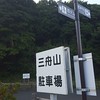


The above images may not be of the site on this page, but were taken nearby. They are loaded from Flickr so please click on them for image credits.
Click here to see more info for this site
Nearby sites
Click here to view sites on an interactive map of the areaKey: Red: member's photo, Blue: 3rd party photo, Yellow: other image, Green: no photo - please go there and take one, Grey: site destroyed
Download sites to:
KML (Google Earth)
GPX (GPS waypoints)
CSV (Garmin/Navman)
CSV (Excel)
To unlock full downloads you need to sign up as a Contributory Member. Otherwise downloads are limited to 50 sites.
Turn off the page maps and other distractions
Nearby sites listing. In the following links * = Image available
1.3km SSW 203° Kinu Yokoana* Rock Cut Tomb
2.7km SW 229° Terayatsu Yokoana* Rock Cut Tomb
4.2km S 191° Kameda Yokoana* Rock Cut Tomb
8.6km S 182° Daiman Yokoana* Rock Cut Tomb
17.5km E 96° Enchō-ji temple* Standing Stone (Menhir)
28.3km W 276° Zuisen-ji temple* Modern Stone Circle etc
28.6km W 275° Jōmyō-ji temple* Modern Stone Circle etc
30.0km W 270° Kōmyō-ji temple (in Kamakura)* Modern Stone Circle etc
30.1km W 277° Kenchō-ji temple* Modern Stone Circle etc
30.5km W 277° Meigetsu-in temple* Modern Stone Circle etc
31.6km WNW 284° Shichikokuyama Yokoana* Rock Cut Tomb
33.9km W 281° Senbagayatsu Yokoana* Rock Cut Tomb
35.3km NNW 337° Ōmori Kaizuka* Ancient Village or Settlement
35.4km ENE 66° Nagara Yokoana* Rock Cut Tomb
36.0km S 181° Higashiyama Yokoana* Rock Cut Tomb
37.3km NNW 328° Sengen Jinja Kofun* NOT SET
40.2km NNW 327° Noge Ōtsuka Kofun* Long Barrow
40.5km NW 321° Maginu Kofun* Passage Grave
42.3km NW 312° Ichigao Yokoana* Rock Cut Tomb
42.7km N 349° Kiyosumi Teien garden* Modern Stone Circle etc
43.2km NNW 345° Hemisphere* Modern Stone Circle etc
44.2km NNW 331° Gōtoku-ji temple* Modern Stone Circle etc
44.6km W 280° Koshinoyama Yokoana* Rock Cut Tomb
44.8km NW 312° Hayano Yokoana* Rock Cut Tomb
47.4km NNW 347° Yayoi* Ancient Mine, Quarry or other Industry
View more nearby sites and additional images


 We would like to know more about this location. Please feel free to add a brief description and any relevant information in your own language.
 Wir möchten mehr über diese Stätte erfahren. Bitte zögern Sie nicht, eine kurze Beschreibung und relevante Informationen in Deutsch hinzuzufügen.
 Nous aimerions en savoir encore un peu sur les lieux. S'il vous plaît n'hesitez pas à ajouter une courte description et tous les renseignements pertinents dans votre propre langue.
 Quisieramos informarnos un poco más de las lugares. No dude en añadir una breve descripción y otros datos relevantes en su propio idioma.