

<< Our Photo Pages >> Sakamoto-Kitaura - Stone Circle in Japan in Honshū
Submitted by Aska on Tuesday, 25 August 2009 Page Views: 2926
Neolithic and Bronze AgeSite Name: Sakamoto-Kitaura Alternative Name: 坂本北裏Country: Japan
NOTE: This site is 7.137 km away from the location you searched for.
Region: Honshū Type: Stone Circle
Nearest Town: Annaka (Gunma pref.) Nearest Village: MatsuidamachiSakamoto 松井
Latitude: 36.352810N Longitude: 138.717510E
Condition:
| 5 | Perfect |
| 4 | Almost Perfect |
| 3 | Reasonable but with some damage |
| 2 | Ruined but still recognisable as an ancient site |
| 1 | Pretty much destroyed, possibly visible as crop marks |
| 0 | No data. |
| -1 | Completely destroyed |
| 5 | Superb |
| 4 | Good |
| 3 | Ordinary |
| 2 | Not Good |
| 1 | Awful |
| 0 | No data. |
| 5 | Can be driven to, probably with disabled access |
| 4 | Short walk on a footpath |
| 3 | Requiring a bit more of a walk |
| 2 | A long walk |
| 1 | In the middle of nowhere, a nightmare to find |
| 0 | No data. |
| 5 | co-ordinates taken by GPS or official recorded co-ordinates |
| 4 | co-ordinates scaled from a detailed map |
| 3 | co-ordinates scaled from a bad map |
| 2 | co-ordinates of the nearest village |
| 1 | co-ordinates of the nearest town |
| 0 | no data |
Internal Links:
External Links:
")
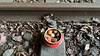
In Gunma Prefecture, especially the area around the Mt. Myōgisan, there were many stone circles which are believed to the ritual site of Myōgisan worship. Most of them are destroyed or buried back into the earth after the excavation during the construction of motorways and the bullet-express railway.
Sakamoto-Kitaura circle may be the sole survived one, but it was moved to the entrance of parking area of Tōge-no-yu (峠の湯) spa from the original site.
You may be viewing yesterday's version of this page. To see the most up to date information please register for a free account.
Do not use the above information on other web sites or publications without permission of the contributor.
Nearby Images from Flickr
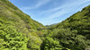
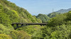
The above images may not be of the site on this page, but were taken nearby. They are loaded from Flickr so please click on them for image credits.
Click here to see more info for this site
Nearby sites
Click here to view sites on an interactive map of the areaKey: Red: member's photo, Blue: 3rd party photo, Yellow: other image, Green: no photo - please go there and take one, Grey: site destroyed
Download sites to:
KML (Google Earth)
GPX (GPS waypoints)
CSV (Garmin/Navman)
CSV (Excel)
To unlock full downloads you need to sign up as a Contributory Member. Otherwise downloads are limited to 50 sites.
Turn off the page maps and other distractions
Nearby sites listing. In the following links * = Image available
14.4km WSW 255° Mozawa Minami-Ishidō* Stone Circle
20.7km E 88° Inarimori* Chambered Cairn
24.2km E 82° Hodota Hachimanzuka Kofun* Long Barrow
26.1km ESE 117° Ipponsugi Kofun* Passage Grave
29.1km ESE 107° Yama-no-Ue Kofun* Passage Grave
29.1km ENE 72° Mitsuya Kofun* Passage Grave
29.6km NE 52° Kanai Kofun* Passage Grave
30.1km SW 226° Kitazawa* Standing Stone (Menhir)
30.4km E 81° Ōyama Kofun* Chambered Cairn
30.5km ESE 108° Isezuka Kofun* Passage Grave
30.7km NE 53° Kanai Higashiura* Ancient Village or Settlement
35.5km NE 40° Gunma Astronomical Observatory* Modern Stone Circle etc
42.8km E 84° Ōmuro Kofungun (in Gunma)* Passage Grave
45.0km NNE 32° Yaze* Ancient Village or Settlement
46.3km NW 311° Hatchō Yoroizuka Kofun* Chambered Cairn
47.6km NW 310° Amazuka Kofungun* Chambered Cairn
47.7km E 80° Takei Haiji* Not Known (by us)
47.9km NW 313° Ōgi-no-Iri Kofungun* Chambered Cairn
48.0km NW 313° Ōboshi Kofungun* Chambered Cairn
48.1km WNW 303° Enmei-ji temple* Modern Stone Circle etc
48.5km NW 310° Daimyōjin Kofungun* Chambered Cairn
48.7km WNW 297° Makiuchi Kofungun* Chambered Cairn
48.8km WNW 297° Kuwanei SoraZuka Kofun* Chambered Cairn
48.9km WNW 297° Kuwanei Kubo Kofun* Chambered Cairn
48.9km WNW 297° Kuwanei YoroiZuka Kofungun* Chambered Cairn
View more nearby sites and additional images


 We would like to know more about this location. Please feel free to add a brief description and any relevant information in your own language.
 Wir möchten mehr über diese Stätte erfahren. Bitte zögern Sie nicht, eine kurze Beschreibung und relevante Informationen in Deutsch hinzuzufügen.
 Nous aimerions en savoir encore un peu sur les lieux. S'il vous plaît n'hesitez pas à ajouter une courte description et tous les renseignements pertinents dans votre propre langue.
 Quisieramos informarnos un poco más de las lugares. No dude en añadir una breve descripción y otros datos relevantes en su propio idioma.