<< Our Photo Pages >> Kōzen-ji temple (in Nagano) - Modern Stone Circle etc in Japan in Honshū
Submitted by Aska on Sunday, 26 January 2020 Page Views: 624
Modern SitesSite Name: Kōzen-ji temple (in Nagano) Alternative Name: 興禅寺 Kozen-jiCountry: Japan
NOTE: This site is 26.18 km away from the location you searched for.
Region: Honshū Type: Modern Stone Circle etc
Nearest Town: Kiso-machi (Nagano prefecture) Nearest Village: Fukushima 福島
Latitude: 35.694650N Longitude: 137.688460E
Condition:
| 5 | Perfect |
| 4 | Almost Perfect |
| 3 | Reasonable but with some damage |
| 2 | Ruined but still recognisable as an ancient site |
| 1 | Pretty much destroyed, possibly visible as crop marks |
| 0 | No data. |
| -1 | Completely destroyed |
| 5 | Superb |
| 4 | Good |
| 3 | Ordinary |
| 2 | Not Good |
| 1 | Awful |
| 0 | No data. |
| 5 | Can be driven to, probably with disabled access |
| 4 | Short walk on a footpath |
| 3 | Requiring a bit more of a walk |
| 2 | A long walk |
| 1 | In the middle of nowhere, a nightmare to find |
| 0 | No data. |
| 5 | co-ordinates taken by GPS or official recorded co-ordinates |
| 4 | co-ordinates scaled from a detailed map |
| 3 | co-ordinates scaled from a bad map |
| 2 | co-ordinates of the nearest village |
| 1 | co-ordinates of the nearest town |
| 0 | no data |
Internal Links:
External Links:
 (PID:206927)")
Kōzen-ji is located in a post town Fukushima on the old highway Nakasendō (中山道). It contains some gardens including a vast dry landscape garden designed by the modern gardener Mirei SHIGEMORI (1896-1975).
Open 8:30-16:30 all year around, admission 500 Japanese Yen (2024 price).
You may be viewing yesterday's version of this page. To see the most up to date information please register for a free account.
Do not use the above information on other web sites or publications without permission of the contributor.
Nearby Images from Flickr
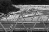
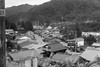
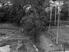
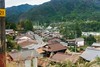
The above images may not be of the site on this page, but were taken nearby. They are loaded from Flickr so please click on them for image credits.
Click here to see more info for this site
Nearby sites
Click here to view sites on an interactive map of the areaKey: Red: member's photo, Blue: 3rd party photo, Yellow: other image, Green: no photo - please go there and take one, Grey: site destroyed
Download sites to:
KML (Google Earth)
GPX (GPS waypoints)
CSV (Garmin/Navman)
CSV (Excel)
To unlock full downloads you need to sign up as a Contributory Member. Otherwise downloads are limited to 50 sites.
Turn off the page maps and other distractions
Nearby sites listing. In the following links * = Image available
0m E 90° Jōshō-ji temple* Modern Stone Circle etc
33.4km NE 43° Ina Baien plum orchard* Modern Stone Circle etc
37.9km SW 221° Shōge Kofungun* Chambered Cairn
38.7km SW 232° Himeguri* Standing Stones
39.0km SW 234° Mitabi* Standing Stone (Menhir)
39.3km SW 220° Nabeyama* Standing Stones
40.0km SW 234° Kawai* Standing Stones
40.8km ENE 66° Onshō-ji temple* Modern Stone Circle etc
41.4km SW 227° Takenami* Standing Stones
41.9km SW 231° Fuji* Standing Stones
52.3km NNE 29° Shiojiri Honjin* Modern Stone Circle etc
55.8km WSW 237° Mizano Kofungun* Chambered Cairn
55.9km NE 39° Manji-no Sekibutsu* Sculptured Stone
56.5km WSW 236° Fudōdō Kofungun* Chambered Cairn
56.8km ENE 69° Mukōhara* Stone Circle
58.0km ENE 63° Tsubodaira* Burial Chamber or Dolmen
58.3km WSW 241° Gukei-ji temple* Modern Stone Circle etc
60.4km NE 54° Togariishi* Ancient Village or Settlement
61.3km ENE 79° Mumei-no Daisekitō* Modern Stone Circle etc
63.8km SW 233° Kokeizan Kofungun* Chambered Cairn
63.9km WSW 244° Jirobeizuka Kofun* Passage Grave
64.6km NW 325° Kaitō* Stone Circle
65.1km ENE 75° Kinsei* Stone Circle
65.2km WSW 251° Shōgen-ji Temple* Modern Stone Circle etc
65.8km WSW 245° Kasekirin Kōen park* Modern Stone Circle etc
View more nearby sites and additional images


 We would like to know more about this location. Please feel free to add a brief description and any relevant information in your own language.
 Wir möchten mehr über diese Stätte erfahren. Bitte zögern Sie nicht, eine kurze Beschreibung und relevante Informationen in Deutsch hinzuzufügen.
 Nous aimerions en savoir encore un peu sur les lieux. S'il vous plaît n'hesitez pas à ajouter une courte description et tous les renseignements pertinents dans votre propre langue.
 Quisieramos informarnos un poco más de las lugares. No dude en añadir una breve descripción y otros datos relevantes en su propio idioma.