
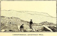
, Aubrey Burl")
<< Our Photo Pages >> Nagareyama Kofun - Long Barrow in Japan in Honshū
Submitted by Aska on Monday, 20 June 2011 Page Views: 4742
Iron Age and Later PrehistorySite Name: Nagareyama Kofun Alternative Name: ナガレ山古墳Country: Japan
NOTE: This site is 1.788 km away from the location you searched for.
Region: Honshū Type: Long Barrow
Nearest Town: Kawai-chō (Nara pref.) Nearest Village: Samita 佐味田
Latitude: 34.560061N Longitude: 135.736240E
Condition:
| 5 | Perfect |
| 4 | Almost Perfect |
| 3 | Reasonable but with some damage |
| 2 | Ruined but still recognisable as an ancient site |
| 1 | Pretty much destroyed, possibly visible as crop marks |
| 0 | No data. |
| -1 | Completely destroyed |
| 5 | Superb |
| 4 | Good |
| 3 | Ordinary |
| 2 | Not Good |
| 1 | Awful |
| 0 | No data. |
| 5 | Can be driven to, probably with disabled access |
| 4 | Short walk on a footpath |
| 3 | Requiring a bit more of a walk |
| 2 | A long walk |
| 1 | In the middle of nowhere, a nightmare to find |
| 0 | No data. |
| 5 | co-ordinates taken by GPS or official recorded co-ordinates |
| 4 | co-ordinates scaled from a detailed map |
| 3 | co-ordinates scaled from a bad map |
| 2 | co-ordinates of the nearest village |
| 1 | co-ordinates of the nearest town |
| 0 | no data |
Internal Links:
External Links:
")
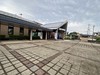
A reconstructed keyhole-shaped tumulus in Umami Kyūryō Kōen (馬見丘陵公園 = Umami hilly park) which contains many tumuli, namely the park is a tumuli preservation area in a newly developed residential town.
This tumulus was reconstructed half as it was, paved with pebbles, half as it is, covered with weeds.
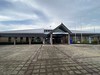
A museum attached, admission free, open 9:00-17:00, closed on Monday and the days around the new years day.
You may be viewing yesterday's version of this page. To see the most up to date information please register for a free account.
")
 (PID:200198)")
")
Do not use the above information on other web sites or publications without permission of the contributor.
Nearby Images from Flickr

The above images may not be of the site on this page, but were taken nearby. They are loaded from Flickr so please click on them for image credits.
Click here to see more info for this site
Nearby sites
Click here to view sites on an interactive map of the areaKey: Red: member's photo, Blue: 3rd party photo, Yellow: other image, Green: no photo - please go there and take one, Grey: site destroyed
Download sites to:
KML (Google Earth)
GPX (GPS waypoints)
CSV (Garmin/Navman)
CSV (Excel)
To unlock full downloads you need to sign up as a Contributory Member. Otherwise downloads are limited to 50 sites.
Turn off the page maps and other distractions
Nearby sites listing. In the following links * = Image available
1.1km S 185° Mitsuyoshi-Ishizuka Kofun* Long Barrow
5.9km E 80° Karako Kagi* Ancient Village or Settlement
7.1km SW 231° Iwaya temple* Ancient Temple
7.4km SE 129° Koguriishi* Not Known (by us)
7.4km SW 233° Rokutan-ji temple* Ancient Temple
8.4km W 277° Matsuokayama Kofun* Holed Stone
8.5km W 277° ChausuZuka Kofun* Chambered Cairn
9.0km W 279° Takaida Yokoana* Rock Cut Tomb
9.3km E 100° Makimuku Ishizuka Kofun* Long Barrow
9.5km SW 235° Futagozuka Kofun (in Ōsaka)* Passage Grave
9.6km SW 236° Yamada Takatsuka Kofun* Passage Grave
9.8km W 272° Anpuku-ji Sekkan* Cist
9.8km W 272° Anpuku-ji Yokoana* Rock Cut Tomb
9.9km ESE 104° Hashihaka Kofun* Long Barrow
9.9km N 1° Yata-dera temple* Modern Stone Circle etc
10.1km ENE 66° Tenri replica Moai* Modern Stone Circle etc
10.1km WSW 237° Koshimaezuka Kofun* Passage Grave
10.1km NW 312° Takayasu-no-Ki* Hillfort
10.2km ESE 103° Hokenoyama Kofun* Long Barrow
10.2km W 261° Hayato-ishi (in Ōsaka)* Carving
10.5km ENE 70° Nishiyama Kofun (in Nara)* Long Barrow
10.6km E 92° Kushiyama Kofun* Long Barrow
10.9km SSE 149° Maruyama Kofun (in Kashihara city)* Long Barrow
11.0km SSE 165° Amatsu-Iwatowake Jinja shrine* Stone Circle
11.1km SSE 154° Masuda-no-Iwafune* Not Known (by us)
View more nearby sites and additional images


 We would like to know more about this location. Please feel free to add a brief description and any relevant information in your own language.
 Wir möchten mehr über diese Stätte erfahren. Bitte zögern Sie nicht, eine kurze Beschreibung und relevante Informationen in Deutsch hinzuzufügen.
 Nous aimerions en savoir encore un peu sur les lieux. S'il vous plaît n'hesitez pas à ajouter une courte description et tous les renseignements pertinents dans votre propre langue.
 Quisieramos informarnos un poco más de las lugares. No dude en añadir una breve descripción y otros datos relevantes en su propio idioma.