<< Our Photo Pages >> Hirayama Family Residence garden - Modern Stone Circle etc in Japan in Kyūshū
Submitted by Aska on Monday, 06 April 2020 Page Views: 568
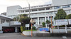
Modern SitesSite Name: Hirayama Family Residence garden Alternative Name: 平山氏庭園 Hirayama-shi TeienCountry: Japan
NOTE: This site is 0.834 km away from the location you searched for.
Region: Kyūshū Type: Modern Stone Circle etc
Nearest Town: Shibushi (Kagoshima prefecture) Nearest Village: ShibushichōChō 志布
Latitude: 31.481770N Longitude: 131.106840E
Condition:
| 5 | Perfect |
| 4 | Almost Perfect |
| 3 | Reasonable but with some damage |
| 2 | Ruined but still recognisable as an ancient site |
| 1 | Pretty much destroyed, possibly visible as crop marks |
| 0 | No data. |
| -1 | Completely destroyed |
| 5 | Superb |
| 4 | Good |
| 3 | Ordinary |
| 2 | Not Good |
| 1 | Awful |
| 0 | No data. |
| 5 | Can be driven to, probably with disabled access |
| 4 | Short walk on a footpath |
| 3 | Requiring a bit more of a walk |
| 2 | A long walk |
| 1 | In the middle of nowhere, a nightmare to find |
| 0 | No data. |
| 5 | co-ordinates taken by GPS or official recorded co-ordinates |
| 4 | co-ordinates scaled from a detailed map |
| 3 | co-ordinates scaled from a bad map |
| 2 | co-ordinates of the nearest village |
| 1 | co-ordinates of the nearest town |
| 0 | no data |
Internal Links:
External Links:
")
You may be viewing yesterday's version of this page. To see the most up to date information please register for a free account.
Do not use the above information on other web sites or publications without permission of the contributor.
Nearby Images from Flickr

The above images may not be of the site on this page, but were taken nearby. They are loaded from Flickr so please click on them for image credits.
Click here to see more info for this site
Nearby sites
Click here to view sites on an interactive map of the areaKey: Red: member's photo, Blue: 3rd party photo, Yellow: other image, Green: no photo - please go there and take one, Grey: site destroyed
Download sites to:
KML (Google Earth)
GPX (GPS waypoints)
CSV (Garmin/Navman)
CSV (Excel)
To unlock full downloads you need to sign up as a Contributory Member. Otherwise downloads are limited to 50 sites.
Turn off the page maps and other distractions
Nearby sites listing. In the following links * = Image available
345m N 359° Amamizu Family Residence garden* Modern Stone Circle etc
28.2km NE 55° Yoshō-kan* Modern Stone Circle etc
39.1km ENE 59° San Messe Nichinan Moai* Modern Stone Circle etc
45.4km NW 310° Hayato-zuka* Ancient Temple
59.8km N 350° HigashiNiwara underground tunnel tombs* Not Known (by us)
63.8km W 260° Chiran Buke Yashiki gardens* Modern Stone Circle etc
66.7km W 277° Saigō Takamori Gyoza-ishi* Natural Stone / Erratic / Other Natural Feature
66.8km NNW 329° Nagayama* Chambered Cairn
67.4km W 277° Kurokawa cave* Cave or Rock Shelter
70.1km NNW 334° Shimauchi underground tunnel tombs* Not Known (by us)
71.5km WNW 302° Sannōdake* Stone Circle
71.8km W 273° Ishizuka Koumi-ishi* Natural Stone / Erratic / Other Natural Feature
72.0km NW 314° Byūbaru* Chambered Cairn
73.2km W 272° Iriki* Burial Chamber or Dolmen
74.4km W 268° Tamate Jinja shrine* Burial Chamber or Dolmen
75.2km NNE 21° Saitobaru Kofungun* Long Barrow
75.2km W 264° Kaseda Samurai Residence gardens Modern Stone Circle etc
75.8km W 266° Takaya Jinja shrine* Natural Stone / Erratic / Other Natural Feature
77.5km NW 320° Uzun Kofungun* Chambered Cairn
81.1km WSW 253° Matsuno-o* Standing Stones
85.3km NNW 340° Kyōgamine* Rock Cut Tomb
87.5km WNW 297° Yoko-oka* Chambered Cairn
88.3km NNW 338° Ōmura* Rock Cut Tomb
90.2km NNW 345° Shinfukada* Chambered Cairn
90.5km W 264° Mt. Noma-dake* Rock Outcrop
View more nearby sites and additional images


 We would like to know more about this location. Please feel free to add a brief description and any relevant information in your own language.
 Wir möchten mehr über diese Stätte erfahren. Bitte zögern Sie nicht, eine kurze Beschreibung und relevante Informationen in Deutsch hinzuzufügen.
 Nous aimerions en savoir encore un peu sur les lieux. S'il vous plaît n'hesitez pas à ajouter une courte description et tous les renseignements pertinents dans votre propre langue.
 Quisieramos informarnos un poco más de las lugares. No dude en añadir una breve descripción y otros datos relevantes en su propio idioma.