<< Our Photo Pages >> Schwedenstein Hohendorf - Early Christian Sculptured Stone in Germany in Brandenburg, Berlin
Submitted by KaiHofmann on Sunday, 08 September 2013 Page Views: 1577
Early Medieval (Dark Age)Site Name: Schwedenstein HohendorfCountry: Germany
NOTE: This site is 3.94 km away from the location you searched for.
Land: Brandenburg, Berlin Type: Early Christian Sculptured Stone
Nearest Town: Golssen Nearest Village: Hohendorf
Latitude: 51.948920N Longitude: 13.559550E
Condition:
| 5 | Perfect |
| 4 | Almost Perfect |
| 3 | Reasonable but with some damage |
| 2 | Ruined but still recognisable as an ancient site |
| 1 | Pretty much destroyed, possibly visible as crop marks |
| 0 | No data. |
| -1 | Completely destroyed |
| 5 | Superb |
| 4 | Good |
| 3 | Ordinary |
| 2 | Not Good |
| 1 | Awful |
| 0 | No data. |
| 5 | Can be driven to, probably with disabled access |
| 4 | Short walk on a footpath |
| 3 | Requiring a bit more of a walk |
| 2 | A long walk |
| 1 | In the middle of nowhere, a nightmare to find |
| 0 | No data. |
| 5 | co-ordinates taken by GPS or official recorded co-ordinates |
| 4 | co-ordinates scaled from a detailed map |
| 3 | co-ordinates scaled from a bad map |
| 2 | co-ordinates of the nearest village |
| 1 | co-ordinates of the nearest town |
| 0 | no data |
Internal Links:
External Links:
")
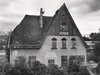
Early Christian stone with a cross and a knife engraving on its frontside.
You may be viewing yesterday's version of this page. To see the most up to date information please register for a free account.
")
")
")
")
Do not use the above information on other web sites or publications without permission of the contributor.
Nearby Images from Flickr
The above images may not be of the site on this page, but were taken nearby. They are loaded from Flickr so please click on them for image credits.
Click here to see more info for this site
Nearby sites
Click here to view sites on an interactive map of the areaKey: Red: member's photo, Blue: 3rd party photo, Yellow: other image, Green: no photo - please go there and take one, Grey: site destroyed
Download sites to:
KML (Google Earth)
GPX (GPS waypoints)
CSV (Garmin/Navman)
CSV (Excel)
To unlock full downloads you need to sign up as a Contributory Member. Otherwise downloads are limited to 50 sites.
Turn off the page maps and other distractions
Nearby sites listing. In the following links * = Image available
8.5km SE 137° Zieckau Kreuz* Ancient Cross
9.7km E 97° Kasel-Golzig Burgwall* Ancient Village or Settlement
13.5km W 277° Lochow Wallanlage* Ancient Village or Settlement
15.5km WNW 299° Wallanlage Petkus Ancient Village or Settlement
15.7km SSE 158° Waltersdorf Steinkreuz* Ancient Cross
17.0km SSE 152° Riedebeck Slawenburg* Ancient Village or Settlement
18.2km SE 138° Slawenburg Freesdorf* Ancient Village or Settlement
18.6km SSE 163° Teufelsstein Gehren* Natural Stone / Erratic / Other Natural Feature
19.7km SW 236° Borchhold* Ancient Village or Settlement
20.7km NNW 326° Fernneuendorf Hügelgräberfeld* Barrow Cemetery
22.4km SSW 214° Striesa Grabhügel* Round Barrow(s)
22.7km SW 216° Hügelgräberfeld Striesa* Barrow Cemetery
23.1km NNW 326° Mühlenberg Neuendorfer See* Ancient Village or Settlement
23.8km NNW 329° Scheers Berg* Ancient Village or Settlement
24.9km NNW 328° Heimatstube Sperenberg* Museum
25.0km SW 236° Bärwalde Burgwall* Ancient Village or Settlement
25.5km WNW 302° Woltersdorf Hügelgraberfeld* Barrow Cemetery
26.1km ESE 110° Kreuzstein Krimnitz* Early Christian Sculptured Stone
26.3km SSE 167° Pahlsdorf Kreuzstein* Early Christian Sculptured Stone
26.4km ESE 114° Gross Beuchow Ringwall* Ancient Village or Settlement
26.5km NNE 22° Germanische Siedlung Klein Köris* Museum
27.8km S 178° Steinkreuz Friedersdorf* Ancient Cross
27.8km NNW 331° Fläzstein Rehagen* Natural Stone / Erratic / Other Natural Feature
28.8km SE 131° Slawenburg Gross Jehser Ancient Village or Settlement
29.0km WNW 302° Burgwall Luckenwalde* Ancient Village or Settlement
View more nearby sites and additional images


 We would like to know more about this location. Please feel free to add a brief description and any relevant information in your own language.
 Wir möchten mehr über diese Stätte erfahren. Bitte zögern Sie nicht, eine kurze Beschreibung und relevante Informationen in Deutsch hinzuzufügen.
 Nous aimerions en savoir encore un peu sur les lieux. S'il vous plaît n'hesitez pas à ajouter une courte description et tous les renseignements pertinents dans votre propre langue.
 Quisieramos informarnos un poco más de las lugares. No dude en añadir una breve descripción y otros datos relevantes en su propio idioma.