

<< Text Pages >> Grotta dell'Addaura - Cave or Rock Shelter in Italy in Sicily (Sicilia)
Submitted by KaiHofmann on Thursday, 03 March 2011 Page Views: 5935
Natural PlacesSite Name: Grotta dell''AddauraCountry: Italy
NOTE: This site is 37.551 km away from the location you searched for.
Region: Sicily (Sicilia) Type: Cave or Rock Shelter
Nearest Town: Palermo Nearest Village: Addaura
Latitude: 38.186408N Longitude: 13.353063E
Condition:
| 5 | Perfect |
| 4 | Almost Perfect |
| 3 | Reasonable but with some damage |
| 2 | Ruined but still recognisable as an ancient site |
| 1 | Pretty much destroyed, possibly visible as crop marks |
| 0 | No data. |
| -1 | Completely destroyed |
| 5 | Superb |
| 4 | Good |
| 3 | Ordinary |
| 2 | Not Good |
| 1 | Awful |
| 0 | No data. |
| 5 | Can be driven to, probably with disabled access |
| 4 | Short walk on a footpath |
| 3 | Requiring a bit more of a walk |
| 2 | A long walk |
| 1 | In the middle of nowhere, a nightmare to find |
| 0 | No data. |
| 5 | co-ordinates taken by GPS or official recorded co-ordinates |
| 4 | co-ordinates scaled from a detailed map |
| 3 | co-ordinates scaled from a bad map |
| 2 | co-ordinates of the nearest village |
| 1 | co-ordinates of the nearest town |
| 0 | no data |
Be the first person to rate this site - see the 'Contribute!' box in the right hand menu.
Internal Links:
External Links:
Cave or Rock Shelter in Sicily (Sicilia)
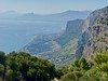
Mesolithic cave with engravings of humans at the Monte Pellegrino close to Palermo.
You may be viewing yesterday's version of this page. To see the most up to date information please register for a free account.
Do not use the above information on other web sites or publications without permission of the contributor.
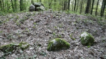
Nearby Images from Flickr


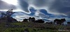
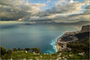
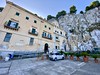
The above images may not be of the site on this page, but were taken nearby. They are loaded from Flickr so please click on them for image credits.
Click here to see more info for this site
Nearby sites
Click here to view sites on an interactive map of the areaKey: Red: member's photo, Blue: 3rd party photo, Yellow: other image, Green: no photo - please go there and take one, Grey: site destroyed
Download sites to:
KML (Google Earth)
GPX (GPS waypoints)
CSV (Garmin/Navman)
CSV (Excel)
To unlock full downloads you need to sign up as a Contributory Member. Otherwise downloads are limited to 50 sites.
Turn off the page maps and other distractions
Nearby sites listing. In the following links * = Image available
17.7km WSW 257° Grotta dei Puntali* Cave or Rock Shelter
18.9km SE 124° Solunto* Ancient Village or Settlement
27.9km SSW 209° Monte Iato Ancient Village or Settlement
44.7km SE 126° Mura Pregne dolmen (Sicily)* Burial Chamber or Dolmen
47.5km ESE 120° Gela Temples Ancient Temple
47.5km ESE 120° Himera Temple* Ancient Temple
50.3km W 260° Grotta dell'Uzzo* Cave or Rock Shelter
53.1km WSW 239° Segesta* Ancient Village or Settlement
58.5km SSW 198° Mount Adranone* Ancient Village or Settlement
61.0km ESE 105° Cefalu Temple of Artemis* Ancient Temple
68.6km S 190° Caltabellotta* Ancient Temple
69.0km S 191° Caltabellotta Temple of Cronos* Ancient Temple
80.6km SW 215° Selinous Temple of Apollo* Ancient Temple
80.7km SW 214° Selinous Temple F* Ancient Temple
80.7km SW 214° Selinous Temple of Hera* Ancient Temple
81.3km SW 215° Selinous* Ancient Village or Settlement
81.5km SW 215° Selinous Temple D Ancient Temple
81.5km SW 215° Selinous Temple C* Ancient Temple
81.6km SW 215° Selinous Temple A and O* Ancient Temple
82.2km ESE 105° Halaesa* Ancient Village or Settlement
84.0km SW 222° Cave di Cusa* Ancient Mine, Quarry or other Industry
85.3km WSW 246° Mozia* Museum
88.4km S 184° Heraclea Minoa* Ancient Village or Settlement
91.8km WSW 242° Capo Boeo* Museum
92.5km WSW 258° Grotta del Genovese* Cave or Rock Shelter
View more nearby sites and additional images


 We would like to know more about this location. Please feel free to add a brief description and any relevant information in your own language.
 Wir möchten mehr über diese Stätte erfahren. Bitte zögern Sie nicht, eine kurze Beschreibung und relevante Informationen in Deutsch hinzuzufügen.
 Nous aimerions en savoir encore un peu sur les lieux. S'il vous plaît n'hesitez pas à ajouter une courte description et tous les renseignements pertinents dans votre propre langue.
 Quisieramos informarnos un poco más de las lugares. No dude en añadir una breve descripción y otros datos relevantes en su propio idioma.