<< Text Pages >> Freesen Huegelgrab - Round Barrow(s) in Germany in Mecklenburg-Western Pomerania
Submitted by AlexHunger on Saturday, 25 March 2006 Page Views: 1895
Neolithic and Bronze AgeSite Name: Freesen HuegelgrabCountry: Germany
NOTE: This site is 5.855 km away from the location you searched for.
Land: Mecklenburg-Western Pomerania Type: Round Barrow(s)
Nearest Town: Bergen Nearest Village: Trent
Latitude: 54.494978N Longitude: 13.259772E
Condition:
| 5 | Perfect |
| 4 | Almost Perfect |
| 3 | Reasonable but with some damage |
| 2 | Ruined but still recognisable as an ancient site |
| 1 | Pretty much destroyed, possibly visible as crop marks |
| 0 | No data. |
| -1 | Completely destroyed |
| 5 | Superb |
| 4 | Good |
| 3 | Ordinary |
| 2 | Not Good |
| 1 | Awful |
| 0 | No data. |
| 5 | Can be driven to, probably with disabled access |
| 4 | Short walk on a footpath |
| 3 | Requiring a bit more of a walk |
| 2 | A long walk |
| 1 | In the middle of nowhere, a nightmare to find |
| 0 | No data. |
| 5 | co-ordinates taken by GPS or official recorded co-ordinates |
| 4 | co-ordinates scaled from a detailed map |
| 3 | co-ordinates scaled from a bad map |
| 2 | co-ordinates of the nearest village |
| 1 | co-ordinates of the nearest town |
| 0 | no data |
Internal Links:
External Links:
Tumulus in Mecklenburg-Western Pomerania
Island of Rügen.
Positional co-ordinates scaled from a map source.
You may be viewing yesterday's version of this page. To see the most up to date information please register for a free account.
Do not use the above information on other web sites or publications without permission of the contributor.
Nearby Images from Flickr
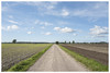
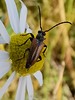
The above images may not be of the site on this page, but were taken nearby. They are loaded from Flickr so please click on them for image credits.
Click here to see more info for this site
Nearby sites
Click here to view sites on an interactive map of the areaKey: Red: member's photo, Blue: 3rd party photo, Yellow: other image, Green: no photo - please go there and take one, Grey: site destroyed
Download sites to:
KML (Google Earth)
GPX (GPS waypoints)
CSV (Garmin/Navman)
CSV (Excel)
To unlock full downloads you need to sign up as a Contributory Member. Otherwise downloads are limited to 50 sites.
Turn off the page maps and other distractions
Nearby sites listing. In the following links * = Image available
1.2km E 84° Heidenmuehl Grabhuegel Round Barrow(s)
6.5km SSE 165° Steinshof Huegelgrab Round Barrow(s)
6.7km NNE 27° Moritzhagen Grabhuegel 2 Round Barrow(s)
7.0km NNE 34° Moritzhagen Grabhuegel 1 Round Barrow(s)
8.1km ESE 108° Woorke Grabhügel 0* Round Barrow(s)
8.2km ESE 107° Woorke Grabhügel 1* Round Barrow(s)
8.3km ESE 107° Woorke Grabhügel 3* Round Barrow(s)
8.3km ESE 106° Woorke Grabhügel 4* Round Barrow(s)
8.3km ESE 108° Woorke Grabhügel 2* Round Barrow(s)
8.4km ESE 106° Woorke Grabhügel 6* Round Barrow(s)
8.4km ESE 106° Woorke Grabhügel 5* Round Barrow(s)
8.4km ESE 105° Woorke Grabhügel 8* Round Barrow(s)
8.5km ESE 107° Woorke Grabhügel 7* Round Barrow(s)
8.5km ESE 105° Woorke Grabhügel 9* Round Barrow(s)
8.6km ESE 105° Woorke Grabhügel 11* Round Barrow(s)
8.6km ESE 104° Woorke Grabhügel 10* Round Barrow(s)
8.6km ESE 105° Woorke Grabhügel 12* Round Barrow(s)
9.4km ESE 115° Patzig Grabhügel 1* Round Barrow(s)
9.5km ESE 115° Patzig Grabhügel 2* Round Barrow(s)
10.6km ESE 104° Gnies Grabhuegel 1* Round Barrow(s)
11.0km ESE 116° Dramwitz Grabhügel 2 Round Barrow(s)
11.0km ESE 113° Dramwitz Grabhügel 3* Round Barrow(s)
11.1km ESE 115° Dramwitz Grabhügel 1 Round Barrow(s)
11.2km ESE 101° Gnies Grabhuegel 2* Round Barrow(s)
12.6km ESE 107° Tempelberg Grabhuegel (Rügen)* Round Barrow(s)
View more nearby sites and additional images


 We would like to know more about this location. Please feel free to add a brief description and any relevant information in your own language.
 Wir möchten mehr über diese Stätte erfahren. Bitte zögern Sie nicht, eine kurze Beschreibung und relevante Informationen in Deutsch hinzuzufügen.
 Nous aimerions en savoir encore un peu sur les lieux. S'il vous plaît n'hesitez pas à ajouter une courte description et tous les renseignements pertinents dans votre propre langue.
 Quisieramos informarnos un poco más de las lugares. No dude en añadir una breve descripción y otros datos relevantes en su propio idioma.