 with our Megalithic Portal iPhone app")
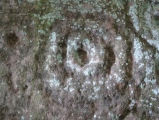

<< Text Pages >> 괴정동 - Burial Chamber or Dolmen in South Korea
Submitted by Klingon on Tuesday, 14 November 2006 Page Views: 2825
Neolithic and Bronze AgeSite Name: 괴정동 Alternative Name: goe-jeong-dongCountry: South Korea
NOTE: This site is 8.718 km away from the location you searched for.
Type: Burial Chamber or Dolmen
Latitude: 36.339100N Longitude: 127.193370E
Condition:
| 5 | Perfect |
| 4 | Almost Perfect |
| 3 | Reasonable but with some damage |
| 2 | Ruined but still recognisable as an ancient site |
| 1 | Pretty much destroyed, possibly visible as crop marks |
| 0 | No data. |
| -1 | Completely destroyed |
| 5 | Superb |
| 4 | Good |
| 3 | Ordinary |
| 2 | Not Good |
| 1 | Awful |
| 0 | No data. |
| 5 | Can be driven to, probably with disabled access |
| 4 | Short walk on a footpath |
| 3 | Requiring a bit more of a walk |
| 2 | A long walk |
| 1 | In the middle of nowhere, a nightmare to find |
| 0 | No data. |
| 5 | co-ordinates taken by GPS or official recorded co-ordinates |
| 4 | co-ordinates scaled from a detailed map |
| 3 | co-ordinates scaled from a bad map |
| 2 | co-ordinates of the nearest village |
| 1 | co-ordinates of the nearest town |
| 0 | no data |
Be the first person to rate this site - see the 'Contribute!' box in the right hand menu.
Internal Links:
External Links:
Burial Chamber (Dolmen) in South Korea
SM Nelson (1993) Archaeology of Korea. Cambridge World Archaeology. Cambridge. pp. 112
You may be viewing yesterday's version of this page. To see the most up to date information please register for a free account.
Do not use the above information on other web sites or publications without permission of the contributor.
Nearby Images from Flickr
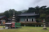
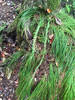
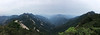
The above images may not be of the site on this page, but were taken nearby. They are loaded from Flickr so please click on them for image credits.
Click here to see more info for this site
Nearby sites
Click here to view sites on an interactive map of the areaKey: Red: member's photo, Blue: 3rd party photo, Yellow: other image, Green: no photo - please go there and take one, Grey: site destroyed
Download sites to:
KML (Google Earth)
GPX (GPS waypoints)
CSV (Garmin/Navman)
CSV (Excel)
To unlock full downloads you need to sign up as a Contributory Member. Otherwise downloads are limited to 50 sites.
Turn off the page maps and other distractions
Nearby sites listing. In the following links * = Image available
14.1km WSW 250° Sangick-ri Dolmen* Burial Chamber or Dolmen
15.3km NNW 336° GongsanSeong* Hillfort
15.5km NNW 333° Songsan-ni gobungun* Rock Art
17.2km N 349° 성원리 Burial Chamber or Dolmen
23.1km E 82° Birae-dong dolmens* Burial Chamber or Dolmen
23.3km WSW 253° Neungsan-ni gobungun* Rock Art
23.6km WSW 254° BuyeoNasang* Hillfort
25.2km SW 217° 성궁리 Burial Chamber or Dolmen
34.8km E 99° Chungbuk do* Burial Chamber or Dolmen
38.2km E 93° Seoktan-ni dolmen and menhir* Standing Stone (Menhir)
39.2km SSW 202° Mireuk-sa temple* Ancient Temple
41.4km E 99° Seoktan-ri Menhir* Standing Stone (Menhir)
42.6km E 90° Jongmi-ri menhir* Standing Stone (Menhir)
43.3km E 88° Dodeok-ri menhir* Standing Stone (Menhir)
47.4km NE 41° SangdangSanseong* Hillfort
50.4km W 277° 상님리 Burial Chamber or Dolmen
51.7km ENE 71° SamnyeonSanseong* Hillfort
52.7km WNW 292° 내동리 Burial Chamber or Dolmen
52.7km N 351° 남송리 Burial Chamber or Dolmen
54.0km WSW 242° Boryoeong County Menhir* Standing Stones
58.0km W 259° Jukcheong-ri 326-1* Burial Chamber or Dolmen
68.2km SSW 205° Woljon standing stone* Standing Stone (Menhir)
85.3km SW 215° Guam-ri Dolmen* Burial Chamber or Dolmen
102.6km NE 37° Buheung-sa temple* Pyramid / Mastaba
103.0km NNE 21° Cheo-ri Menhir* Standing Stone (Menhir)
View more nearby sites and additional images


 We would like to know more about this location. Please feel free to add a brief description and any relevant information in your own language.
 Wir möchten mehr über diese Stätte erfahren. Bitte zögern Sie nicht, eine kurze Beschreibung und relevante Informationen in Deutsch hinzuzufügen.
 Nous aimerions en savoir encore un peu sur les lieux. S'il vous plaît n'hesitez pas à ajouter une courte description et tous les renseignements pertinents dans votre propre langue.
 Quisieramos informarnos un poco más de las lugares. No dude en añadir una breve descripción y otros datos relevantes en su propio idioma.