<< Our Photo Pages >> Gyosan-ni goindolgun - Burial Chamber or Dolmen in South Korea
Submitted by Aska on Saturday, 07 October 2017 Page Views: 870
Neolithic and Bronze AgeSite Name: Gyosan-ni goindolgun Alternative Name: 교산리 고인돌군, 橋山里支石墓群Country: South Korea
NOTE: This site is 19.205 km away from the location you searched for.
Type: Burial Chamber or Dolmen
Nearest Town: Incheon city, Ganghwa island Nearest Village: Gyosan-ni 교산리
Latitude: 37.790900N Longitude: 126.395610E
Condition:
| 5 | Perfect |
| 4 | Almost Perfect |
| 3 | Reasonable but with some damage |
| 2 | Ruined but still recognisable as an ancient site |
| 1 | Pretty much destroyed, possibly visible as crop marks |
| 0 | No data. |
| -1 | Completely destroyed |
| 5 | Superb |
| 4 | Good |
| 3 | Ordinary |
| 2 | Not Good |
| 1 | Awful |
| 0 | No data. |
| 5 | Can be driven to, probably with disabled access |
| 4 | Short walk on a footpath |
| 3 | Requiring a bit more of a walk |
| 2 | A long walk |
| 1 | In the middle of nowhere, a nightmare to find |
| 0 | No data. |
| 5 | co-ordinates taken by GPS or official recorded co-ordinates |
| 4 | co-ordinates scaled from a detailed map |
| 3 | co-ordinates scaled from a bad map |
| 2 | co-ordinates of the nearest village |
| 1 | co-ordinates of the nearest town |
| 0 | no data |
Internal Links:
External Links:
")
One of the dolmen groups (gondola-gun 고인돌군) registered as a UNESCO World Heritage "Ganghwa Dolmens Site". It consists of 33 dolmens on the mountain ridges which are divided into 4 groups, 2 of them are well signposted. Designated as No. 48 of Monuments of Incheon metropolitan city
You may be viewing yesterday's version of this page. To see the most up to date information please register for a free account.
Do not use the above information on other web sites or publications without permission of the contributor.
Nearby Images from Flickr
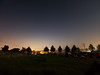
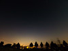
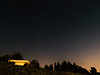

The above images may not be of the site on this page, but were taken nearby. They are loaded from Flickr so please click on them for image credits.
Click here to see more info for this site
Nearby sites
Click here to view sites on an interactive map of the areaKey: Red: member's photo, Blue: 3rd party photo, Yellow: other image, Green: no photo - please go there and take one, Grey: site destroyed
Download sites to:
KML (Google Earth)
GPX (GPS waypoints)
CSV (Garmin/Navman)
CSV (Excel)
To unlock full downloads you need to sign up as a Contributory Member. Otherwise downloads are limited to 50 sites.
Turn off the page maps and other distractions
Nearby sites listing. In the following links * = Image available
3.8km SE 137° Bugeun-ni Jeomgol goindol* Burial Chamber or Dolmen
3.8km SSE 161° Sinsam-ni goindol* Burial Chamber or Dolmen
4.2km ESE 118° Gang-hwa goindolgun* Burial Chamber or Dolmen
4.6km ESE 113° Bugeun-ni goindolgun* Burial Chamber or Dolmen
5.0km SSE 153° Samgeo-ri goindolgun* Burial Chamber or Dolmen
6.0km SSE 153° Gocheon-ni goindolgun* Burial Chamber or Dolmen
6.7km S 175° Osang-ri Dolmens* Burial Chamber or Dolmen
8.5km ESE 111° Daesan-ni goindol* Burial Chamber or Dolmen
18.5km ESE 121° GoJeong-ri dolmens* Burial Chamber or Dolmen
47.4km E 95° 역삼동 Burial Chamber or Dolmen
58.2km SE 135° Gahakdong dolmens* Burial Chamber or Dolmen
59.4km ESE 120° National Museum of Korea* Museum
59.5km NE 50° Haggog-ri Dolmen* Burial Chamber or Dolmen
62.7km S 176° Dukun-ri Dolmens* Burial Chamber or Dolmen
65.2km E 98° 가락동 Burial Chamber or Dolmen
66.8km WNW 295° Ryulgun Gwansanri Dolmen* Burial Chamber or Dolmen
67.2km NE 53° 옥성리 Burial Chamber or Dolmen
67.6km ESE 113° AchasanSeong* Hillfort
69.6km ESE 111° Seoul Amsa-dong prehistoric Sites* Ancient Village or Settlement
69.8km ESE 113° BungnapToseong* Hillfort
70.0km ESE 117° Seokchon-dong gobungun* Chambered Cairn
70.6km ESE 115° MongchonToseong* Hillfort
71.0km ESE 116° Bangi-dong gobungun* Round Barrow(s)
71.1km ESE 121° 수송리 Burial Chamber or Dolmen
77.5km ESE 116° NamhanSanseong* Hillfort
View more nearby sites and additional images


 We would like to know more about this location. Please feel free to add a brief description and any relevant information in your own language.
 Wir möchten mehr über diese Stätte erfahren. Bitte zögern Sie nicht, eine kurze Beschreibung und relevante Informationen in Deutsch hinzuzufügen.
 Nous aimerions en savoir encore un peu sur les lieux. S'il vous plaît n'hesitez pas à ajouter une courte description et tous les renseignements pertinents dans votre propre langue.
 Quisieramos informarnos un poco más de las lugares. No dude en añadir una breve descripción y otros datos relevantes en su propio idioma.