<< Text Pages >> Oberframmering Siedlung - Ancient Village or Settlement in Germany in Bavaria
Submitted by AlexHunger on Saturday, 18 February 2006 Page Views: 2165
Multi-periodSite Name: Oberframmering SiedlungCountry: Germany
NOTE: This site is 20.318 km away from the location you searched for.
Land: Bavaria Type: Ancient Village or Settlement
Nearest Town: Dingolfing Nearest Village: Oberframmering
Latitude: 48.680760N Longitude: 12.726370E
Condition:
| 5 | Perfect |
| 4 | Almost Perfect |
| 3 | Reasonable but with some damage |
| 2 | Ruined but still recognisable as an ancient site |
| 1 | Pretty much destroyed, possibly visible as crop marks |
| 0 | No data. |
| -1 | Completely destroyed |
| 5 | Superb |
| 4 | Good |
| 3 | Ordinary |
| 2 | Not Good |
| 1 | Awful |
| 0 | No data. |
| 5 | Can be driven to, probably with disabled access |
| 4 | Short walk on a footpath |
| 3 | Requiring a bit more of a walk |
| 2 | A long walk |
| 1 | In the middle of nowhere, a nightmare to find |
| 0 | No data. |
| 5 | co-ordinates taken by GPS or official recorded co-ordinates |
| 4 | co-ordinates scaled from a detailed map |
| 3 | co-ordinates scaled from a bad map |
| 2 | co-ordinates of the nearest village |
| 1 | co-ordinates of the nearest town |
| 0 | no data |
Internal Links:
External Links:
Settlement in Bavaria
Positional co-ordinates scaled from a map source. Prehistoric settlement between Isar River and Village. Outline only visible via Aerial Photography.
You may be viewing yesterday's version of this page. To see the most up to date information please register for a free account.
Do not use the above information on other web sites or publications without permission of the contributor.
Nearby Images from Flickr
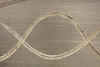
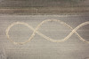

The above images may not be of the site on this page, but were taken nearby. They are loaded from Flickr so please click on them for image credits.
Click here to see more info for this site
Nearby sites
Click here to view sites on an interactive map of the areaKey: Red: member's photo, Blue: 3rd party photo, Yellow: other image, Green: no photo - please go there and take one, Grey: site destroyed
Download sites to:
KML (Google Earth)
GPX (GPS waypoints)
CSV (Garmin/Navman)
CSV (Excel)
To unlock full downloads you need to sign up as a Contributory Member. Otherwise downloads are limited to 50 sites.
Turn off the page maps and other distractions
Nearby sites listing. In the following links * = Image available
1.5km ENE 75° Kothingeichendorf Settlement 1 Ancient Village or Settlement
1.5km ENE 70° Kothingeichendorf Ringheiligtum Henge
1.6km E 84° Kothingeichendorf Settlement 2 Ancient Village or Settlement
7.9km E 93° Gneiding Ringheiligtum Henge
15.0km WNW 296° Hailing Keltische Viereckschanze Ancient Village or Settlement
16.4km ENE 75° Ottmaring-Nindorf Siedlung Ancient Village or Settlement
18.1km ENE 71° Langenisarhofen Ancient Village or Settlement
18.9km E 87° Linzing Siedlung Ancient Village or Settlement
19.9km NNW 335° Aiterhofen Siedlung Ancient Village or Settlement
20.3km NE 41° Natternberg Siedlung Ancient Village or Settlement
20.9km E 88° Osterhofen Siedlung Ancient Village or Settlement
21.9km ESE 112° Galgweis Siedlung Ancient Village or Settlement
23.4km E 91° Künzing-Unternberg Kultanlage Henge
24.9km NW 325° Alburg Siedlung Ancient Village or Settlement
25.3km E 93° Künzing-Bruck Siedlung Ancient Village or Settlement
25.9km E 93° Museum Quintana* Museum
29.9km WNW 302° Geiselhöring Grabhügelfeld Barrow Cemetery
37.7km NW 314° Riekofen Ringheiligtum Henge
39.4km NNW 337° Summstein Wiesenfelden Modern Stone Circle etc
40.0km WSW 259° Mirskofen Siedlung Ancient Village or Settlement
40.0km WSW 255° Altheim Siedlung Ancient Village or Settlement
42.4km WSW 254° Ergolding Siedlung Ancient Village or Settlement
42.6km NW 310° Sengkofen LBK Cemetery* Barrow Cemetery
43.4km SE 125° Bad Griesbach Teufelsstein Rock Art
45.7km WSW 253° Hascherkeller Siedlung Ancient Village or Settlement
View more nearby sites and additional images


 We would like to know more about this location. Please feel free to add a brief description and any relevant information in your own language.
 Wir möchten mehr über diese Stätte erfahren. Bitte zögern Sie nicht, eine kurze Beschreibung und relevante Informationen in Deutsch hinzuzufügen.
 Nous aimerions en savoir encore un peu sur les lieux. S'il vous plaît n'hesitez pas à ajouter une courte description et tous les renseignements pertinents dans votre propre langue.
 Quisieramos informarnos un poco más de las lugares. No dude en añadir una breve descripción y otros datos relevantes en su propio idioma.