 with our Megalithic Portal iPhone app")

<< Our Photo Pages >> Menhir von Thalbürgel - Standing Stone (Menhir) in Germany in Thuringia
Submitted by Klingon on Friday, 14 January 2005 Page Views: 3943
Neolithic and Bronze AgeSite Name: Menhir von ThalbürgelCountry: Germany
NOTE: This site is 2.682 km away from the location you searched for.
Land: Thuringia Type: Standing Stone (Menhir)
Nearest Town: Hermsdorf Nearest Village: Thalbürgel
Latitude: 50.928300N Longitude: 11.764030E
Condition:
| 5 | Perfect |
| 4 | Almost Perfect |
| 3 | Reasonable but with some damage |
| 2 | Ruined but still recognisable as an ancient site |
| 1 | Pretty much destroyed, possibly visible as crop marks |
| 0 | No data. |
| -1 | Completely destroyed |
| 5 | Superb |
| 4 | Good |
| 3 | Ordinary |
| 2 | Not Good |
| 1 | Awful |
| 0 | No data. |
| 5 | Can be driven to, probably with disabled access |
| 4 | Short walk on a footpath |
| 3 | Requiring a bit more of a walk |
| 2 | A long walk |
| 1 | In the middle of nowhere, a nightmare to find |
| 0 | No data. |
| 5 | co-ordinates taken by GPS or official recorded co-ordinates |
| 4 | co-ordinates scaled from a detailed map |
| 3 | co-ordinates scaled from a bad map |
| 2 | co-ordinates of the nearest village |
| 1 | co-ordinates of the nearest town |
| 0 | no data |
Internal Links:
External Links:
I have visited· I would like to visit
Klingon visited on 24th Nov 2004 - their rating: Cond: 5 Amb: 5 Access: 4
")
No official name, I label it Menhir von Thalbürgel.
height: 1.1 m
You may be viewing yesterday's version of this page. To see the most up to date information please register for a free account.
Do not use the above information on other web sites or publications without permission of the contributor.
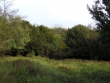
Nearby Images from Flickr
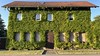
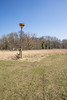
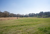
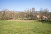
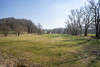
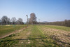
The above images may not be of the site on this page, but were taken nearby. They are loaded from Flickr so please click on them for image credits.
Click here to see more info for this site
Nearby sites
Click here to view sites on an interactive map of the areaKey: Red: member's photo, Blue: 3rd party photo, Yellow: other image, Green: no photo - please go there and take one, Grey: site destroyed
Download sites to:
KML (Google Earth)
GPX (GPS waypoints)
CSV (Garmin/Navman)
CSV (Excel)
To unlock full downloads you need to sign up as a Contributory Member. Otherwise downloads are limited to 50 sites.
Turn off the page maps and other distractions
Nearby sites listing. In the following links * = Image available
439m NW 323° Buttermilchquelle* Holy Well or Sacred Spring
1.5km ESE 117° Menhir von Waldeck* Standing Stone (Menhir)
2.9km SE 130° Menhir of Bobeck* Standing Stone (Menhir)
4.5km E 80° Vogelherd (Hermsdorf) Artificial Mound
5.4km NW 307° Alter Gleisberg* Ancient Village or Settlement
8.2km NE 45° Rosenhain Ancient Village or Settlement
8.4km WSW 241° Kolmberg Artificial Mound
9.7km W 277° Jenzig Causewayed Enclosure
9.8km W 267° Steinkreis am Fuchsturm* Modern Stone Circle etc
10.9km ESE 112° Oberndorf Round Barrow(s)
11.2km WSW 254° Johannisberg Wöllnitz* Causewayed Enclosure
11.6km E 81° Kursdorf (3) Artificial Mound
11.8km E 82° Kursdorf (2) Barrow Cemetery
12.1km N 358° Ellrich* Barrow Cemetery
12.3km E 86° Seifartsdorf (3) Round Barrow(s)
12.4km W 277° Otto Schott's Grave* Modern Stone Circle etc
12.5km N 1° Thierschneck Barrow Cemetery
12.5km ENE 71° Am nassen Wald Barrow Cemetery
12.9km E 91° Kursdorf (1) Barrow Cemetery
13.0km ESE 106° Rüdersdorf Round Barrow(s)
13.0km N 6° Schwedenring Graitschen* Turf Maze
13.0km SW 229° Sandberg Ölknitz Ancient Village or Settlement
13.3km ESE 118° Harpersdorf Round Barrow(s)
13.3km NNE 26° Dorstewitz Barrow Cemetery
13.6km E 84° Seifartsdorf (1) Round Barrow(s)
View more nearby sites and additional images


 We would like to know more about this location. Please feel free to add a brief description and any relevant information in your own language.
 Wir möchten mehr über diese Stätte erfahren. Bitte zögern Sie nicht, eine kurze Beschreibung und relevante Informationen in Deutsch hinzuzufügen.
 Nous aimerions en savoir encore un peu sur les lieux. S'il vous plaît n'hesitez pas à ajouter une courte description et tous les renseignements pertinents dans votre propre langue.
 Quisieramos informarnos un poco más de las lugares. No dude en añadir una breve descripción y otros datos relevantes en su propio idioma.