<< Our Photo Pages >> Brunfthof - Causewayed Enclosure in Germany in Thuringia
Submitted by Klingon on Wednesday, 21 October 2020 Page Views: 380
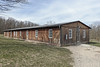
Early Medieval (Dark Age)Site Name: BrunfthofCountry: Germany
NOTE: This site is 1.837 km away from the location you searched for.
Land: Thuringia Type: Causewayed Enclosure
Nearest Town: Weiamr Nearest Village: Ettersburg
Latitude: 51.025760N Longitude: 11.274490E
Condition:
| 5 | Perfect |
| 4 | Almost Perfect |
| 3 | Reasonable but with some damage |
| 2 | Ruined but still recognisable as an ancient site |
| 1 | Pretty much destroyed, possibly visible as crop marks |
| 0 | No data. |
| -1 | Completely destroyed |
| 5 | Superb |
| 4 | Good |
| 3 | Ordinary |
| 2 | Not Good |
| 1 | Awful |
| 0 | No data. |
| 5 | Can be driven to, probably with disabled access |
| 4 | Short walk on a footpath |
| 3 | Requiring a bit more of a walk |
| 2 | A long walk |
| 1 | In the middle of nowhere, a nightmare to find |
| 0 | No data. |
| 5 | co-ordinates taken by GPS or official recorded co-ordinates |
| 4 | co-ordinates scaled from a detailed map |
| 3 | co-ordinates scaled from a bad map |
| 2 | co-ordinates of the nearest village |
| 1 | co-ordinates of the nearest town |
| 0 | no data |
Internal Links:
External Links:
I have visited· I would like to visit
Klingon visited on 11th Oct 2020 - their rating: Cond: 2 Amb: 4 Access: 3
")
The ring wall is dated to the early Middle Ages on the basis of ceramic sherd finds.
You may be viewing yesterday's version of this page. To see the most up to date information please register for a free account.
")
Do not use the above information on other web sites or publications without permission of the contributor.
Nearby Images from Flickr


The above images may not be of the site on this page, but were taken nearby. They are loaded from Flickr so please click on them for image credits.
Click here to see more info for this site
Nearby sites
Click here to view sites on an interactive map of the areaKey: Red: member's photo, Blue: 3rd party photo, Yellow: other image, Green: no photo - please go there and take one, Grey: site destroyed
Download sites to:
KML (Google Earth)
GPX (GPS waypoints)
CSV (Garmin/Navman)
CSV (Excel)
To unlock full downloads you need to sign up as a Contributory Member. Otherwise downloads are limited to 50 sites.
Turn off the page maps and other distractions
Nearby sites listing. In the following links * = Image available
744m N 1° Ettersburg* Standing Stone (Menhir)
4.3km E 98° Prinzenschneise (3)* Round Barrow(s)
4.3km E 99° Prinzenschneise (2)* Round Barrow(s)
4.3km E 98° Prinzenschneise (4)* Round Barrow(s)
4.4km E 100° Prinzenschneise (1)* Round Barrow(s)
4.6km NNW 336° Berlstedt Hünengrab* Round Barrow(s)
6.6km ESE 121° Auf dem Steinberge* Ancient Village or Settlement
6.7km SSE 147° Museum of Prehistory Thuringia* Museum
7.6km NW 326° Palmberg Grabhügel* Round Barrow(s)
8.0km E 91° Bärenhügel* Round Barrow(s)
8.0km NE 40° Wetzstein (Buttelstedt)* Standing Stone (Menhir)
8.4km WNW 297° Am Krummbache* Artificial Mound
11.8km ENE 70° Comthureiholz* Causewayed Enclosure
12.0km SSE 162° Höhlenburg Buchfart* Cave or Rock Shelter
12.2km ENE 67° Pfiffelbach* Round Barrow(s)
12.4km N 352° Clausberg* Causewayed Enclosure
12.6km NE 38° Weitester Hügel* Artificial Mound
13.1km NNW 328° Langensteinsches Gericht* Round Barrow(s)
13.7km NW 311° Schloßvippach* Ancient Village or Settlement
13.8km WNW 283° Galgenhügel Stotternheim* Round Barrow(s)
14.0km NNW 330° Galgenhügel Orlishausen* Artificial Mound
14.8km NW 317° Katzenhügel* Artificial Mound
14.9km WSW 255° Ringelberg Hügelgräber* Artificial Mound
15.4km NNW 328° Kirschhügel* Artificial Mound
16.8km NE 49° Hegegericht Emsen* Misc. Earthwork
View more nearby sites and additional images


 We would like to know more about this location. Please feel free to add a brief description and any relevant information in your own language.
 Wir möchten mehr über diese Stätte erfahren. Bitte zögern Sie nicht, eine kurze Beschreibung und relevante Informationen in Deutsch hinzuzufügen.
 Nous aimerions en savoir encore un peu sur les lieux. S'il vous plaît n'hesitez pas à ajouter une courte description et tous les renseignements pertinents dans votre propre langue.
 Quisieramos informarnos un poco más de las lugares. No dude en añadir una breve descripción y otros datos relevantes en su propio idioma.