Poggio Civitate - Ancient Village or Settlement in Italy in Toscana
Submitted by bat400 on Sunday, 10 November 2013 Page Views: 3661
Site Name: Poggio Civitate Alternative Name: Piano del TesoroCountry: Italy
NOTE: This site is 29.334 km away from the location you searched for.
Region: Toscana Type: Ancient Village or Settlement
Nearest Town: Siena Nearest Village: Murlo
Latitude: 43.161000N Longitude: 11.388000E
Condition:
| 5 | Perfect |
| 4 | Almost Perfect |
| 3 | Reasonable but with some damage |
| 2 | Ruined but still recognisable as an ancient site |
| 1 | Pretty much destroyed, possibly visible as crop marks |
| 0 | No data. |
| -1 | Completely destroyed |
| 5 | Superb |
| 4 | Good |
| 3 | Ordinary |
| 2 | Not Good |
| 1 | Awful |
| 0 | No data. |
| 5 | Can be driven to, probably with disabled access |
| 4 | Short walk on a footpath |
| 3 | Requiring a bit more of a walk |
| 2 | A long walk |
| 1 | In the middle of nowhere, a nightmare to find |
| 0 | No data. |
| 5 | co-ordinates taken by GPS or official recorded co-ordinates |
| 4 | co-ordinates scaled from a detailed map |
| 3 | co-ordinates scaled from a bad map |
| 2 | co-ordinates of the nearest village |
| 1 | co-ordinates of the nearest town |
| 0 | no data |
Internal Links:
External Links:
Ancient Settlement in Toscana.
An Etruscans settlement of large buildings and a multi-craft workshop in the 7th C BCE. After a large fire, the site was leveled and rebuilt in the 6th C BCE as multi winged complex with a central courtyard.
"Speculation as to its function has lead to such theories as a political meeting hall, a religious sanctuary, a palazzo of some type and even an Etruscan version of an agora. Currently, the excavators believe that the building combined the functions of the disparate structures of the earlier phase into a single edifice."
Currently the site of archaeological investigations as part of the Poggio Civitate Excavation Project, University Of Massachusetts Amherst .
Note: Infanticide in paradise? Neo-natal remains lead to speculation - infants in the trash, or burials displaced?
You may be viewing yesterday's version of this page. To see the most up to date information please register for a free account.
Do not use the above information on other web sites or publications without permission of the contributor.
Nearby Images from Flickr

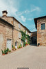
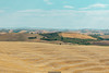
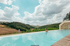

The above images may not be of the site on this page, but were taken nearby. They are loaded from Flickr so please click on them for image credits.
Click here to see more info for this site
Nearby sites
Click here to view sites on an interactive map of the areaKey: Red: member's photo, Blue: 3rd party photo, Yellow: other image, Green: no photo - please go there and take one, Grey: site destroyed
Download sites to:
KML (Google Earth)
GPX (GPS waypoints)
CSV (Garmin/Navman)
CSV (Excel)
To unlock full downloads you need to sign up as a Contributory Member. Otherwise downloads are limited to 50 sites.

 We would like to know more about this location. Please feel free to add a brief description and any relevant information in your own language.
 Wir möchten mehr über diese Stätte erfahren. Bitte zögern Sie nicht, eine kurze Beschreibung und relevante Informationen in Deutsch hinzuzufügen.
 Nous aimerions en savoir encore un peu sur les lieux. S'il vous plaît n'hesitez pas à ajouter une courte description et tous les renseignements pertinents dans votre propre langue.
 Quisieramos informarnos un poco más de las lugares. No dude en añadir una breve descripción y otros datos relevantes en su propio idioma.