<< Text Pages >> Summstein Am Klosterberg - Modern Stone Circle etc in Germany in Thuringia
Submitted by Harald_Platta on Wednesday, 15 November 2017 Page Views: 720
Modern SitesSite Name: Summstein Am KlosterbergCountry: Germany
NOTE: This site is 16.064 km away from the location you searched for.
Land: Thuringia Type: Modern Stone Circle etc
Nearest Town: Friedrichroda
Latitude: 50.861325N Longitude: 10.565775E
Condition:
| 5 | Perfect |
| 4 | Almost Perfect |
| 3 | Reasonable but with some damage |
| 2 | Ruined but still recognisable as an ancient site |
| 1 | Pretty much destroyed, possibly visible as crop marks |
| 0 | No data. |
| -1 | Completely destroyed |
| 5 | Superb |
| 4 | Good |
| 3 | Ordinary |
| 2 | Not Good |
| 1 | Awful |
| 0 | No data. |
| 5 | Can be driven to, probably with disabled access |
| 4 | Short walk on a footpath |
| 3 | Requiring a bit more of a walk |
| 2 | A long walk |
| 1 | In the middle of nowhere, a nightmare to find |
| 0 | No data. |
| 5 | co-ordinates taken by GPS or official recorded co-ordinates |
| 4 | co-ordinates scaled from a detailed map |
| 3 | co-ordinates scaled from a bad map |
| 2 | co-ordinates of the nearest village |
| 1 | co-ordinates of the nearest town |
| 0 | no data |
Be the first person to rate this site - see the 'Contribute!' box in the right hand menu.
Internal Links:
External Links:
The Summstein ("Humming Stone") is a modern stone sculpture situated in Friedrichroda (Thuringia/Germany).
Further information and literature on Summsteine in general: MP page Großer Summstein.
Reference:
[01] Open Street Maps: Knoten: Summstein (529542530)
You may be viewing yesterday's version of this page. To see the most up to date information please register for a free account.
Do not use the above information on other web sites or publications without permission of the contributor.
Nearby Images from Flickr


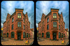
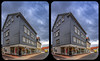
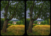

The above images may not be of the site on this page, but were taken nearby. They are loaded from Flickr so please click on them for image credits.
Click here to see more info for this site
Nearby sites
Click here to view sites on an interactive map of the areaKey: Red: member's photo, Blue: 3rd party photo, Yellow: other image, Green: no photo - please go there and take one, Grey: site destroyed
Download sites to:
KML (Google Earth)
GPX (GPS waypoints)
CSV (Garmin/Navman)
CSV (Excel)
To unlock full downloads you need to sign up as a Contributory Member. Otherwise downloads are limited to 50 sites.
Turn off the page maps and other distractions
Nearby sites listing. In the following links * = Image available
13.2km NW 324° Venushöhle, Tannhäuserhöhle Cave or Rock Shelter
13.9km WNW 301° Flußbetthöhle Farnroda Cave or Rock Shelter
17.3km W 263° Schweina Barrow Cemetery
21.2km WNW 302° Eisenacher Burg Ancient Village or Settlement
22.0km N 3° Harth-Haus Grabhügel* Round Barrow(s)
23.9km WSW 258° Celts' spa Museum
24.4km NNW 334° Alte Burg Berka vor dem Hainich Hillfort
25.1km SSE 154° Wilder Kopf* Artificial Mound
26.7km SSE 158° Suhler Leube* Ancient Trackway
27.4km SSE 154° Am Geiersberg Artificial Mound
28.1km S 181° Streitschlag (2)* Artificial Mound
28.3km S 181° Streitschlag (1) Artificial Mound
28.5km S 181° Schulzenkopf (2)* Artificial Mound
28.5km WSW 244° Langenfeld Artificial Mound
28.8km S 181° Schulzenkopf (1)* Artificial Mound
28.8km WSW 241° Bernshausen Artificial Mound
28.9km S 181° Rodeland* Barrow Cemetery
29.2km ENE 68° Gräberfelder Bindersleben* Round Barrow(s)
29.5km S 176° Dietzhausen (2) Artificial Mound
29.7km S 179° Buchberg Artificial Mound
30.0km S 176° Dietzhausen (1) Artificial Mound
30.2km S 180° Herrnausleite Artificial Mound
30.3km S 179° Silbachshöhe (1) Artificial Mound
30.4km S 179° Silbachshöhe (2) Causewayed Enclosure
30.6km S 176° Dietzhausen (3) Artificial Mound
View more nearby sites and additional images


 We would like to know more about this location. Please feel free to add a brief description and any relevant information in your own language.
 Wir möchten mehr über diese Stätte erfahren. Bitte zögern Sie nicht, eine kurze Beschreibung und relevante Informationen in Deutsch hinzuzufügen.
 Nous aimerions en savoir encore un peu sur les lieux. S'il vous plaît n'hesitez pas à ajouter une courte description et tous les renseignements pertinents dans votre propre langue.
 Quisieramos informarnos un poco más de las lugares. No dude en añadir una breve descripción y otros datos relevantes en su propio idioma.