<< Our Photo Pages >> Funkenburg Westgreußen - Ancient Village or Settlement in Germany in Thuringia
Submitted by Klingon on Thursday, 16 June 2005 Page Views: 4673
Multi-periodSite Name: Funkenburg WestgreußenCountry: Germany
NOTE: This site is 13.117 km away from the location you searched for.
Land: Thuringia Type: Ancient Village or Settlement
Nearest Town: Sömmerda Nearest Village: Westgreußen
Latitude: 51.238900N Longitude: 10.915500E
Condition:
| 5 | Perfect |
| 4 | Almost Perfect |
| 3 | Reasonable but with some damage |
| 2 | Ruined but still recognisable as an ancient site |
| 1 | Pretty much destroyed, possibly visible as crop marks |
| 0 | No data. |
| -1 | Completely destroyed |
| 5 | Superb |
| 4 | Good |
| 3 | Ordinary |
| 2 | Not Good |
| 1 | Awful |
| 0 | No data. |
| 5 | Can be driven to, probably with disabled access |
| 4 | Short walk on a footpath |
| 3 | Requiring a bit more of a walk |
| 2 | A long walk |
| 1 | In the middle of nowhere, a nightmare to find |
| 0 | No data. |
| 5 | co-ordinates taken by GPS or official recorded co-ordinates |
| 4 | co-ordinates scaled from a detailed map |
| 3 | co-ordinates scaled from a bad map |
| 2 | co-ordinates of the nearest village |
| 1 | co-ordinates of the nearest town |
| 0 | no data |
Internal Links:
External Links:
I have visited· I would like to visit
fornjotr Klingon have visited here
")
The Funkenburg (spark's fortress) Westgreußen was an ancient Germanic settlement from 200 BC to 50 AD. Today it's an outdoor museum with reconstructed houses and a wall. Some ancient activities are provided like baking bread, spinning wool, making pottery, knotting flew and shoot with bow and arrow.
phone / fax: +49(0)3636/704616
German webpage
You may be viewing yesterday's version of this page. To see the most up to date information please register for a free account.
")
Do not use the above information on other web sites or publications without permission of the contributor.
Nearby Images from Flickr

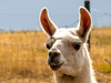

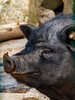
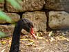
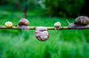
The above images may not be of the site on this page, but were taken nearby. They are loaded from Flickr so please click on them for image credits.
Click here to see more info for this site
Nearby sites
Click here to view sites on an interactive map of the areaKey: Red: member's photo, Blue: 3rd party photo, Yellow: other image, Green: no photo - please go there and take one, Grey: site destroyed
Download sites to:
KML (Google Earth)
GPX (GPS waypoints)
CSV (Garmin/Navman)
CSV (Excel)
To unlock full downloads you need to sign up as a Contributory Member. Otherwise downloads are limited to 50 sites.
Turn off the page maps and other distractions
Nearby sites listing. In the following links * = Image available
5.2km NNE 23° Feldengel* Standing Stone (Menhir)
5.6km N 351° Der Hök* Artificial Mound
6.1km NNE 20° Der Höck* Artificial Mound
10.7km ENE 69° Rastplatz Bilzingsleben* Ancient Village or Settlement
11.6km ENE 66° Sonnenkultstein Bilzingsleben* Sculptured Stone
11.8km NE 45° Kohnstein Causewayed Enclosure
12.5km SE 125° Galgenhügel Weissensee* Artificial Mound
12.9km NNW 334° Ölmüllersberg Causewayed Enclosure
15.1km E 84° Schwedenschanze Kindelbrück Causewayed Enclosure
15.3km SE 138° Schallenburg Ancient Village or Settlement
15.8km NNE 32° Rottleben Artificial Mound
16.4km NNW 339° Frauenberg Causewayed Enclosure
16.8km ENE 68° Sieben Hügel* Barrow Cemetery
16.8km E 86° Langer Stein Büchel* Standing Stone (Menhir)
17.6km WNW 291° Holzsußra Artificial Mound
17.6km ESE 109° Orlishügel* Artificial Mound
17.9km ESE 109° Breitfurt* Ancient Village or Settlement
17.9km N 358° Am wilden Mann Artificial Mound
18.1km ESE 108° Rastanlage Leubinger Fürstenhügel* Museum
18.3km NE 38° Kosackenberg* Cave or Rock Shelter
18.3km ENE 58° Seehausen Menhir* Standing Stone (Menhir)
18.5km ENE 68° Im Hagen* Barrow Cemetery
18.5km NNE 27° Ochsenburg Ancient Village or Settlement
18.5km ESE 107° Leubinger Hügel* Round Barrow(s)
18.9km NNW 331° Heiliger Berg Misc. Earthwork
View more nearby sites and additional images


 We would like to know more about this location. Please feel free to add a brief description and any relevant information in your own language.
 Wir möchten mehr über diese Stätte erfahren. Bitte zögern Sie nicht, eine kurze Beschreibung und relevante Informationen in Deutsch hinzuzufügen.
 Nous aimerions en savoir encore un peu sur les lieux. S'il vous plaît n'hesitez pas à ajouter une courte description et tous les renseignements pertinents dans votre propre langue.
 Quisieramos informarnos un poco más de las lugares. No dude en añadir una breve descripción y otros datos relevantes en su propio idioma.