

<< Our Photo Pages >> Haugset Runestone - Carving in Norway in Oppland
Submitted by kenntha88 on Friday, 13 November 2020 Page Views: 366
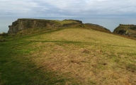
Early Medieval (Dark Age)Site Name: Haugset RunestoneCountry: Norway
NOTE: This site is 9.218 km away from the location you searched for.
Fylke: Oppland Type: Carving
Nearest Village: Raufoss
Latitude: 60.617855N Longitude: 10.766022E
Condition:
| 5 | Perfect |
| 4 | Almost Perfect |
| 3 | Reasonable but with some damage |
| 2 | Ruined but still recognisable as an ancient site |
| 1 | Pretty much destroyed, possibly visible as crop marks |
| 0 | No data. |
| -1 | Completely destroyed |
| 5 | Superb |
| 4 | Good |
| 3 | Ordinary |
| 2 | Not Good |
| 1 | Awful |
| 0 | No data. |
| 5 | Can be driven to, probably with disabled access |
| 4 | Short walk on a footpath |
| 3 | Requiring a bit more of a walk |
| 2 | A long walk |
| 1 | In the middle of nowhere, a nightmare to find |
| 0 | No data. |
| 5 | co-ordinates taken by GPS or official recorded co-ordinates |
| 4 | co-ordinates scaled from a detailed map |
| 3 | co-ordinates scaled from a bad map |
| 2 | co-ordinates of the nearest village |
| 1 | co-ordinates of the nearest town |
| 0 | no data |
Internal Links:
External Links:
")
This runestone was found in 1967 when a small shed was beeing built. It was located around 1 metre down in the ground with the runic inscription facing down. It was surrounded by a cairn of smaller stones (burial cairn or stone setting?). The stone was moved to the garden of the house of the finder and a small roof was built over it to protect it from the elements. It is now a part of the garden.
The stone is 1,7 metres in height, around 1 metre wide and 30-40cm thick. It has an almost hexagonal cross section and the top looks to be cut straight off. It almost resemble a pillar more than a standing stone. It is made in a very light, almost white type of granit.
The runic inscription is on one of the narrower sides and going bottom to top. The runes are around 15-20 cm in height and very thin carved and are written in the younger futhark, dating the stone to around 900-1000AD. The inscription say "Agli set this stone in memory of Ulv, his brother".
You may be viewing yesterday's version of this page. To see the most up to date information please register for a free account.
")
")
")
")
")
")
Do not use the above information on other web sites or publications without permission of the contributor.
Click here to see more info for this site
Nearby sites
Click here to view sites on an interactive map of the areaKey: Red: member's photo, Blue: 3rd party photo, Yellow: other image, Green: no photo - please go there and take one, Grey: site destroyed
Download sites to:
KML (Google Earth)
GPX (GPS waypoints)
CSV (Garmin/Navman)
CSV (Excel)
To unlock full downloads you need to sign up as a Contributory Member. Otherwise downloads are limited to 50 sites.
Turn off the page maps and other distractions
Nearby sites listing. In the following links * = Image available
1.0km ENE 62° Hol-Mellom* Round Barrow(s)
6.6km NNE 15° Kolbuvegen-Hammerstad* Round Barrow(s)
7.8km NNE 23° Alstadsteinen runestone* Carving
7.8km NNE 17° Nedre Stabo* Round Barrow(s)
7.9km NNE 25° Alfstadhaug-Totenvegen* Stone Circle
7.9km NNE 14° Prinsehaugen/Kongehaugen* Round Barrow(s)
8.1km NNE 13° Slettavegen-Grimstad* Round Barrow(s)
8.3km N 10° Kongsengen* Round Barrow(s)
8.5km NNE 31° Hoff (Oppland)* Round Barrow(s)
8.5km NNE 14° Nedre-La* Round Barrow(s)
8.6km NNE 14° Lunden-Nordlivegen* Cairn
8.6km NE 37° Storhaugen-Totenvegen* Round Barrow(s)
9.0km NE 43° Balkeenga* Round Barrow(s)
9.1km NE 37° Gile (Rondehaugen)* Barrow Cemetery
10.0km NE 48° Hveem Standing Stone* Standing Stone (Menhir)
10.2km NE 43° Hatbøl* Round Barrow(s)
10.7km NNE 12° Djupedalsborgen* Hillfort
17.5km NE 41° Eiksberget* Hillfort
18.0km NNE 15° Sterud Østre* Barrow Cemetery
18.2km NNE 21° Fossum (Hedmark)* Carving
20.2km ENE 73° Sotenodden* Barrow Cemetery
20.3km ENE 73° Brurstien* Hillfort
20.9km NNE 23° Duengerhøgda-Ousdal* Round Barrow(s)
21.0km NNE 21° Ousdal Nordre* Barrow Cemetery
21.6km ENE 69° Ileberget Hillfort* Hillfort
View more nearby sites and additional images


 We would like to know more about this location. Please feel free to add a brief description and any relevant information in your own language.
 Wir möchten mehr über diese Stätte erfahren. Bitte zögern Sie nicht, eine kurze Beschreibung und relevante Informationen in Deutsch hinzuzufügen.
 Nous aimerions en savoir encore un peu sur les lieux. S'il vous plaît n'hesitez pas à ajouter une courte description et tous les renseignements pertinents dans votre propre langue.
 Quisieramos informarnos un poco más de las lugares. No dude en añadir una breve descripción y otros datos relevantes en su propio idioma.