<< Text Pages >> Manerba del Garda Chambered Tombs - Chambered Tomb in Italy in Lombardia
Submitted by SolarMegalith on Tuesday, 14 April 2009 Page Views: 3394
Neolithic and Bronze AgeSite Name: Manerba del Garda Chambered TombsCountry: Italy
NOTE: This site is 21.612 km away from the location you searched for.
Region: Lombardia Type: Chambered Tomb
Nearest Town: Lonato Nearest Village: Manerba del Garda
Latitude: 45.552400N Longitude: 10.552850E
Condition:
| 5 | Perfect |
| 4 | Almost Perfect |
| 3 | Reasonable but with some damage |
| 2 | Ruined but still recognisable as an ancient site |
| 1 | Pretty much destroyed, possibly visible as crop marks |
| 0 | No data. |
| -1 | Completely destroyed |
| 5 | Superb |
| 4 | Good |
| 3 | Ordinary |
| 2 | Not Good |
| 1 | Awful |
| 0 | No data. |
| 5 | Can be driven to, probably with disabled access |
| 4 | Short walk on a footpath |
| 3 | Requiring a bit more of a walk |
| 2 | A long walk |
| 1 | In the middle of nowhere, a nightmare to find |
| 0 | No data. |
| 5 | co-ordinates taken by GPS or official recorded co-ordinates |
| 4 | co-ordinates scaled from a detailed map |
| 3 | co-ordinates scaled from a bad map |
| 2 | co-ordinates of the nearest village |
| 1 | co-ordinates of the nearest town |
| 0 | no data |
Be the first person to rate this site - see the 'Contribute!' box in the right hand menu.
Internal Links:
External Links:
Chambered Tomb in Lombardia
Close to the village Manerba a unique discovery was made - a group of chambered tombs with timber chambers. The chambers had 2x1 m in size, and their floor was covered with stones. Most of the tombs had trances of fire, probably connected with some rituals.
The Manerba site shows similarities with several chambered tombs from the area of Western Alps.
You may be viewing yesterday's version of this page. To see the most up to date information please register for a free account.
Do not use the above information on other web sites or publications without permission of the contributor.
Nearby Images from Flickr

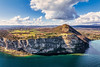
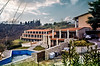
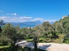
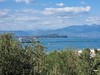
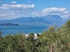
The above images may not be of the site on this page, but were taken nearby. They are loaded from Flickr so please click on them for image credits.
Click here to see more info for this site
Nearby sites
Click here to view sites on an interactive map of the areaKey: Red: member's photo, Blue: 3rd party photo, Yellow: other image, Green: no photo - please go there and take one, Grey: site destroyed
Download sites to:
KML (Google Earth)
GPX (GPS waypoints)
CSV (Garmin/Navman)
CSV (Excel)
To unlock full downloads you need to sign up as a Contributory Member. Otherwise downloads are limited to 50 sites.
Turn off the page maps and other distractions
Nearby sites listing. In the following links * = Image available
1.7km ENE 77° La Rocca di Manerba* Ancient Temple
10.2km ENE 71° Roccia delle Griselle* Carving
15.5km NE 53° Crero* Carving
24.1km NE 44° Castelletto* Carving
41.1km WNW 303° Pyramids of Zone* Natural Stone / Erratic / Other Natural Feature
43.2km NNE 31° MAG Museo Alta Garda Museum
45.5km NNE 27° Monte San Martino, Campi, Riva Dell Garda* Ancient Temple
46.7km NW 324° Boario Terme Archeopark Museum
47.5km NW 322° Luine* Rock Art
47.6km SSE 156° Museo Archeologico (Mantova)* Museum
50.2km NNW 333° Ossimo Stones Sculptured Stone
51.1km NNW 329° Borno 4 Sculptured Stone
51.1km NNW 333° Anvoia Stones* Standing Stones
51.4km NNW 333° Asino-Anvoia* Standing Stones
51.4km NNW 328° Borno Stone* Standing Stone (Menhir)
53.3km NNW 343° Nadro Cup-Marked-Stone* Rock Art
53.4km NNW 343° Foppe-Nadro Museum* Museum
53.8km NNW 343° Nadro Ancient Road* Ancient Trackway
54.1km NNW 343° Foppe-Nadro Stone* Standing Stone (Menhir)
54.2km NNW 343° Foppe-Nadro Villaggio Prehistorico* Museum
54.4km NNW 343° Sotto Roccia shelter II* Cave or Rock Shelter
54.4km NNW 343° Foppe-Nadro Rock 1* Rock Art
54.5km NNW 343° Foppe-Nadro Rock 4* Rock Art
54.5km NNW 343° Foppe-Nadro Rock 6* Rock Art
54.5km NNW 343° Foppe-Nadro Rock 21* Rock Art
View more nearby sites and additional images


 We would like to know more about this location. Please feel free to add a brief description and any relevant information in your own language.
 Wir möchten mehr über diese Stätte erfahren. Bitte zögern Sie nicht, eine kurze Beschreibung und relevante Informationen in Deutsch hinzuzufügen.
 Nous aimerions en savoir encore un peu sur les lieux. S'il vous plaît n'hesitez pas à ajouter une courte description et tous les renseignements pertinents dans votre propre langue.
 Quisieramos informarnos un poco más de las lugares. No dude en añadir una breve descripción y otros datos relevantes en su propio idioma.