 with our Megalithic Portal iPhone app")


<< Text Pages >> Gabes Archeology Museum - Museum in Tunisia
Submitted by AlexHunger on Thursday, 17 April 2008 Page Views: 3659
MuseumsSite Name: Gabes Archeology Museum Alternative Name: TacapaeCountry: Tunisia
NOTE: This site is 88.389 km away from the location you searched for.
Type: Museum
Nearest Town: Gabes Nearest Village: Gabes
Latitude: 33.885736N Longitude: 10.106156E
Condition:
| 5 | Perfect |
| 4 | Almost Perfect |
| 3 | Reasonable but with some damage |
| 2 | Ruined but still recognisable as an ancient site |
| 1 | Pretty much destroyed, possibly visible as crop marks |
| 0 | No data. |
| -1 | Completely destroyed |
| 5 | Superb |
| 4 | Good |
| 3 | Ordinary |
| 2 | Not Good |
| 1 | Awful |
| 0 | No data. |
| 5 | Can be driven to, probably with disabled access |
| 4 | Short walk on a footpath |
| 3 | Requiring a bit more of a walk |
| 2 | A long walk |
| 1 | In the middle of nowhere, a nightmare to find |
| 0 | No data. |
| 5 | co-ordinates taken by GPS or official recorded co-ordinates |
| 4 | co-ordinates scaled from a detailed map |
| 3 | co-ordinates scaled from a bad map |
| 2 | co-ordinates of the nearest village |
| 1 | co-ordinates of the nearest town |
| 0 | no data |
Be the first person to rate this site - see the 'Contribute!' box in the right hand menu.
Internal Links:
External Links:
Museum in Tunisia
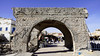
Tacapae was a Punic town and was then taken over by the Romans.
There is an Archaeology and Folk Arts Museum.
You may be viewing yesterday's version of this page. To see the most up to date information please register for a free account.
Do not use the above information on other web sites or publications without permission of the contributor.
Nearby Images from Flickr
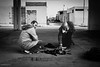
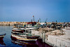

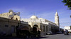
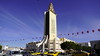
The above images may not be of the site on this page, but were taken nearby. They are loaded from Flickr so please click on them for image credits.
Click here to see more info for this site
Nearby sites
Click here to view sites on an interactive map of the areaKey: Red: member's photo, Blue: 3rd party photo, Yellow: other image, Green: no photo - please go there and take one, Grey: site destroyed
Download sites to:
KML (Google Earth)
GPX (GPS waypoints)
CSV (Garmin/Navman)
CSV (Excel)
To unlock full downloads you need to sign up as a Contributory Member. Otherwise downloads are limited to 50 sites.
Turn off the page maps and other distractions
Nearby sites listing. In the following links * = Image available
100.2km NNE 32° Thaenae Ancient Village or Settlement
111.9km NNE 33° Municipalité de Sfax Musee Museum
165.6km NNE 19° El Jem Museum* Museum
166.2km NNE 19° Thysdrus* Ancient Village or Settlement
175.6km NNW 329° Sufetula Ancient Village or Settlement
186.2km NW 320° Celium Mausoleum Marker Stone
217.9km NNE 12° Hadrumet* Ancient Village or Settlement
220.8km NNE 13° Sousse Museum* Museum
233.6km NNW 340° Mactaris Numidian Tomb* Chambered Tomb
233.6km NNW 340° Mactaris* Ancient Village or Settlement
234.0km NNW 340° Maktar Museum* Museum
244.9km NNW 339° The Camel Stones* Standing Stone (Menhir)
246.8km NNW 338° Eles Megalithic Tomb 60* Burial Chamber or Dolmen
246.8km NNW 338° Eles Megalithic Tomb 25* Burial Chamber or Dolmen
246.8km NNW 338° Eles Megalithic Tomb 61* Burial Chamber or Dolmen
246.8km NNW 338° Eles Megalithic Tomb 62* Burial Chamber or Dolmen
246.8km NNW 338° Eles Megalithic Tomb 24* Burial Chamber or Dolmen
246.9km NNW 338° Eles Megalithic Tomb 63* Burial Chamber or Dolmen
246.9km NNW 338° Eles Megalithic Tomb 23* Burial Chamber or Dolmen
246.9km NNW 338° Eles Megalithic Tomb 22* Burial Chamber or Dolmen
247.0km NNW 338° Eles Megalithic Tomb 18* Burial Chamber or Dolmen
247.0km NNW 338° Eles Megalithic Tomb 17* Burial Chamber or Dolmen
247.1km NNW 338° Eles Megalithic Tomb 17B* Burial Chamber or Dolmen
247.1km NNW 338° Eles Megalithic Tomb 19* Burial Chamber or Dolmen
247.1km NNW 339° Eles Megalithic Tomb 07* Burial Chamber or Dolmen
View more nearby sites and additional images


 We would like to know more about this location. Please feel free to add a brief description and any relevant information in your own language.
 Wir möchten mehr über diese Stätte erfahren. Bitte zögern Sie nicht, eine kurze Beschreibung und relevante Informationen in Deutsch hinzuzufügen.
 Nous aimerions en savoir encore un peu sur les lieux. S'il vous plaît n'hesitez pas à ajouter une courte description et tous les renseignements pertinents dans votre propre langue.
 Quisieramos informarnos un poco más de las lugares. No dude en añadir una breve descripción y otros datos relevantes en su propio idioma.