<< Our Photo Pages >> Dengelstein - Natural Stone / Erratic / Other Natural Feature in Germany in Bavaria
Submitted by AlexHunger on Saturday, 18 February 2006 Page Views: 4242
Natural PlacesSite Name: Dengelstein Alternative Name: DenkelsteinCountry: Germany
NOTE: This site is 21.715 km away from the location you searched for.
Land: Bavaria Type: Natural Stone / Erratic / Other Natural Feature
Latitude: 47.710278N Longitude: 10.406111E
Condition:
| 5 | Perfect |
| 4 | Almost Perfect |
| 3 | Reasonable but with some damage |
| 2 | Ruined but still recognisable as an ancient site |
| 1 | Pretty much destroyed, possibly visible as crop marks |
| 0 | No data. |
| -1 | Completely destroyed |
| 5 | Superb |
| 4 | Good |
| 3 | Ordinary |
| 2 | Not Good |
| 1 | Awful |
| 0 | No data. |
| 5 | Can be driven to, probably with disabled access |
| 4 | Short walk on a footpath |
| 3 | Requiring a bit more of a walk |
| 2 | A long walk |
| 1 | In the middle of nowhere, a nightmare to find |
| 0 | No data. |
| 5 | co-ordinates taken by GPS or official recorded co-ordinates |
| 4 | co-ordinates scaled from a detailed map |
| 3 | co-ordinates scaled from a bad map |
| 2 | co-ordinates of the nearest village |
| 1 | co-ordinates of the nearest town |
| 0 | no data |
Internal Links:
External Links:
I have visited· I would like to visit
Klingon visited on 2nd Feb 2016 - their rating: Cond: 2 Amb: 5 Access: 3
")
Glacial Eratic surrounded by square henge. Outline only visible via Aerial Photography.
You may be viewing yesterday's version of this page. To see the most up to date information please register for a free account.
")
Do not use the above information on other web sites or publications without permission of the contributor.
Nearby Images from Flickr
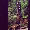
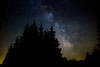

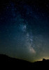
The above images may not be of the site on this page, but were taken nearby. They are loaded from Flickr so please click on them for image credits.
Click here to see more info for this site
Nearby sites
Click here to view sites on an interactive map of the areaKey: Red: member's photo, Blue: 3rd party photo, Yellow: other image, Green: no photo - please go there and take one, Grey: site destroyed
Download sites to:
KML (Google Earth)
GPX (GPS waypoints)
CSV (Garmin/Navman)
CSV (Excel)
To unlock full downloads you need to sign up as a Contributory Member. Otherwise downloads are limited to 50 sites.
Turn off the page maps and other distractions
Nearby sites listing. In the following links * = Image available
27.7km SE 127° Summstein Lithophon* Modern Stone Circle etc
30.8km WSW 254° Grünenbach 'Der Stein' Misc. Earthwork
33.3km NNE 31° Rieden Grabhügelfeld Barrow Cemetery
38.4km NE 52° Viereckschanze Leeder* Misc. Earthwork
41.8km NW 324° Tannheim Keltische Viereckschanze Ancient Village or Settlement
50.3km ESE 105° Unterammergau* Rock Art
52.7km NE 48° Pürgel Grabhügelfeld Round Barrow(s)
53.4km N 356° Waltenhausen Kreuz Ancient Cross
57.0km W 278° Haslachwald Grabhügelgruppe Barrow Cemetery
57.9km WNW 288° Baindt Viereckschanze Ancient Village or Settlement
57.9km WNW 288° Hartwald Grabhügelgruppe Barrow Cemetery
60.6km NE 54° Keltenschanze Utting* Misc. Earthwork
61.7km W 280° Dickenwald Grabhügelgruppe Barrow Cemetery
62.4km WNW 301° Olzreute-Enzisholz Ancient Village or Settlement
62.7km ESE 113° Kaltenbrunn* Modern Stone Circle etc
62.9km NE 40° Unfriedshausen Ancient Village or Settlement
63.1km NE 40° Pestenacker* Ancient Village or Settlement
65.1km NW 308° Mittelbiberach Keltische Viereckschanze Ancient Village or Settlement
65.6km WNW 288° Schreckensee Ancient Village or Settlement
66.0km ENE 60° Archaeological Park Herrsching* Museum
66.0km ENE 60° Baiuvarian Cemetery Herrsching* Barrow Cemetery
66.8km SSE 149° Sautens Opferstein Natural Stone / Erratic / Other Natural Feature
68.8km NW 304° Siedlung Forschner Ancient Village or Settlement
70.5km WSW 245° Holed Stone / Schalenstein Strich* Holed Stone
70.9km WSW 245° Holed Stone / Schalenstein Unter-Altenstein* Holed Stone
View more nearby sites and additional images


 We would like to know more about this location. Please feel free to add a brief description and any relevant information in your own language.
 Wir möchten mehr über diese Stätte erfahren. Bitte zögern Sie nicht, eine kurze Beschreibung und relevante Informationen in Deutsch hinzuzufügen.
 Nous aimerions en savoir encore un peu sur les lieux. S'il vous plaît n'hesitez pas à ajouter une courte description et tous les renseignements pertinents dans votre propre langue.
 Quisieramos informarnos un poco más de las lugares. No dude en añadir una breve descripción y otros datos relevantes en su propio idioma.