<< Text Pages >> Tadrart Acacus Rock Art - Rock Art in Libya
Submitted by AlexHunger on Sunday, 23 July 2006 Page Views: 5885
Rock ArtSite Name: Tadrart Acacus Rock ArtCountry: Libya Type: Rock Art
Nearest Town: Tripoli Nearest Village: Guadames
Latitude: 24.833330N Longitude: 10.333330E
Condition:
| 5 | Perfect |
| 4 | Almost Perfect |
| 3 | Reasonable but with some damage |
| 2 | Ruined but still recognisable as an ancient site |
| 1 | Pretty much destroyed, possibly visible as crop marks |
| 0 | No data. |
| -1 | Completely destroyed |
| 5 | Superb |
| 4 | Good |
| 3 | Ordinary |
| 2 | Not Good |
| 1 | Awful |
| 0 | No data. |
| 5 | Can be driven to, probably with disabled access |
| 4 | Short walk on a footpath |
| 3 | Requiring a bit more of a walk |
| 2 | A long walk |
| 1 | In the middle of nowhere, a nightmare to find |
| 0 | No data. |
| 5 | co-ordinates taken by GPS or official recorded co-ordinates |
| 4 | co-ordinates scaled from a detailed map |
| 3 | co-ordinates scaled from a bad map |
| 2 | co-ordinates of the nearest village |
| 1 | co-ordinates of the nearest town |
| 0 | no data |
Internal Links:
External Links:
Cup and Ring marks / Rock Art in Libya
Thousands of cave paintings in very different styles, dating from 12,000 BCE to 100 CE.
Now Unesco World Heritage Site
You may be viewing yesterday's version of this page. To see the most up to date information please register for a free account.
Do not use the above information on other web sites or publications without permission of the contributor.
Nearby Images from Flickr
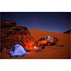
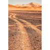
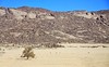
The above images may not be of the site on this page, but were taken nearby. They are loaded from Flickr so please click on them for image credits.
Click here to see more info for this site
Nearby sites
Click here to view sites on an interactive map of the areaKey: Red: member's photo, Blue: 3rd party photo, Yellow: other image, Green: no photo - please go there and take one, Grey: site destroyed
Download sites to:
KML (Google Earth)
GPX (GPS waypoints)
CSV (Garmin/Navman)
CSV (Excel)
To unlock full downloads you need to sign up as a Contributory Member. Otherwise downloads are limited to 50 sites.
Turn off the page maps and other distractions
Nearby sites listing. In the following links * = Image available
18.7km E 84° Wadi Teshuinat* Rock Art
62.7km WSW 252° Sefar Rock Art Rock Art
65.9km WSW 255° Tassili* Rock Art
66.3km WSW 256° Tin Abateka Rock Art Rock Art
77.0km W 263° Tin Mgharen Rock Art Rock Art
86.8km W 271° Oued Amazak Rock Art Rock Art
127.0km ESE 108° Wadi I-n-Afuda Rock Art 2 Rock Art
127.9km ESE 115° Wadi Intananait Rock Art 2 Rock Art
133.2km E 85° Wadi Ti-n-Sharuma Rock Art 3 Rock Art
133.3km ESE 114° Wadi Intananait Rock Art 1 Rock Art
134.1km ENE 78° Wadi Taleschout Rock Art 3 Rock Art
134.5km ESE 101° Aramas-in-Kufar Rock Art Rock Art
134.7km ESE 105° Wadi Ankbritt Rock Art Rock Art
136.6km ENE 60° Wadi Imrawen Rock Art 3 Rock Art
136.9km ESE 106° Wadi I-n-Afuda Rock Art 1 Rock Art
140.5km E 84° Wadi Ti-n-Sharuma Rock Art 2 Rock Art
142.7km E 79° Wadi Taleschout Rock Art 2 Rock Art
147.4km ENE 62° Wadi Imrawen Rock Art 2 Rock Art
147.8km E 82° Wadi I-n- Hagarin Rock Art Rock Art
150.0km E 83° Wadi Ti-n-Sharuma Rock Art 1 Rock Art
152.1km E 80° Wadi Taleschout Rock Art 1 Rock Art
152.8km ENE 59° Wadi Meseknan Rock Art 4 Rock Art
154.0km NE 56° Wadi Meseknan Rock Art 5 Rock Art
154.2km ENE 72° Wadi I-n-Aramas Rock Art Rock Art
154.4km ENE 64° Wadi Imrawen Rock Art 1 Rock Art
View more nearby sites and additional images


 We would like to know more about this location. Please feel free to add a brief description and any relevant information in your own language.
 Wir möchten mehr über diese Stätte erfahren. Bitte zögern Sie nicht, eine kurze Beschreibung und relevante Informationen in Deutsch hinzuzufügen.
 Nous aimerions en savoir encore un peu sur les lieux. S'il vous plaît n'hesitez pas à ajouter une courte description et tous les renseignements pertinents dans votre propre langue.
 Quisieramos informarnos un poco más de las lugares. No dude en añadir una breve descripción y otros datos relevantes en su propio idioma.