 with our Megalithic Portal iPhone app")

<< Our Photo Pages >> Vorset standing stone - Standing Stone (Menhir) in Norway in Nord-Trøndelag
Submitted by kenntha88 on Thursday, 06 October 2022 Page Views: 267
Iron Age and Later PrehistorySite Name: Vorset standing stoneCountry: Norway
NOTE: This site is 6.283 km away from the location you searched for.
Fylke: Nord-Trøndelag Type: Standing Stone (Menhir)
Nearest Town: Trondheim Nearest Village: Rye
Latitude: 63.414446N Longitude: 10.146219E
Condition:
| 5 | Perfect |
| 4 | Almost Perfect |
| 3 | Reasonable but with some damage |
| 2 | Ruined but still recognisable as an ancient site |
| 1 | Pretty much destroyed, possibly visible as crop marks |
| 0 | No data. |
| -1 | Completely destroyed |
| 5 | Superb |
| 4 | Good |
| 3 | Ordinary |
| 2 | Not Good |
| 1 | Awful |
| 0 | No data. |
| 5 | Can be driven to, probably with disabled access |
| 4 | Short walk on a footpath |
| 3 | Requiring a bit more of a walk |
| 2 | A long walk |
| 1 | In the middle of nowhere, a nightmare to find |
| 0 | No data. |
| 5 | co-ordinates taken by GPS or official recorded co-ordinates |
| 4 | co-ordinates scaled from a detailed map |
| 3 | co-ordinates scaled from a bad map |
| 2 | co-ordinates of the nearest village |
| 1 | co-ordinates of the nearest town |
| 0 | no data |
Internal Links:
External Links:
")
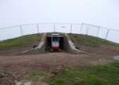
In between the farm buildings at the large farm Vorset at a rocky hill with a beautiful view in all directions is a burial cairn with a standing stone in the center. The cairn and stone is a part of a private garden. The cairn is covred in grass and can be hard to make out under the vegetation despite its size.
The cairn is 12 metres in diameter and 2 metres in height. It was excavated back in 1850 but without any findings. The standing stone was taken down during the excavation but was later restored.
The stone is in the center of the cairn. It is tilting slightly to one side. The stone is 2,2 metres in height, 50cm wide and 25cm thick. It has a small knotch in one side.
You may be viewing yesterday's version of this page. To see the most up to date information please register for a free account.
")
")
")
")
")
Do not use the above information on other web sites or publications without permission of the contributor.
Click here to see more info for this site
Nearby sites
Click here to view sites on an interactive map of the areaKey: Red: member's photo, Blue: 3rd party photo, Yellow: other image, Green: no photo - please go there and take one, Grey: site destroyed
Download sites to:
KML (Google Earth)
GPX (GPS waypoints)
CSV (Garmin/Navman)
CSV (Excel)
To unlock full downloads you need to sign up as a Contributory Member. Otherwise downloads are limited to 50 sites.
Turn off the page maps and other distractions
Nearby sites listing. In the following links * = Image available
1.5km NNE 22° Søndre By Standing Stone* Standing Stone (Menhir)
1.6km WNW 281° Skaret Stone Age Settlement* Ancient Village or Settlement
1.7km WNW 293° Sebillahullet* Cave or Rock Shelter
4.2km NNE 25° Vorpnesset* Cairn
6.9km SSW 195° Høgstenen* Hillfort
9.0km WNW 289° Jostu-Geiteneset* Barrow Cemetery
9.1km W 281° Middagshaugen* Ancient Village or Settlement
9.7km NNW 338° Stykket Carvings* Carving
10.3km SSW 201° Børsa Standing Stones* Standing Stones
10.5km SSW 206° Jyssan* Barrow Cemetery
10.6km NNW 328° Lille-Rein* Barrow Cemetery
12.0km E 82° The Harberg runestone* Carving
12.4km E 84° Olavskilden Holy Well or Sacred Spring
12.7km E 83° Church of saint Olav* Museum
17.0km SSW 197° Steinsåsen* Hillfort
18.3km E 87° Presthus* Standing Stones
19.5km E 87° Ranheim* Standing Stone (Menhir)
20.1km ESE 113° Digre* Barrow Cemetery
23.5km SW 225° Grøtte Standing Stone* Standing Stone (Menhir)
24.1km E 90° Kvegjerdet* Barrow Cemetery
27.6km S 179° Jutulsteinbakken* Barrow Cemetery
29.8km NNW 330° Hasselvikveien-Hårberg* Standing Stone (Menhir)
30.3km NNW 330° Hårberg Runestone* Carving
30.5km SSE 166° Litlstenen* Hillfort
31.2km SSE 168° Horg the Chieftain's grave* Chambered Tomb
View more nearby sites and additional images


 We would like to know more about this location. Please feel free to add a brief description and any relevant information in your own language.
 Wir möchten mehr über diese Stätte erfahren. Bitte zögern Sie nicht, eine kurze Beschreibung und relevante Informationen in Deutsch hinzuzufügen.
 Nous aimerions en savoir encore un peu sur les lieux. S'il vous plaît n'hesitez pas à ajouter une courte description et tous les renseignements pertinents dans votre propre langue.
 Quisieramos informarnos un poco más de las lugares. No dude en añadir una breve descripción y otros datos relevantes en su propio idioma.